- Voir les favoris
Tournoux forts and forest
Sport, Pedestrian sports, Hiking itinerary
in Saint-Paul-sur-Ubaye
9.9
km
4h
Hard
-
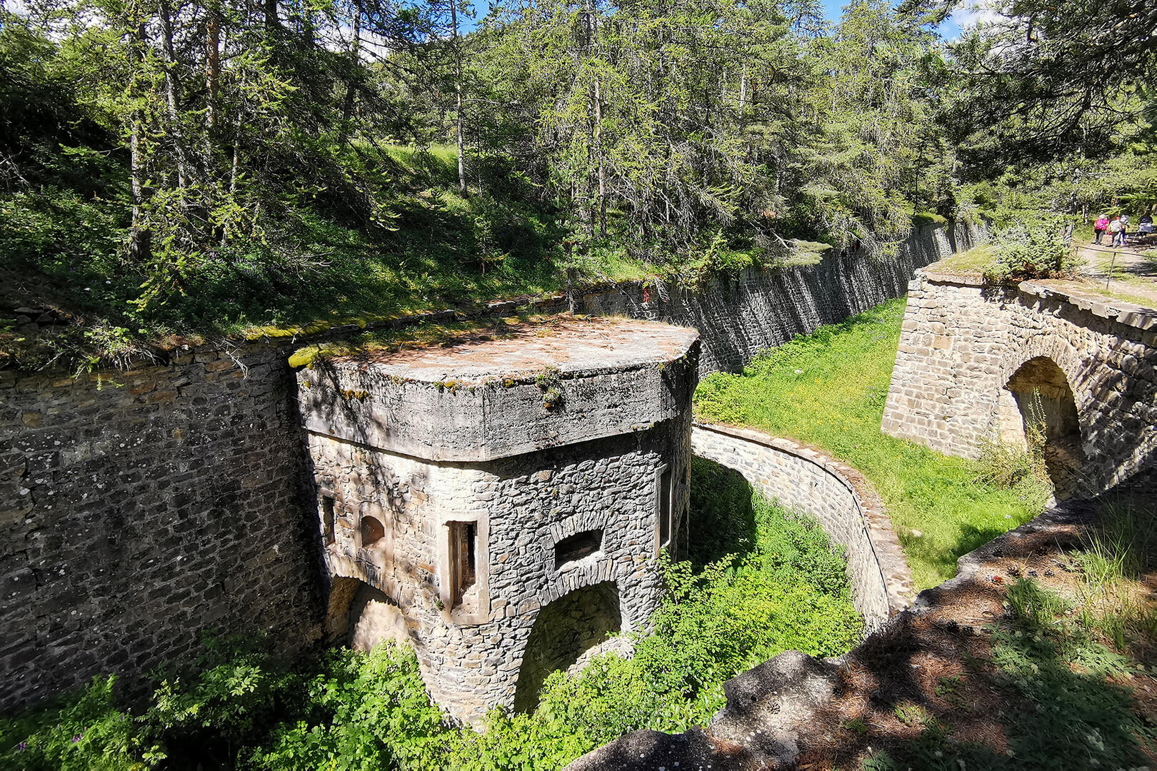
A beautiful shaded trail between fortifications and forests, the Tournoux walk allows visitors to discover an impressive fortified complex built in the 19th century, spread over 700 metres of elevation.
-
Numerous information panels and an orientation table accompany hikers as they discover this remarkable fortified heritage site in the Ubaye Valley.
From the peaceful village of Tournoux, the gentle climb takes place in the middle of a pleasant forest of larch and silver fir trees.
Discovering the Caurres battery, then the Serre de L'Aut fort, gives you an insight into the rich military heritage of the Ubaye.
The return journey is easy via the Bachasses spring, and a visit to the...Numerous information panels and an orientation table accompany hikers as they discover this remarkable fortified heritage site in the Ubaye Valley.
From the peaceful village of Tournoux, the gentle climb takes place in the middle of a pleasant forest of larch and silver fir trees.
Discovering the Caurres battery, then the Serre de L'Aut fort, gives you an insight into the rich military heritage of the Ubaye.
The return journey is easy via the Bachasses spring, and a visit to the village and its traditional wash house brings the day to a pleasant close.
- Departure
- Saint-Paul-sur-Ubaye
-
-
Difference in height
- 490.292 m
-
-
-
Documentation
- GPX / KML files allow you to export the trail of your hike to your GPS (or other navigation tool)
-
-
-
Accepted customers
-
- See all reviews
- 490 meters of difference in height
-
- Maximum altitude : 1948 m
- Minimum altitude : 1474 m
- Total positive elevation : 490 m
- Total negative elevation : -490 m
- Max positive elevation : 277 m
- Min positive elevation : -277 m
Services
-
-
Services
-
