 Slpmm 1
- From Place de l’Eglise, go to the seafront on Rue Victor Hugo and follow the coastline.
Yellow marking - At the pumping station gate, (CAM 17 signpost), continue on the dirt track, keeping the Les Impériaux tailings pond on your left.
- When you reach the low dike from the right, go past the information board, and a barrier, and follow the dike to the Rousty Bridge which marks the entrance to the National Reserve.
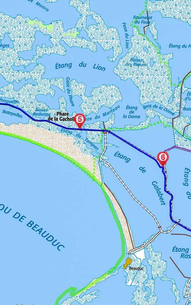
- Go straight over the Rousty Bridge. Continue along the dike to the sea and La Gachole lighthouse, (CAM 18 sign).
- Go straight on after the bridge and the car park. The trail veers to the right. From 6 to 8 hours outside the itinerary, secondary link access to intermediate accommodation 12 km – 3 hours. Take Chemin du Fangassier C 135 on the left and then D 36c and Chemin de la Bélugue C 140.
- After this car park, the Poste de Vannage and the pumping station bridge, turn right (CAM 19 signpost). At the next crossroads, keep straight on.
- At the next crossroads, go left and stay on the left to get to La Tourvieille. Keep straight on.
- Leave Chemin C 140 on your left, (CAM 20 sign), and go to Faraman. At the first houses, the road veers left and then right towards the plane trees and then straight on.
- When you get to the salt marshes, turn left. Go past the Ecomusée du Sel, which is currently closed. At the garages, stay left and then continue straight on. When you reach Salin de Giraud, after Place Adrien Badin and Hôtel La Camargue, the boulevard veers left and then right to join up with Rue d’Arles. At the roundabout, take the first exit towards the plane trees, past La Poste, the Groupe Scolaire, and the Mairie.