Aller au contenu principal
Voir les favoris
en
TO & Travel Agents
Medias
Get Inspired
Towns and Villages
A Breathtaking Coast
Natural Areas
Resorts in The Alps
Urban escapes
Provence
Alpes
Côte d’Azur
Things to do
Guided Tours
Outdoor Activities
Water activities
Sports and outdoor activities
Leisure & Relaxation
Culture and heritage
Shopping and Crafts
Wine and gastronomy
Events & Agenda
Biking in Provence-Alpes-Côte d’Azur
The Most Beautiful Routes
Plan your Stay
Accommodation
Restaurants
Useful Information
Plan your Stay
Get Inspired
Discover the beautiful Provence-Alpes-Côte d’Azur region and its wealth of tourist attractions. Set between Mediterranean Sea and mountains, our region overflows with exciting and exceptional things to see and do. We offer a fabulous choice of tours and activities for your stay. Welcome to a whole new world of travel experiences!
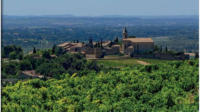
Towns and Villages
Provence-Alpes-Côte d’Azur seduces by the plurality of its landscapes, from the seabed of the Mediterranean to the snowy summits of the Massif des Écrins, some of which exceed 4000 meters in altitude. But the region also owes much to its towns and villages. Large cities concentrate museums, monuments, shopping centers, tourist activities and entertainment, villages and hamlets welcome holidaymakers seeking authenticity, as well as enthusiasts of serenity and wide-open spaces.
A Breathtaking Coast
Provence-Alpes-Côte d’Azur is home to 700 km of exceptional Mediterranean coastline that brims with little coves, creeks, capes and peninsulas. A breathtaking sight, with magical vistas over the Med…
©
Seray.T
Natural Areas
Welcome to Provence-Alpes-Côte d’Azur, France’s top destination for 100% green tourism. Home to 4 national parks, 9 regional nature reserves, countless protected areas and a myriad of quality-certified eco-tourism establishments and service providers, there’s something for every nature lover in Provence-Alpes-Côte d’Azur.
Traileurs Serre Chevalier Dans Les Pas D Helene Alpes
©
Traileurs Serre Chevalier Dans Les Pas D Helene Alpes
|
Dans les pas d'Hélène
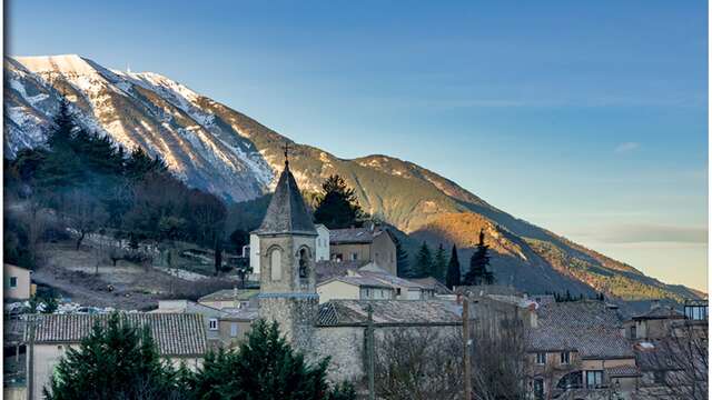
Resorts in The Alps
Famous throughout the world for its coastline and the hinterland of Provence, the mountainous massifs of the Provence-Alpes-Côte d’Azur region gain new members every winter-spring season. Those who have had a taste of it now know that snow has its good habits in the South. Because it is possible to note 2,500 hours of sunshine per year and to ski in a powder snow in January on Easter Monday!
Urban escapes
Experience amazing urban escapes in Provence-Alpes-Côte d’Azur. From the coast to the Provençal countryside and the hinterland of Nice to as far as the Alps. Each stop promises you a unique and rich experience that is illuminated by the southern sun.
Provence
Parc des Ecrins
©
Parc des Ecrins
Alpes
©
Fotolia
Côte d’Azur
Between the sea and mountains, the Mediterranean shores from Saint-Tropez to Menton, the hills of Provence and the Alpine Mercantour Massif, the Côte d’Azur offers a great diversity of landscapes. The beauty of its beaches and the splendour of its luxury hotels, the fame of its Festivals and the celebrity of its Artists create a lovely balance with the green forests and valleys of the mountain hinterland, the red-tile roofs of its age-old perched villages and the bright yellow of mimosas in bloom…
Things to do
Fancy touring the South of France? Explore the unique Provence-Alpes-Côte d’Azur region, nestling between sea and mountains and overflowing with must-see sights and exceptional holiday experiences! We offer a vast palette of tours and activities for your holiday in the South of France. The Provence-Alpes-Côte d’Azur region keeps its promises – welcome and enjoy!
Visites Guidees
©
Visites Guidees
|
AS
Guided Tours
Discover the top guided tours in Provence-Alpes-Côte d’Azur.
©
VINZI / Evrard V.
Outdoor Activities
In Provence-Alpes-Côte d’Azur, you have it all: the sea, the mountains, the countryside and abundant sunshine. By bike, on horseback, on a hike, in the snow, or even in a hot-air balloon, reconnect with nature and recharge your batteries.
Water activities
Enjoy the sea, the calanques, the lakes and the rivers of the le Sud region to treat yourself to a swimming break, a rafting or paddle-board outing, a diving lesson, or why not an introduction to sailing?
Sports and outdoor activities
With its wide-open spaces, mountain massifs, 4 national parks and no less than 8 regional natural parks, Provence-Alpes-Côte d’Azur promises you discoveries and thrills while mountain biking, skiing, golfing, and hiking in the great outdoors -plus an array of aerial sports. Taking part in sports and outdoor activities on vacation has never been so easy – and so much fun.
Leisure & Relaxation
Whether you’re travelling with family, friends, or a partner, you’ll love experiencing Provence-Alpes-Côte d’Azur’s many amusement parks, zoos and gardens at a leisurely pace. And if you’re seeking relaxation, the South is also home to many gorgeous spas and thermal baths. Pure bliss!
©
AlainMouton
Culture and heritage
Contemporary art, Roman heritage, religious architecture, typical villages and Alpine fortifications, Provence-Alpes-Côte d’Azur abounds with rich and varied cultural experiences. Dive into this historic universe and its fascinating aesthetics.
Shopping and Crafts
With its renowned, colourful and characterful crafts, its mega shopping centres, its generous terroir and its palette of gourmet specialities, Provence-Alpes-Côte d’Azur is an incredible shopping destination. Track down the souvenirs of your dreams, to wear, to eat or to admire.
Wine and gastronomy
The Provence-Alpes-Côte d’Azur region bursts with exceptional flavours and fragrances both on the plate and in the glass. Savour them as you explore the local food markets, “bistrots de pays” restaurants, top tables and vineyards of the South.
©
CDUTREY
Events & Agenda
Throughout the year, Provence-Alpes-Côte d’Azur beats to the rhythm of its events. From the famous Carnaval de Nice and Festival of Avignon to the Latino-Mexican Fêtes de Barcelonnette, discover the events in le Sud which are not to be missed.
©
Nico GOMEZ
Biking in Provence-Alpes-Côte d’Azur
Welcome to Provence-Alpes-Côte d’Azur! The Région Sud is an exhilarating cocktail of three unique destinations: Provence, whose roads are bordered with olive trees and lavender fields. The Alps, where legendary passes rub shoulders with verdant valleys. And finally, the Côte d’Azur: its routes with sea views are the ideal playground for cyclists in any gear. Whether on roads or on trails, and with family or friends, in Provence-Alpes-Côte d’Azur, there is always a route to be pedalled.
The Most Beautiful Routes
The history-laden Route Napoléon, the Painters Route that follows in the footsteps of the great masters, or the dazzling yellow blossoms along the Mimosa Route, discover the most beautiful routes in Provence-Alpes-Côte d’Azur.
Plan your Stay
In the South of France, between the Mediterranean Sea and the mountains, lies the Provence-Alps-Côte d’Azur region nestled within stunning natural borders. Here, come and choose from a wide variety of accommodations and outstanding B&Bs. Discover the ultimate in gastronomy with a Mediterranean accent and a contemporary twist, created by passionate Chefs.
Accommodation
From hotel and guest rooms in the city and countryside to unusual places to stay that are surrounded by nature, find the lodging that best suits you for your holiday in Provence-Alpes-Côte d’Azur.
Restaurants
Treat yourself to a delicious meal in one of the best restaurants in le Sud. Village bistrot, a high-altitude restaurant, a tasty seaside table, or even a Michelin-starred restaurant, Provence-Alpes-Côte d’Azur will satisfy all your gourmet desires.
Useful Information
What administrative steps should you take before you depart? When and how to get to Provence-Alpes-Côte d’Azur? How to get around once you arrive? What are the prices of City Passes? Here’s all the information you need to prepare for your trip.
Sejour Ensues La Redonne
©
Sejour Ensues La Redonne
|
C.Chillio
Plan your Stay
Would you like to spend a few days or weeks in Provence Alpes Côte d’Azur? The South invites you to discover its lifestyle and its most beautiful spots and offers you memorable stays, combining culture, sport and idleness.
Close
Menu
Home
Things to do
Routes and walks
La randonnée de Vaison-la-Romaine par Terra Rando
La randonnée de Vaison-la-Romaine par Terra Rando
Pedestrian sports
Hiking itinerary
84110 Vaison-la-Romaine
Getting there
×
Open the itinerary in
Google Maps
Apple Plans
Waze
Mappy
I'm going by train!
×
Please note that the nearest station is more than
Share
Ajouter aux favoris
Add to my favorites
×
Share this sheet
La randonnée de Vaison-la-Romaine par Terra Rando
E-mail
WhatsApp
Facebook
X
LinkedIn
Pinterest
©
Terra Rando
©
Terra Rando
©
Terra Rando
©
Terra Rando
×
©
Terra Rando
©
Terra Rando
©
Terra Rando
©
Terra Rando
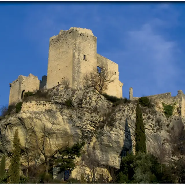
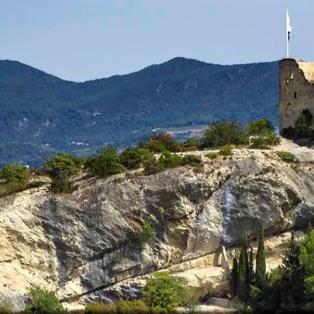
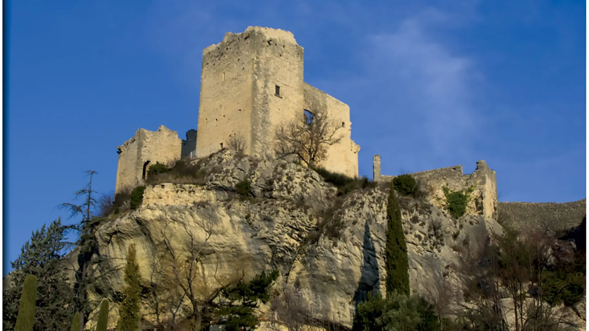
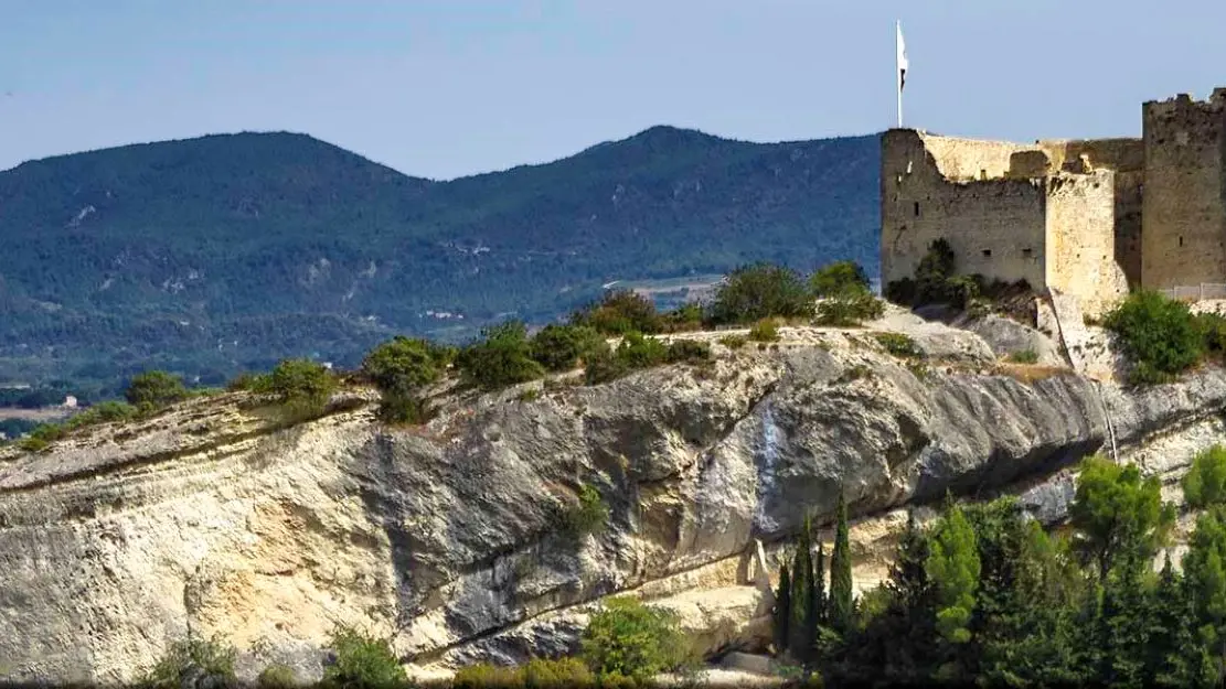
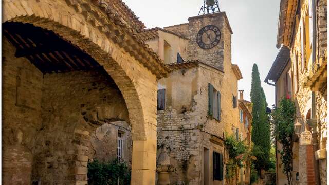
The Vaison la Romaine hike takes you on a journey back in time through the exceptional heritage of the Vaucluse.
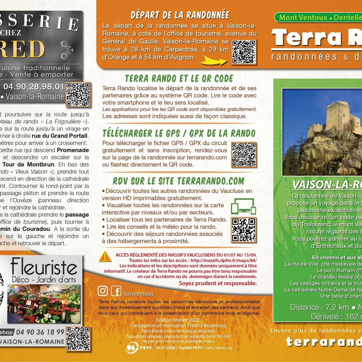
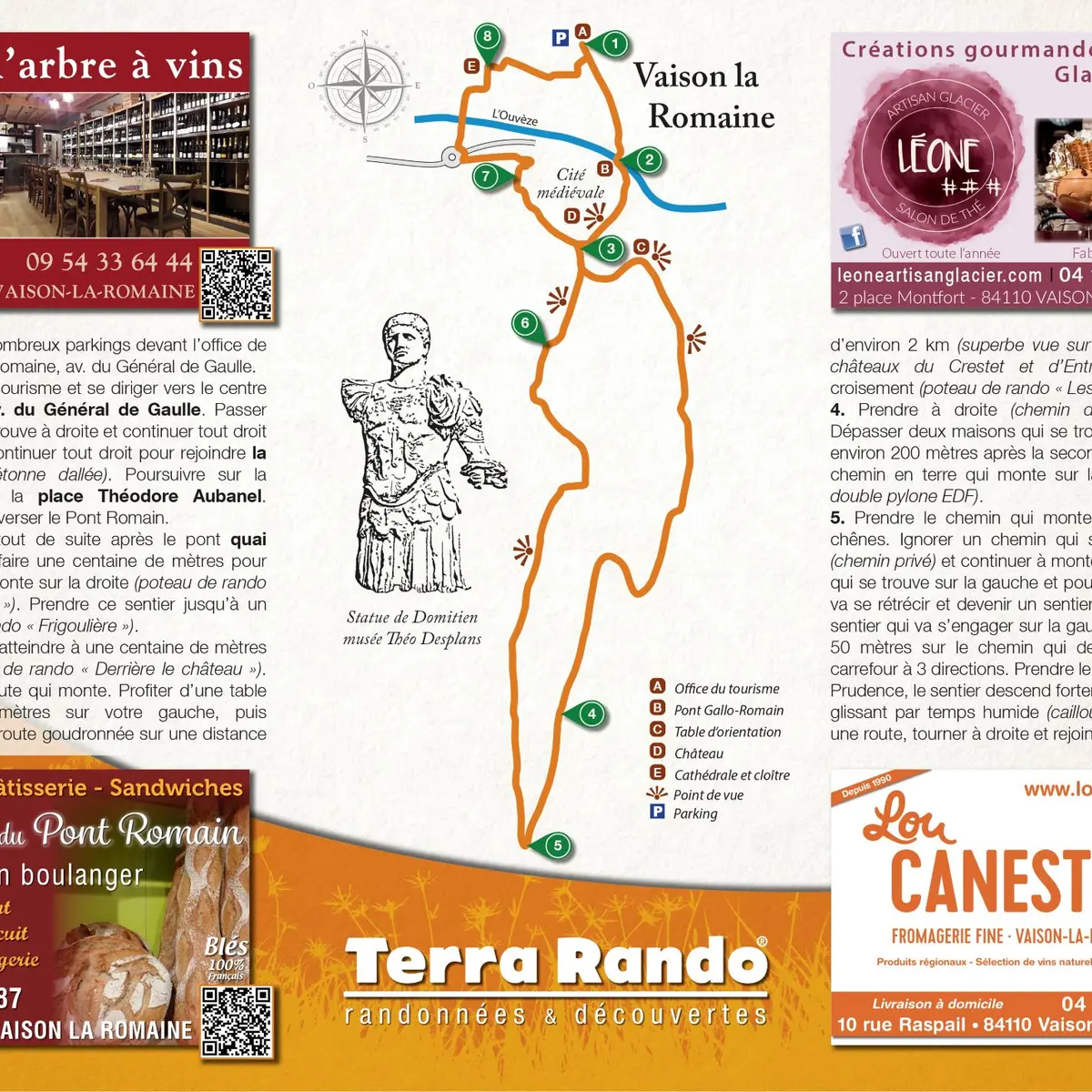
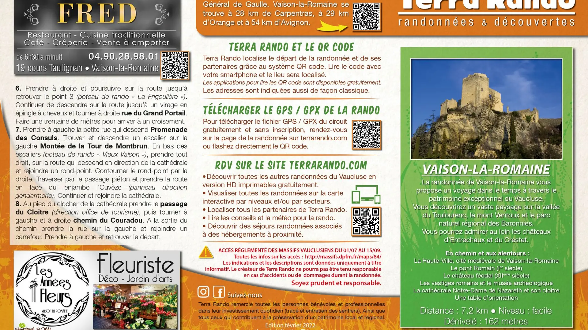
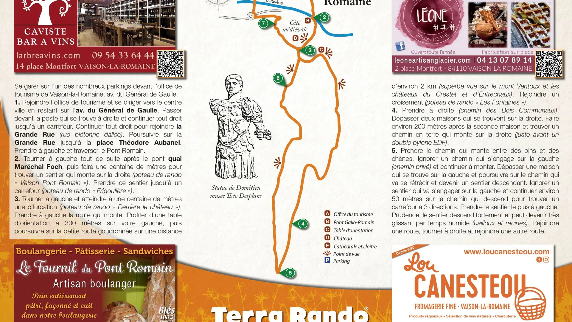
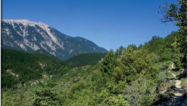
You'll discover a vast landscape overlooking the Toulourenc valley, Mont Ventoux and the Baronnies regional nature park. In the distance, you can admire the Entrechaux and Crestet castles. Distance: 7.2 km / Level: easy / Difference in altitude: 162 m / Réf carte ©IGN : 3040ET. To see along the way and around the hike: > La Haute Ville, medieval town of Vaison la Romaine > The Roman bridge (1st century) > The feudal castle (12th century) > Roman remains and archaeological museum > Notre-Dame de Nazareth cathedral and cloister > An orientation table The hiking map is available free of charge from the Vaison Ventoux Provence Tourist Office. Also on the terrarando.com website: tips for hiking in the Vaucluse and practical information from Terra Rando's partners. Happy hiking and discovering...
Read more
Plain text period
From 01/01 to 31/12.
Services
Animals accepted
View all services
×
Services
Pets welcome
Pets allowed on leash only.
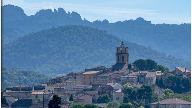
La randonnée de Séguret par Terra Rando
Departing from Séguret, this hike takes you on a discovery of the superb heritage and wine-growing terroir of this listed village.
Séguret
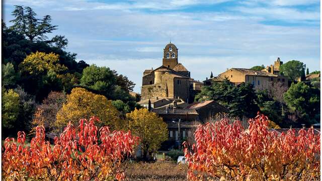
La randonnée de Sablet par Terra Rando
This hike will introduce you to the magnificent terroir of Sablet. Enjoy superb views of the Dentelles Sarrasines, the Saint-Amand ridge, the Pas de l'Aigle and the Rhône valley.
Sablet
La randonnée de Savoillans par Terra Rando
Savoillans is located in the Toulourenc valley, north of Mont Ventoux.
Savoillan
La randonnée de Puyméras par Terra Rando
This hike takes you to the north of Vaucluse, on the borders of the Baronnies provençales regional nature park. Starting in the heart of the village, the trail takes you...
Puyméras
La randonnée de Cairanne par Terra Rando
The Cairanne hike takes you to the heights for superb views of the Dentelles de Montmirail and Mont Ventoux.
Cairanne
Le Piè Gu' hiking trail in Savoillans by Terra Rando
Discover magnificent panoramic views on this hike starting from Savoillans. You'll reach the Piè Gu borie to admire a vast view over the Baronnies provençales nature park, the...
Savoillan
Close
Popular searches
{% label %}
Filter search
Page types
All
Articles
Agenda
Lists
Aucun résultat
/
English
Français
Deutsch
Close
×