Distance: 26.15 km - Climb: 530m - Descent: 1,177m
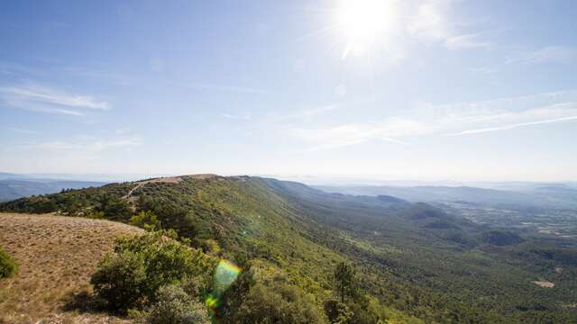
It is time to hurtle down some of the height you've gained. Even so this stretch will prove to be physical with one final climb towards the high point (alt. 1,445m) of the Vaucluse long distance mountain bike trail. Leaving Chalet Reynard, you will plunge downhill into the heart of the forest on the southern face on fast twisting paths. From the majestic Black Pine forest at Perrache and the refreshing "Font d'Angiou", a long climb will take you to the Col de la Frache (alt. 1,327m) as you twist and turn towards the northern slopes of Mont Ventoux. The long steep overhanging path which follows is a great classic of the Ventoux, playful and technical, bordered by a protected forest of century-old trees. A new twist towards the Eastern face will lead you in a long descent on a singletrack to Aurel and the Sault Plateau.Routes available on www.openrunner.com code 3435851