The Massif des Roques, Massif de la Chaîne des Côtes and Massif de la Trévaresse form a large, wooded chain situated to the North of the Bouches-du-Rhône. This massif is bordered to the North by the river Durance, to the South by the Massif des Quatre Termes and the plain of Aix, to the West by the A7 highway and to the East by the A51 highway.
The Massif des Roques, whose altitude varies from 394 m at Vernègues to 83 m in the plain, is characterised by a varied and very uneven relief, with steep slopes, deep valleys and interior plateaux. Its chalky cliffs are mainly west-southwest / east-northeast facing, while the valleys are mainly oriented North-South. This section of the massif is crossed by the RD16 and RD22 roads, and the TGV Méditerranée high-speed railway line.
The Chaîne des Côtes is a more compact massif, characterised by chalky rock formations and cliffs. It is set opposite the Luberon mountain, located beyond the river Durance. This massif rises to a height of 482 m and stretches out globally from East to West, between the plains of Durance and Lambesc. Its very ragged relief, in particular on the northern slope, lends it a quasi-mountainous aspect, and it can only be crossed via the D67 road and Plateau de Malivert. It is sheltered by the sub-massifs of Saint-Estève and La Quille, which form a succession of small and less rugged hills with gentle shapes descending from Bassin Saint-Christophe and petering out near Plateau de la Trévaresse. This northwest / southeast facing entity, regularly carved with northeast / southwest facing valleys, can only be crossed via the D66 road, linking Saint-Estève Janson and Rognes.
Plateau de la Trévaresse forms a tabular, East-West facing barrier to the North of the plain of Aix. This plateau is crossed by numerous public roads, generally running from North to South: D13, D14, D543 and D18. It rises to an altitude of 502 m to the South of Cabannes, and is clearly divided into a northern and southern face, both with even slopes.
Situated in the coastal Provence climate zone, the Massif des Roques, Massif de la Chaîne des Côtes and Massif de la Trévaresse benefit from fairly warm average annual temperatures (13° C) and average to fairly low rainfall (600 to 700 mm/year). The prevailing wind is a diverted Mistral. …
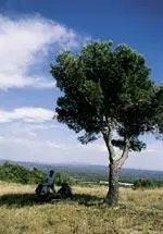
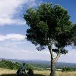
Part of the small, natural region known as the Coteaux de Basse Durance, the Massif des Roques, Massif de la Chaîne des Côtes and Massif de la Trévaresse are, alongside Concors and Sainte-Victoire, the Bouches-du-Rhône's most highly-forested massifs.
…
Their densely-forested and wild aspect is an intrinsic part of the quality of life of the surrounding villages, but despite this, they do not benefit from any particular protective measures. The northern hills are part of the vast ZICO (Bird Conservation Zone) covering the Plateau de l’Arbois, garrigues of Lançon and Chaîne des Côtes and intended to preserve the quality and authenticity of the environments available to birds inhabiting the Durance area (Bonelli's eagle, Egyptian vulture, eagle owl, Montagu's harrier, etc.). A voluntary nature reserve covering 700 acres was set up around Barben (Réserve Naturelle Volontaire de la Propriété de Saint-Pons) in 1991. These three massifs are also the site of several Natural Zones of Ecological, Faunistic and Floristic Interest (ZNIEFF), relative to their valleys, open peaks and unusual geological formations.