For over a century, the intensification of agriculture, urban development, and the growth of infrastructure and transport networks have led to fragmentation and loss of the biological diversity that makes the European continent so rich.
Natura 2000 was born out of a desire to maintain this biodiversity while taking into account social, economic, cultural, and regional activities. With the dual objective of preserving biological diversity and enhancing the value of its territories, Europe has been working since 1992 to create an ambitious network of sites spanning the whole of Europe: the flight of migratory birds is a poetic reminder that nature and its preservation know no borders. This network is now complete: it covers nearly 18% of the European Union's land area (almost 1 million km²) and 150,000 km² of its seas and oceans, representing more than 26,000 sites.
"An exceptional natural heritage:
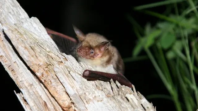
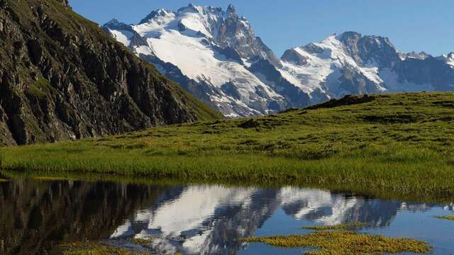
Located at the crossroads of the Alps and the Mediterranean, the Hautes-Alpes offer a wide variety of natural environments. These habitats enable species of flora and fauna to complete their life cycles. Fragile and sensitive, these environments are sometimes mistreated. However, their preservation is often linked to the maintenance of respectful human activities.
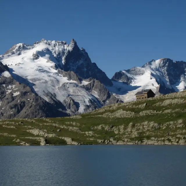
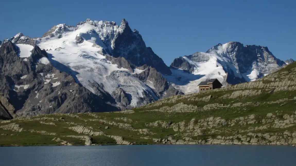
The site: Emparis-Goléon Plateau
The “Emparis-Goléon Plateau” site covers a single municipality: La Grave.
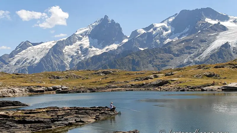
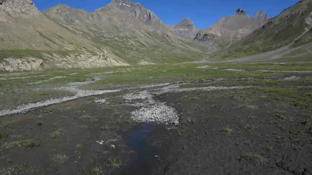
Covering an area of 7,476 hectares, this site is entirely located within the Écrins National Park.
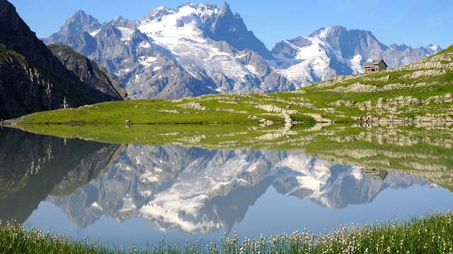
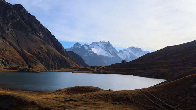
The site is bordered to the south by the Romanche (1,132 m) and extends to the peaks of Pic du Mas de la Grave, Aiguilles d'Arves (3,514 m), and Goléon. It includes the Emparis Plateau and the valleys of Gâ (or Buffe), Martignare, and Maurian (or Goléon).
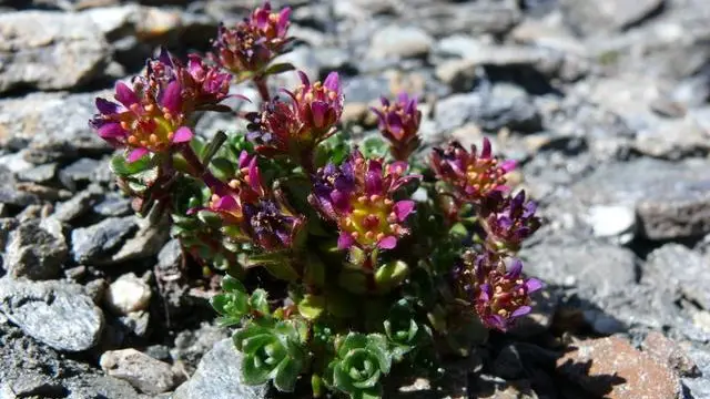
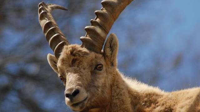
The site's biological diversity is exceptional. Its location on the border between biogeographical areas (inner Alps, intermediate Alps), climatic zones (Northern Alps and Southern Alps), great geological variability and contrasting geomorphology create highly diverse ecological conditions that are favorable to the development of numerous plant and animal species.
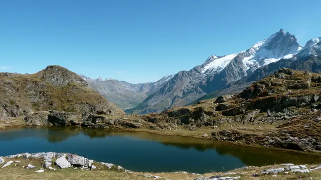
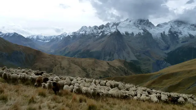
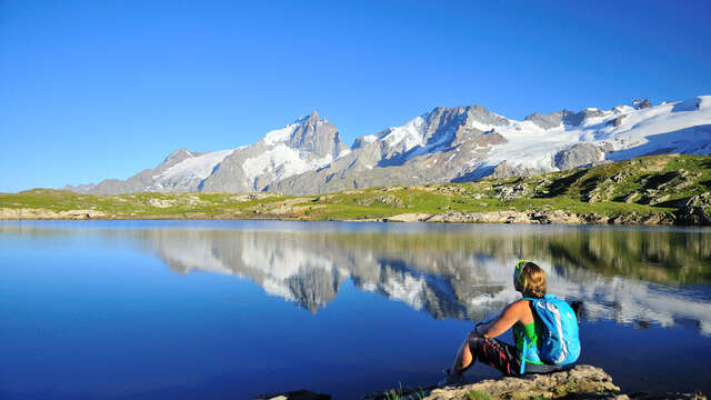
The landscape is strongly linked to agricultural and pastoral activities.
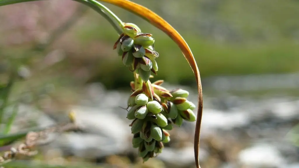
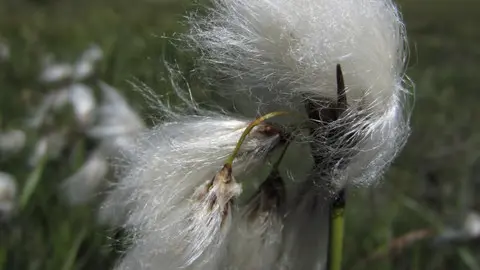
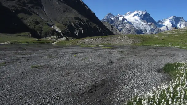
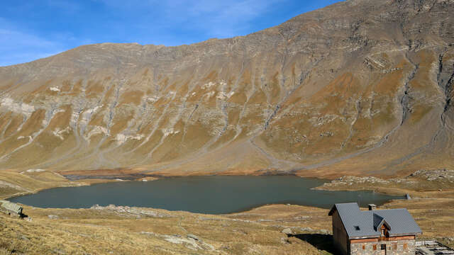
The biologically rich hay meadows surround the hamlets and extend significantly into the Buffe valley. Above approximately 2,200 m, the landscape gives way to mountain pastures, home to herds of cattle and sheep. There are some remarkable wetlands here, particularly in the Goléon valley and on the Emparis plateau.
The site comprises 26 habitats (or natural environments) of Community interest, five of which are priority areas for conservation.
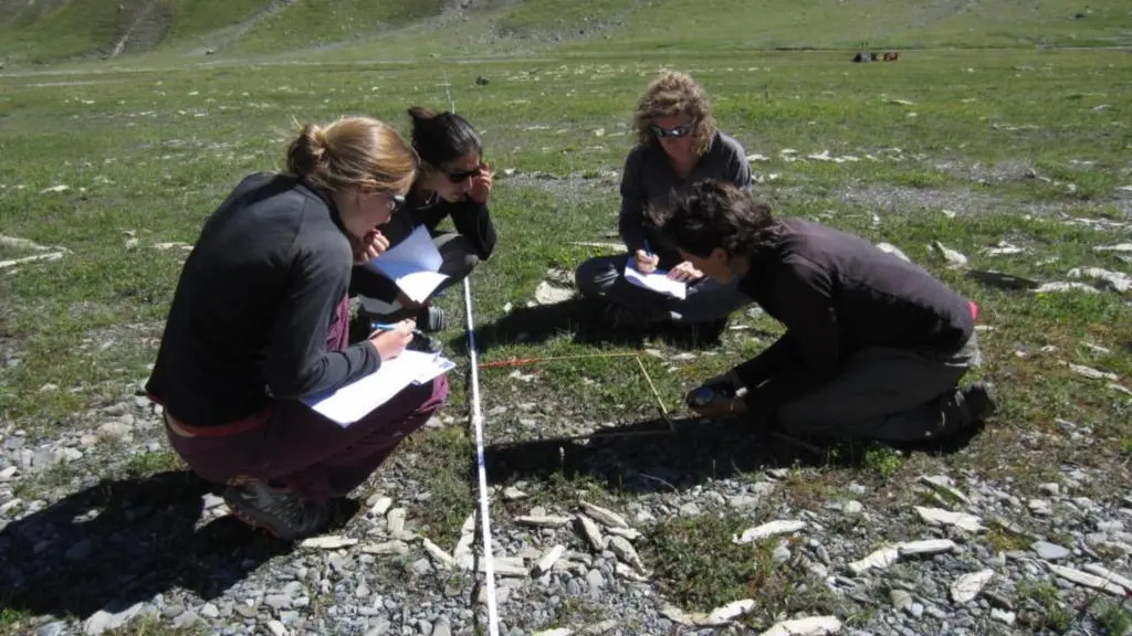
Natura 2000 offers ways to invest in the preservation of the natural environment: pastoralism is by far the most important activity in economic terms and the one that covers the largest area: agro-pastoral habitats represent around 50% of the site's surface area, with eight mountain pastures (78% of the site) farmed by 14 farmers. The effective conservation of habitats and biodiversity depends on maintaining extensive agro-pastoral practices such as mowing and grazing. Through agri-environmental measures, farmers are committed to conserving natural habitats and biodiversity by delaying mowing to promote the plant cycle and allow reproduction, Avoid repeated passage and grazing of animals in sensitive areas (wetlands, etc.).
A contract signed by the municipality and financed by the State and Europe enabled the creation of a footpath and the installation of an information panel on the edge of the Goléon marsh, a wetland sensitive to human activity (2013).
Awareness-raising and environmental education are key elements of the Natura 2000 approach: “better understanding for better protection.”
Read more