Route du Col des Champs

  • Leisure
  • Tourist routes
Ancienne Auberge Fleurie, 04370 Colmars
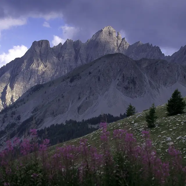
The Col des Champs is a mountain pass at an altitude of 2,045 m, on the border between the Alpes-de-Haute-Provence and Alpes-Maritimes departments, linking Colmars to Saint Martin d'Entraunes in the Ht Var.
It's a small mountain road bordered by forest and very picturesque. The narrowness of the road makes it accessible to vehicles weighing less than 3.5T (and beware of some camping cars!), and the succession of twists and turns takes you up to the summits. You can cover it by car (allow 1 hour to reach St Martin d'Entraunes), or on foot via the GR52 A for the more athletic!

Openings

Openings

From 30 April 2025 until 15 November 2025 - Open everyday
Please note that opening and closing dates vary according to road conditions. Generally from late April to late October / mid-November (weather permitting).
Find out more before you hit the road!

Location

Location

Route du Col des Champs
Ancienne Auberge Fleurie, 04370 Colmars
  • www.verdontourisme.com

Spoken languages

Spoken languages
  • French

Nearby

Nearby

Updated on 29 October 2025 at 10:54
by Office de Tourisme Intercommunal Verdon Tourisme
(Offer identifier : 633772)
Report mistake
Close
Filter search
Page types
  • All
  • Articles
  • Agenda
  • Lists
Aucun résultat