A ZOU TER on guard at Tende, with the mountains in the backgroundTER at Tende station in the Alpes Maritimes
©TER at Tende station in the Alpes Maritimes |Matgrt

Hiking ideas in Mercantour National Park

Trails accessible on public transport

Mercantour National Park is a genuine hiker’s paradise, overflowing with trails for walkers of all levels. What’s more, lots of them are accessible without a car, thanks to the local public transport network. Here is a selection of hikes to help you explore the beautiful Mercantour area while limiting your carbon footprint!

Ubaye valley

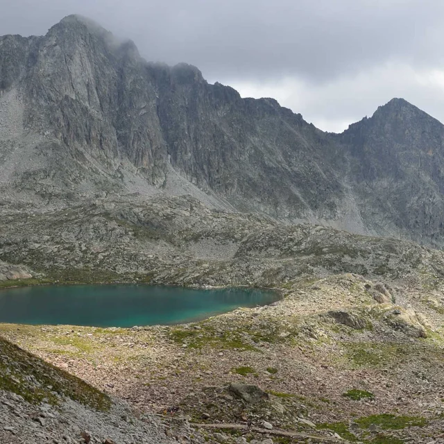
Lac du Lauzanier – From Larche

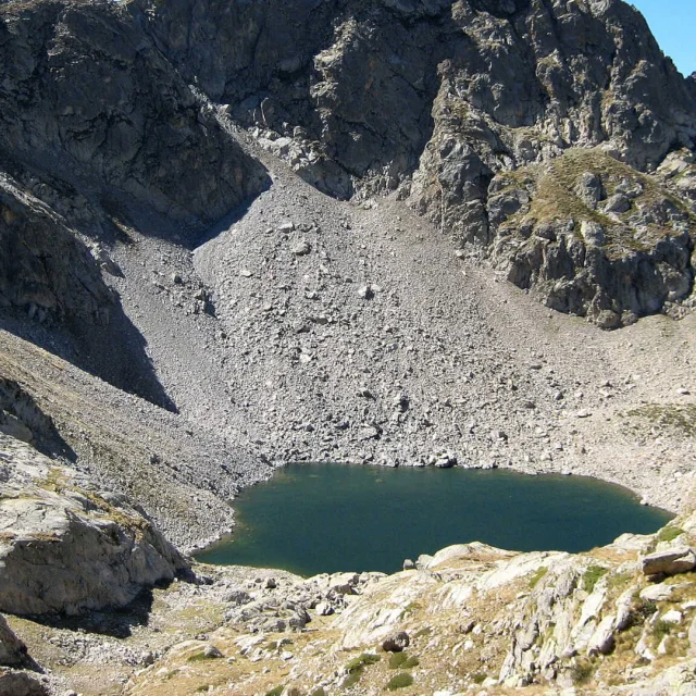
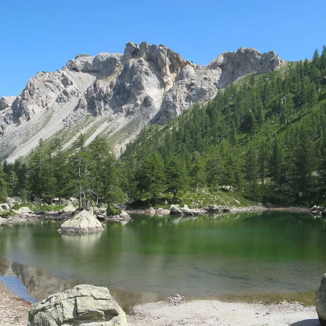
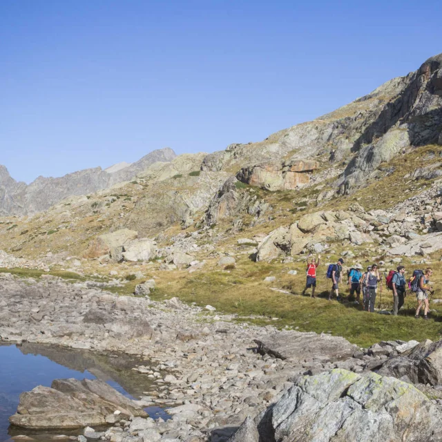
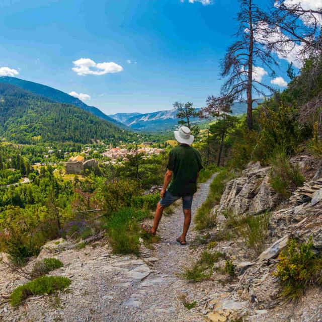
This easy hike bears the “Tourism & Handicap” label, and the first 500 metres are accessible to wheelchairs thanks to the adapted path, also equipped with a multi-sensory reading table developed for people with visual and auditory impairments. The entire first section of the walk runs along the left bank of the Ubayette river, across preserved wetlands and meadows laden with the famous “Reine des Alpes” – more commonly known as the humble thistle. Along the way, you will come across the Tardieu shepherd’s hut and perhaps a shepherd with his flock in the right season. These meadows are also a favourite playground for marmots. “Quiet areas” (zones de tranquillité) have been set up so hikers can observe them discreetly: you might even see one perched on its hind feet with its nose to the wind! Of course, it is prohibited to feed them… The walk continues to Lac du Lauzanier, a beautiful lake reflecting the surrounding mountain décor in its still waters.

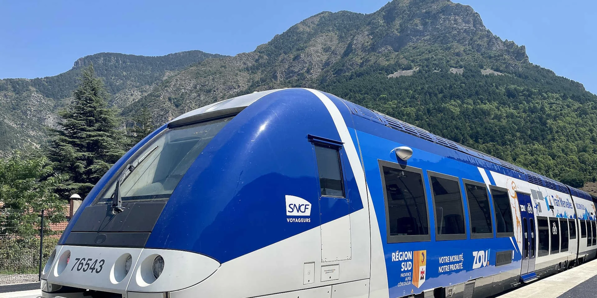
How to get there: ZOU! bus from Marseille and Aix-en-Provence (line 68), Gap (line 535) or Nice (lines 51 + 68) to Barcelonnette. Then take the L3 shuttle from Barcelonnette to Pont Rouge (Larche).
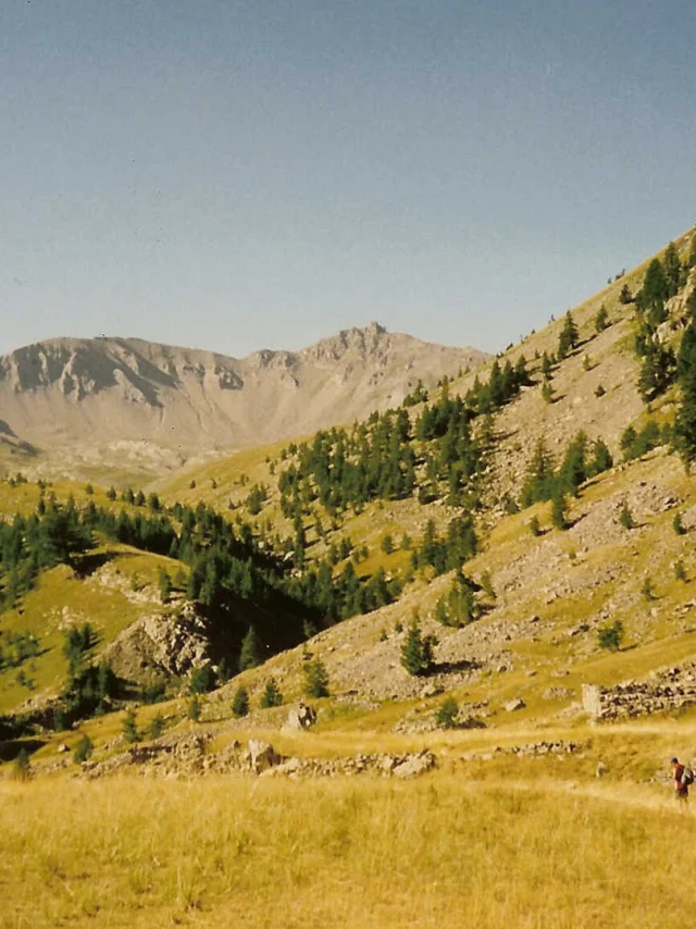
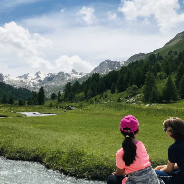
Upper Var Valley

Vallon de l’Estrop – From Estenc

This route follows the GR®52 Grande Traversée du Mercantour long-distance trail and consists of a return hike to Col de Gialorgues. It’s a fairly long trek – around 7 hours – but also fairly easy. The trail plunges into an authentically pastoral world of verdant mountain pastures scattered with shepherd’s huts, as well as rocky, mineral landscapes basking in the gaze of the peaks and summits encircling the valley. Just for the anecdote, the word Estrop comes from stropia meaning flock. And sheep aren’t the only animals that enjoy living here; the local wildlife is particularly rich and – if you’re lucky – you might well spot some ibex or even a snow grouse. Ancient military fortifications await you at Col de Gialorgues, as well as breathtaking views over Vallée de la Tinée. If you’re really feeling motivated, you can continue the climb to the Estrop lakes.

How to get there: ZOU! bus 675 from Nice to Guillaumes. Then take the shuttle (summer only, by request) to Estenc.

Tinée Valley

Lacs de Terre Rouge and Mont Malinvern – From Isola 2000

This hike is actually on two levels. The first, which is more easily accessible, includes a stop-off at the Lacs de Terre Rouge – two pretty, high-altitude lakes surrounded by lush greenery and a majestic mountain cirque. The second level features a fairly technical and quite difficult climb to Mont Malinvern. During the ascension, you will pass La Baisse du Druos, home to the remains of an old military battery. Just above, a superb view awaits, with the rocky Italian cirque of Valscura on one side and the peaks of Cime de la Lause and Tête du Claus on the other. The perfect time to get your camera out! And the perfect time to decide whether you want to continue the adventure… From here on, the trail gets a little trickier and is destined for seasoned hikers as you’ll need to use elbow grease to climb up some sections. However, the ultimate reward awaits you at the top: a panoramic view over France on one side and Italy on the other.

How to get there: Lignes d’Azur bus 92 (summer only, on request) from Nice to Isola 2000 or Lignes d’Azur bus 91 to Isola Village, then take the summer shuttle to Isola 2000.

Col d’Anelle – From Saint-Dalmas-le-Selvage

This easy route follows in the footsteps of the GR®5 Grande Traversée des Alpes long-distance trail and leads to lands steeped in ancient pastoral traditions, overflowing with flowering meadows and larchwood mountain barns also referred to as “butières”. Moreover, the name Anelle comes from the Provençal word agnel meaning lamb. On the way, take time to observe the preserved and varied plant life all around, especially the Bertoloni columbine which grows in shaded areas, easy to spot thanks to its gorgeous blue petals. However, please note that flower picking is not allowed! A magnificent alpine decor surges skywards all around, with the Tête de Vinaigre in the distance, topped with a little fort. On your arrival at Col d’Anelle, lap up the panoramic vistas over Tinée valley and the village of Saint-Dalmas-le-Selvage, adorned with a Romanesque belltower.

How to get there: Lignes d’Azur bus 91 from Nice to Auron or Isola Village. Then take the summer shuttle to Saint-Dalmas-le-Selvage.

Vésubie valley

La Vacherie du Boréon – From Vallée du Boréon

An easy family stroll at the heart of Boréon valley! The round trip takes about 3 hours. Soothing and pleasant, this little hike leads through pretty, shaded forests of cembro pines, spruces, larches and wild raspberries… Please note that as you are in the heart of Mercantour National Park, wild raspberry, strawberry and blueberry picking is regulated and limited to a maximum of 1 litre per person. If in doubt, please check out the park rules. If the weather is fine, the nearby river Boréon promises a refreshing rest. Last but not least, stop off at the Vacherie du Boréon to say hello to the cows and, especially, pick up a delicious local tomme cheese to take home – you can try before you buy!

How to get there: Lignes d’Azur bus 90 from Nice to Saint-Martin-Vésubie. Then take the summer shuttle to Boréon.

Lac Niré – From Vallée du Gordolasque

This round trip is fairly easy with no real difficulties and takes around 5 hours to complete. The trail ventures into the heart of Gordolasque valley, carved out by glacial erosion, and leads to the Refuge de Nice and Lac Niré, crossing the ancient salt route, used in days gone by to transport salt from Provence to the Piedmont. When you reach the refuge, take time to enjoy a rejuvenating rest on the panoramic terrace overlooking the lake of La Fous. The refuge also serves delicious fare made with local produce if you’d like to lunch there. But don’t get too comfy: the hike continues with a final furlong to Lac Niré, with its stunning turquoise waters and magnificent mineral décor you won’t want to miss.

How to get there: Lignes d’Azur bus 90 from Nice to Roquebillière. Then take the summer shuttle to La Gordolasque.

The Valley of Wonders

Rock carvings and lakes of Vallée de Fontanalbe – From Castérino

This 6-hour hike sweeps you 2,000 metres into the air and 5,000 years into the past… The adventure starts with a walk through Fontanalbe valley, renowned for its beautiful plant life. Nestled amid larch trees, the peaceful Refuge de Fontanalbe marks the first key stage of the trail: you can savour a delicious omelette and excellent blueberry tart there if you fancy lunch. Once you’ve got your strength up, continue on your way to the aptly-named Lac Vert (green lake), reflecting the colours and relief surrounding it like a chameleon. Next, take the discovery trail leading to the Voie Sacrée (sacred way) – a genuine open-air museum at the foot of Mont Bégo, home to rock paintings illustrating the life of the first Neolithic and Bronze Age shepherds. On the way back, you will walk along the shores of the Lacs Jumeaux – although a little less impressive than the Voie Sacrée, the lakes are definitely worth admiring.

How to get there: By train from Nice to Saint-Dalmas-de-Tende (caution, modified timetables due to ongoing work in 2025). Then take the Zestbus 23 to Castérino.

You may also like