
- Voir les favoris
See photos (4)
Adèle Planchard refuge from Arsine (Villar d'Arène)
Sport, Pedestrian sports, Hiking itinerary
in Villar-d'Arêne
21.9
km
-
A long and difficult itinerary. An ascent to the refuge that takes in the lush green meadows of the Plan de l'Alpe, and the mineral draperies of the high peaks that shelter the springs of the Romanche.
-
From the Arsine parking lot, follow the track along the edge of the reservoir and then follow the bottom of the valley on the right bank along an excellent path that crosses the Pas d'Anna Falque.
The fork that divides the path between the Plan de l'Alpe (refuge de l'Alpe and chalet refuge de Chamoissière) and Adèle Planchard refuges is well signposted.
Turn right and follow this long path through the Plan de l'Alpe. A long flat section on the right bank at the bottom of the valley,...From the Arsine parking lot, follow the track along the edge of the reservoir and then follow the bottom of the valley on the right bank along an excellent path that crosses the Pas d'Anna Falque.
The fork that divides the path between the Plan de l'Alpe (refuge de l'Alpe and chalet refuge de Chamoissière) and Adèle Planchard refuges is well signposted.
Turn right and follow this long path through the Plan de l'Alpe. A long flat section on the right bank at the bottom of the valley, followed by a short steep slope on the left bank, leads to a grassy plateau.
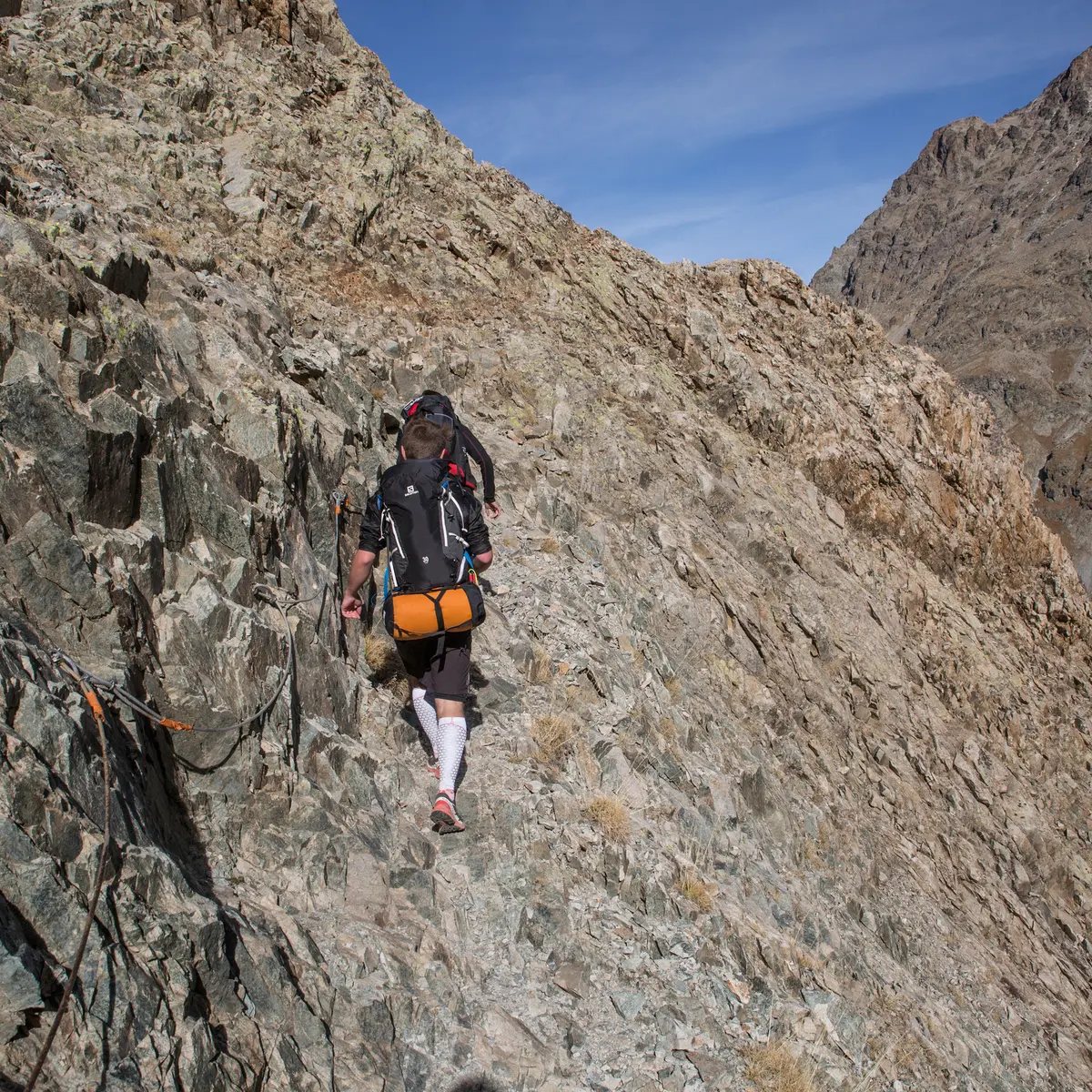
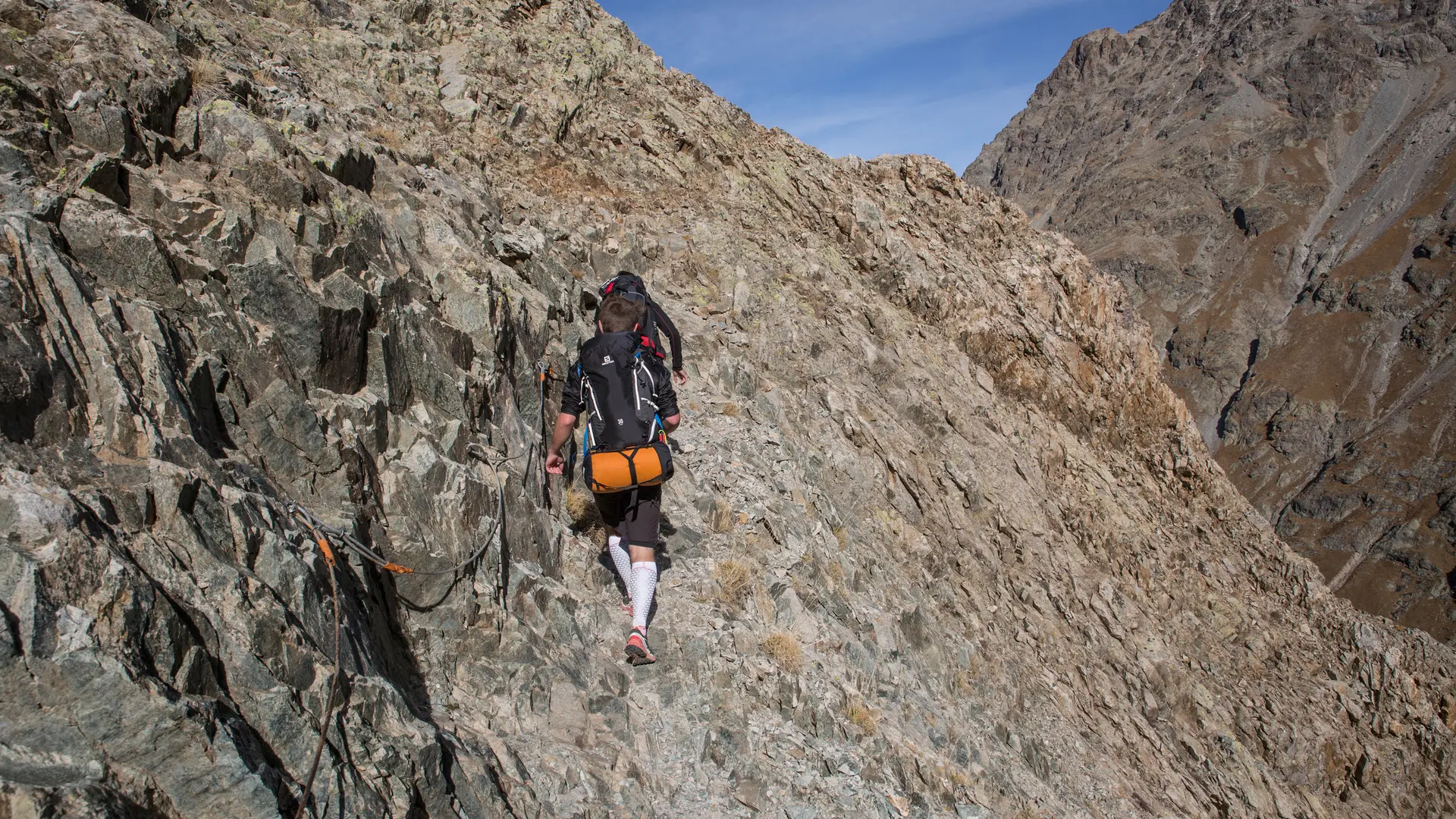
A short kilometer of traverse prepares the tortuous ascent through rocky bars equipped with cables in places.
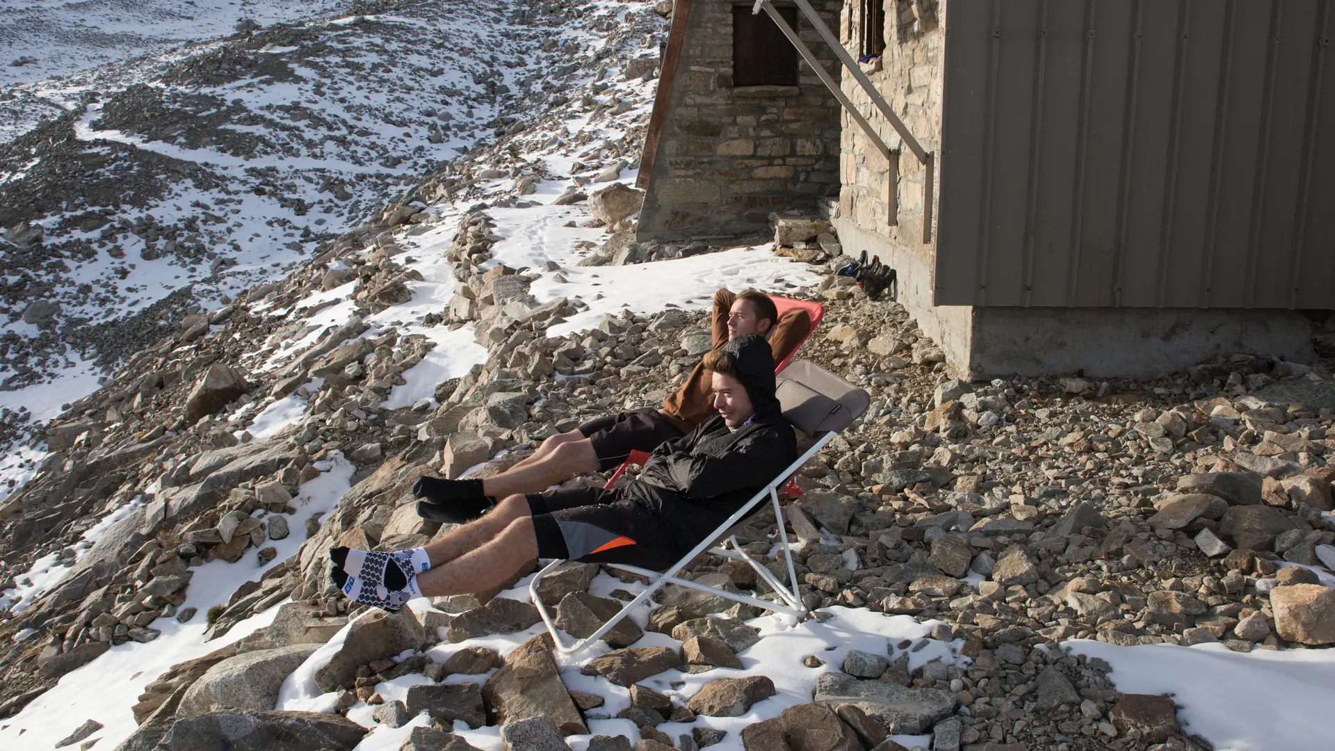
Fill up with water - there's none further up.
At the foot of the final spur: a huge scree that needs to be climbed without getting lost.
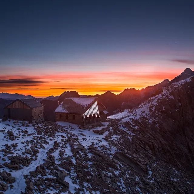
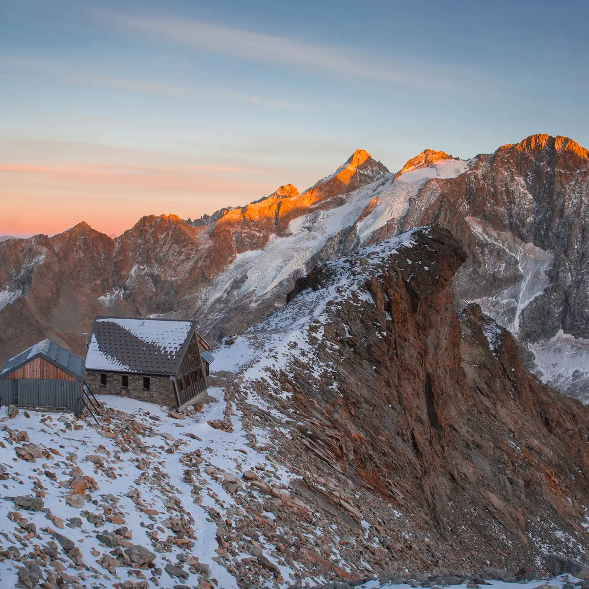
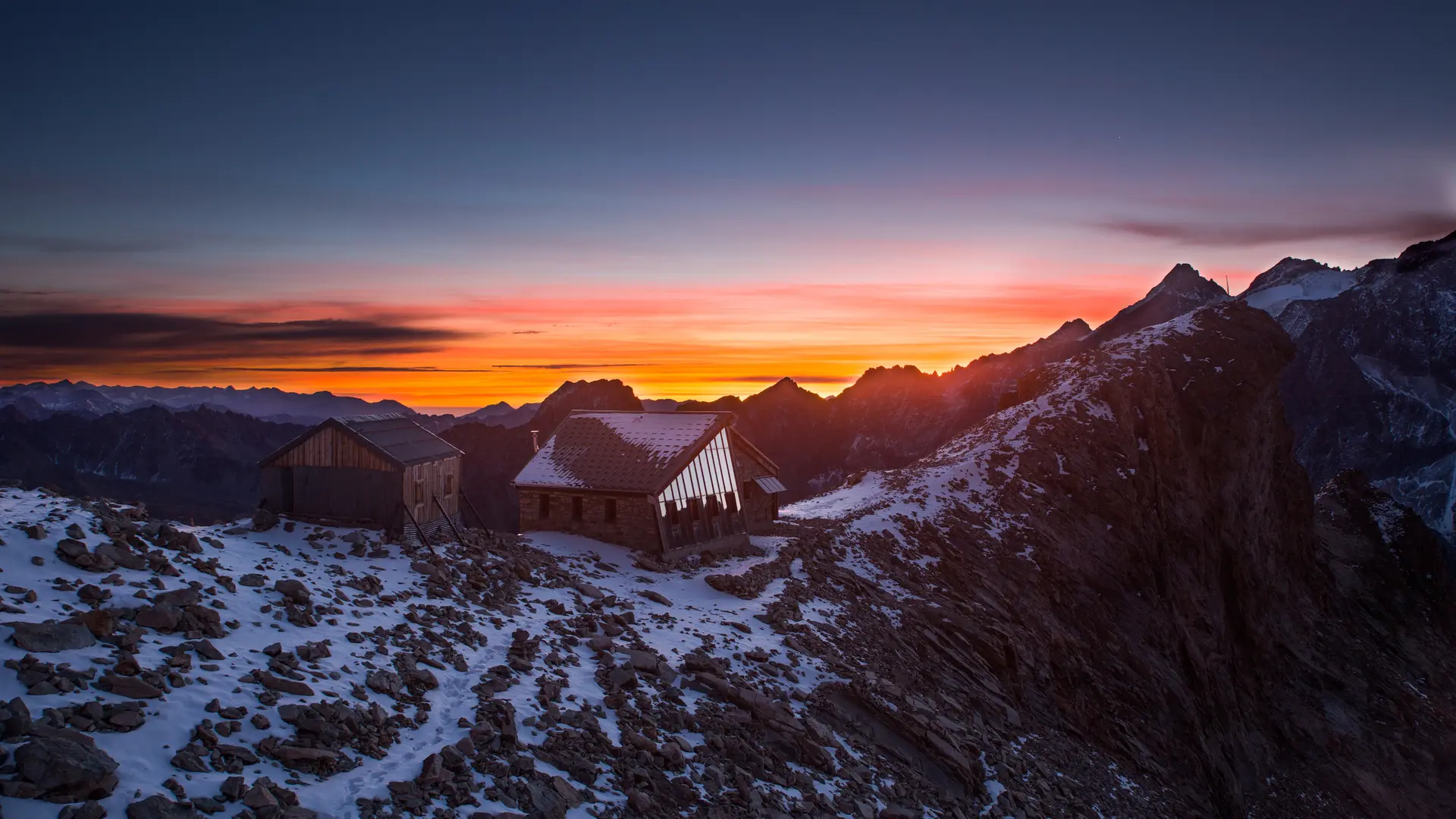
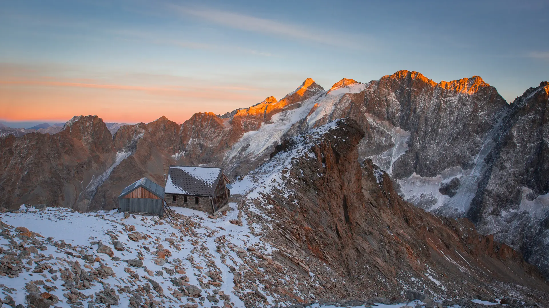
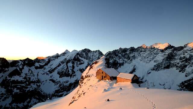
Finally, the Adèle Planchard refuge appears on an avalanche-protected ridge overlooking this mineral space.
Return by the same route.
- Departure
- Villar-d'Arêne
-
-
Difference in height
- 1470.52 m
-
-
-
Plain text period
- Closed temporarily.
-
-
-
Spoken languages
-
-
-
Documentation
- GPX / KML files allow you to export the trail of your hike to your GPS (or other navigation tool)
-
-
-
Accepted customers
-
- See all reviews
- 1471 meters of difference in height
-
- Maximum altitude : 3140 m
- Minimum altitude : 1724 m
- Total positive elevation : 1471 m
- Total negative elevation : -1471 m
- Max positive elevation : 1000 m
- Min positive elevation : -1000 m
