- Voir les favoris
See photos (2)
Cascade de la Pisse in Châteauroux-Les-Alpes
Sport, Pedestrian sports, Hiking itinerary
in Châteauroux-les-Alpes
14.4
km
-
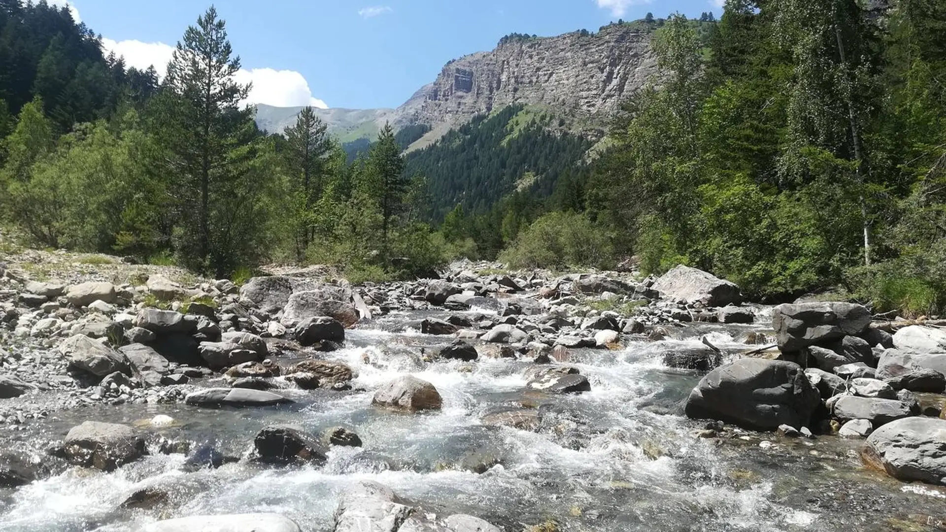
Edged by the canal, close to the famous Rabioux mountain stream and the approaches to the Parc National des Écrins, this loop offers both tranquillity and freshness.
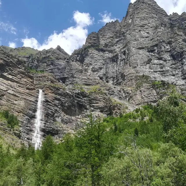
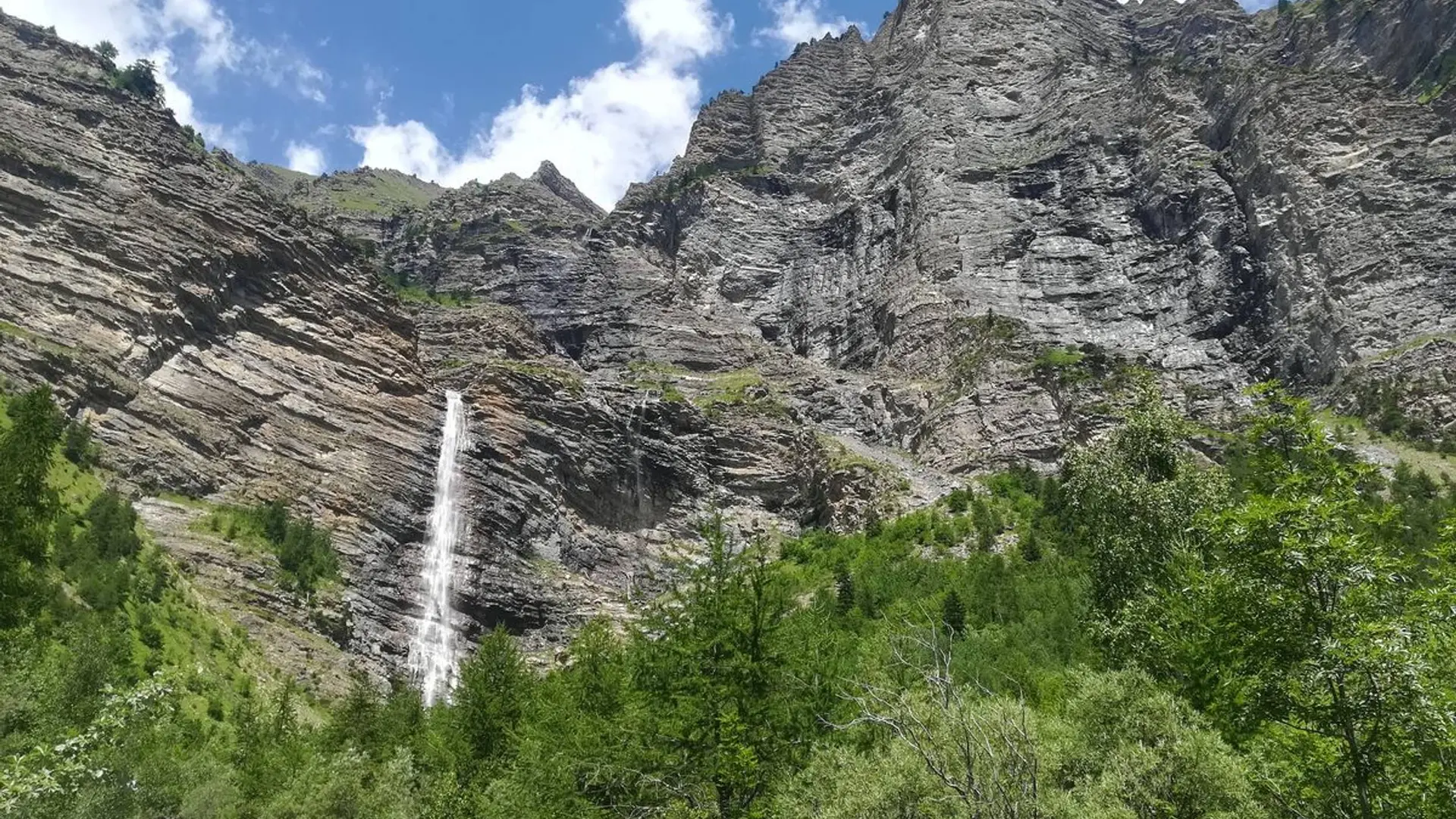
-
From the car park, head along the track towards the waterfall (Cascade de la Pisse). Then turn right onto the path. Follow the Canal Gramorel.
At the next intersection, go slightly downhill to the right and take the narrow path opposite, towards the Cascade de la Pisse. At the next intersection, go straight ahead. When you reach the « Torrent du Rabioux » continue to head towards the Cascade de la Pisse. Cross the Les Muandes footbridge and rejoin the track. Then go left to the Les...From the car park, head along the track towards the waterfall (Cascade de la Pisse). Then turn right onto the path. Follow the Canal Gramorel.
At the next intersection, go slightly downhill to the right and take the narrow path opposite, towards the Cascade de la Pisse. At the next intersection, go straight ahead. When you reach the « Torrent du Rabioux » continue to head towards the Cascade de la Pisse. Cross the Les Muandes footbridge and rejoin the track. Then go left to the Les Muandes car park. Head down the path on the right to reach the waterfall. At the waterfall, return along the same track back to the intersection at the footbridge.
Here, turn left onto the forest track. A few metres further up, turn right at « Le vieux Chemin » towards Les Pinées via Pont de la Serre. Carry straight on towards Les Pinées. You go past chalets and streams.
At the next « La Serre » intersection turn right downhill towards Les Pinées. On the road, you pass the Jean Blanc spring and the bridge. After the bend, turn right onto the path leading uphill towards Les Pinées. Then rejoin the outward path: turn left towards Les Pinées
Easy
- Departure
- Châteauroux-les-Alpes
-
-
Difference in height
- 481.667 m
-
-
-
Departure : Les pinées, Châteauroux-les-alpes.
Arrival : Les pinées, Châteauroux-les-alpes.
Road access : From Embrun, in Châteauroux go past the Park Centre ("Maison du Parc National des Écrins"), and follow signs to Les Pinées..
Parking recommended : Car park in Les Pinées .
Public transport : Public transport: www.pacamobilite.fr
Consider car-sharing: www.blablacar.fr .
- See all reviews
- 482 meters of difference in height
-
- Maximum altitude : 1602 m
- Minimum altitude : 1295 m
- Total positive elevation : 482 m
- Total negative elevation : -328 m
- Max positive elevation : 115 m
- Min positive elevation : -64 m
