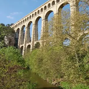
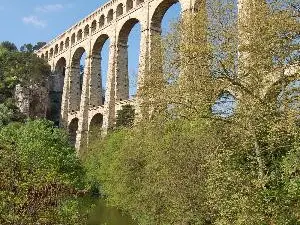
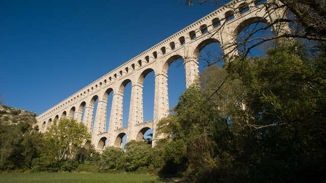
This easy and picturesque cycling itinerary winds its way through the countryside slightly to the west of Aix-en-Provence and crosses the modern village of Coudoux, set facing Etang de Berre lake and the ancient hilltop village of Ventabren, whose massive aqueduct – Roquefavour – still stands witness to the area's past battles for water. It also features a Roman camp, the surprisingly refreshing river Arc, and a myriad of narrow and snaking or wide and welcoming valleys. And although we actively encourage cyclists to keep an eye on the road, nothing will prevent you lapping up the view or heading off onto the side lanes if the mood takes you. One of them leads to Ventabren plateau, where we suggest you take time off to enjoy the sunset over the Etang de Berre lake. Another slides its way towards a pine wood and the ancient Roman camp of Marius. A third leads you on an delightful tour under the aqueduct, offering food for both the body and mind.
Read more