Discover the Ourbes ridge, the starting point of the rocky bar that dominates the right bank of the Gorges du Verdon. The walk starts at the foot of the village (next to the motorhome park and sports fields), at the junction of the D952 and the Chemin de Quinson.
Walk down the chemin de Quinson and, immediately after the ford, if you wish, continue straight on and back to the entrance to the old fortified farmhouse of l'Hert (privately owned, known as "Château de la Reine Jeanne"), a locality in Moustiers.
Then pick up the GR®4 and start climbing at the Maison du Parc du Verdon roundabout. This is the start of a steep ascent.
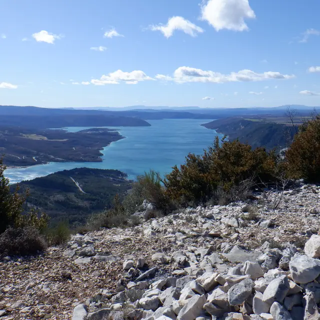
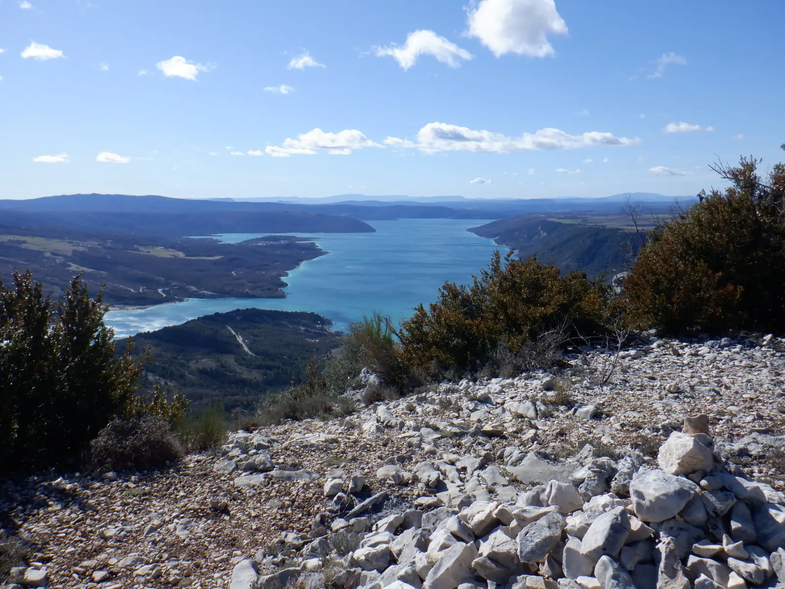
After this ascent, follow the ridge to admire the surrounding views. The Crête de l'Ourbes marks the start of the rocky bar that runs along the right bank of the Verdon canyon.
The descent to the Vénascle plateau is on a fairly steep path. From the plateau, you can return to the village along the Courchon path, which offers a view of Lac de Sainte-Croix.
17.3km · 910m D+ · 5/6h
Read more