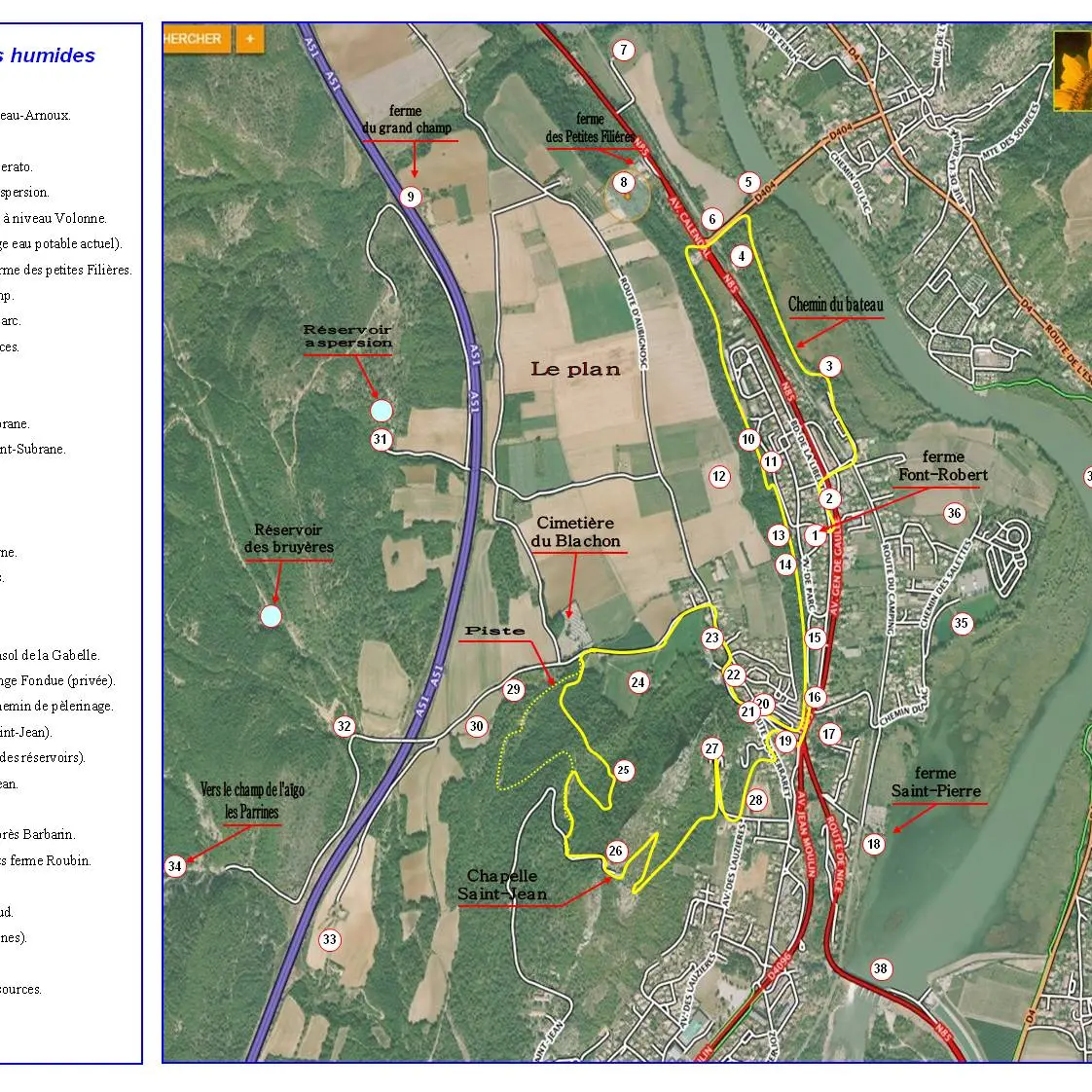
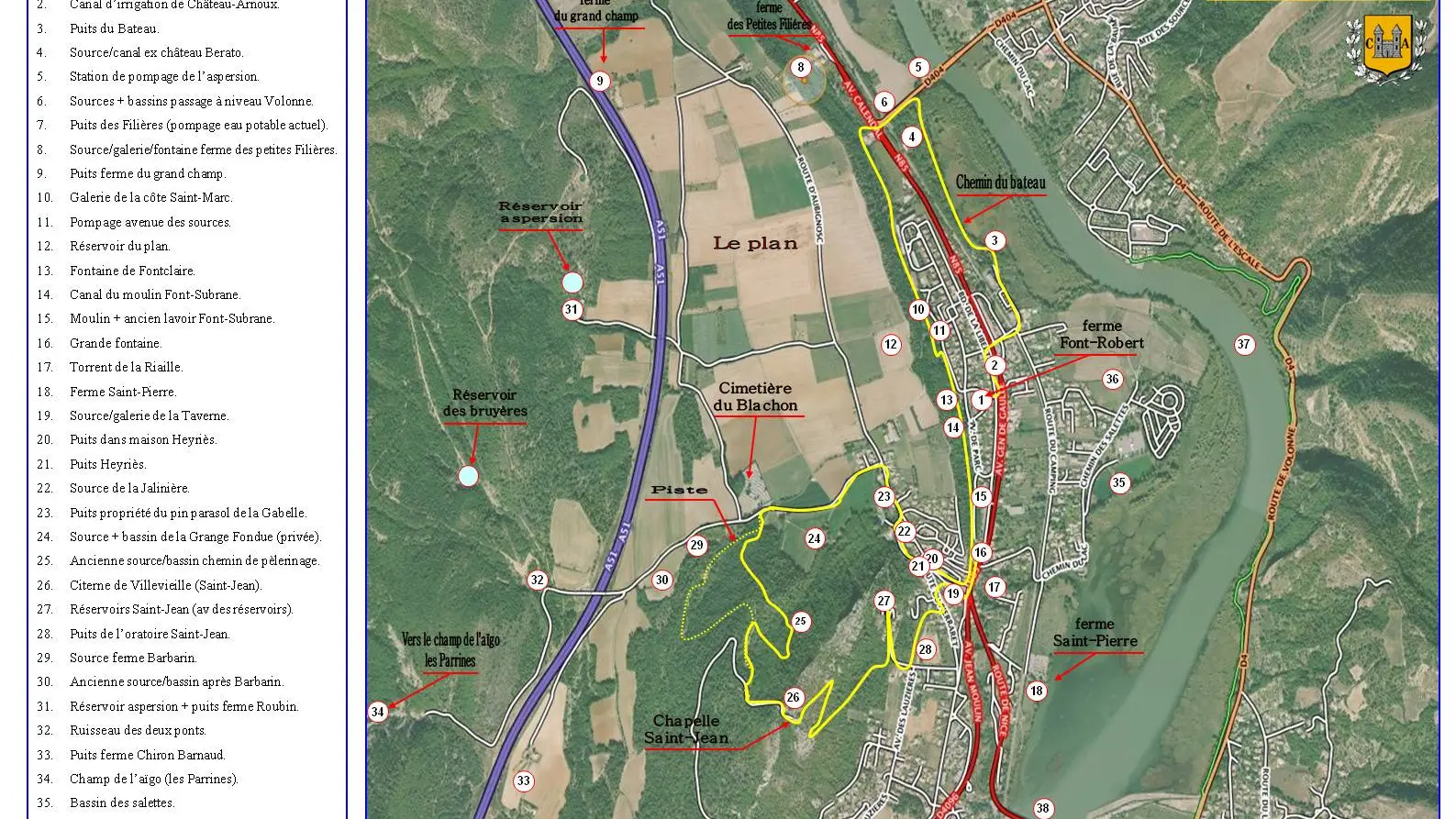
This marked heritage trail allows you to discover the main areas and wetlands of the commune of Château-Arnoux which were built and supplied over the centuries to serve the local population.
This marked heritage trail allows you to discover the main areas and wetlands of the commune of Château-Arnoux which were built and supplied over the centuries to serve the local population.
Read more