Go in the direction of the Porte de Pignerol, then Chemin de Ronde, the Porte de la Durance and the Pont d'Asfeld, the great monuments of Briançon are thus crossed. After the Pont d'Asfeld and in the second hairpin on the stony track, go straight ahead on a small path that goes into the woods. Be careful
at 100 m, take on the right a small path which will lead you on a small channel above the village of Fontenil (never go down in the village, it will be the subject of a next walk).
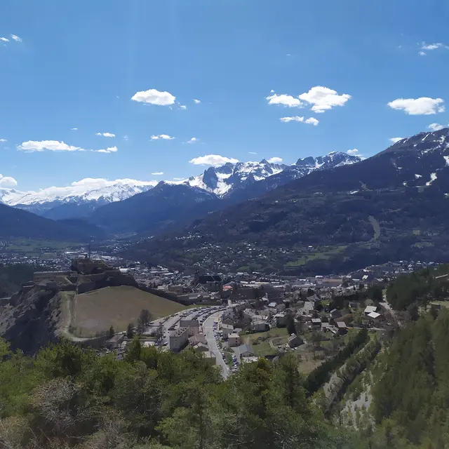
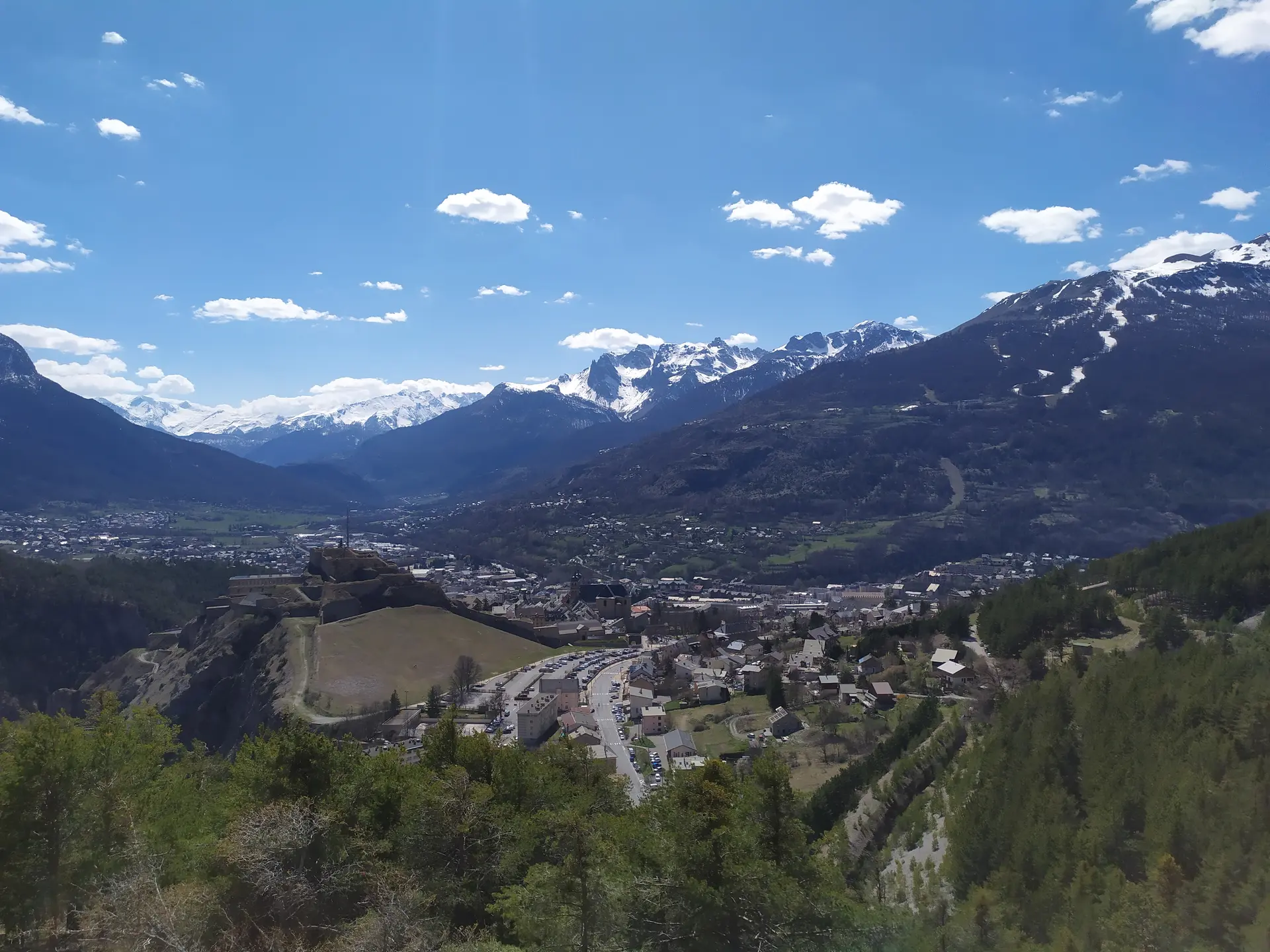
You pass in balcony above the village to join the GR which you leave on your right but which you will take later to go up to the Fort of the Infernet. At this intersection, you will turn left. These are very rolling parts from the start. You take again an old canal which will lead you on very wet red soil to come back
again on a wide and rolling track without stones. You arrive at the small village of La Vachette and at the edge of the national road that leads to Montgenèvre and Italy. Keep to the right and go through a wood that leads you to the road of the batteries of the blade. Head left to cross the torrent du Vallon on a bridge and head right back to Montgenèvre on the wide and stony valley track. The markings are mixed with specific Montgenèvre link markers and blue varnish in places.
The climb is steady for 1 km. At this point, don't miss the left turn in a hairpin on the route du vallon which leads to Montgenèvre via the piste du facteur where it's a little steeper.
Under the place known as Pierre Verte, watch out, this will be the fork with the descent to the left which will lead you to Les Alberts and will take up part of the N°8 and N°9 routes of the Espace trail de Montgenèvre and straight on for the link to Montgenèvre.
On the descent to Fontaine Crétet, you will have to cross the Nationale and a little further down the Durance to arrive on the upper part of the Alberts where you will have to go left in the direction of the Ranch.
Cross the Durance again on the road to the Alberts and head in the direction of a track along the Durance on the Lovers' footbridge.
Cross the road to Névache and go left. Stay along the road for 100m and take the cross-country tracks to the right which will take you above the village of La Vachette. Take a small tarmac road 14 which leads you into a wood and before you reach the chalet forestier des petits bergers, cross the capricious torrent de Malafosse. Then take the short and technical climb above the Rocher de l'ombre to return on a magnificent balcony path above the national road with an unobstructed view
over the forts which will take you out above the Fort des Salettes.
The descent to the Fontaine des Salettes will be done first on a wide and stony track and on the last 500 m on an asphalt road.
Read more