The Via Rhôna, from Lapalud to Caderousse, is a temporary signposted route in southern Lapalud on the left bank towards Vaucluse. The itinerary winds across the agricultural plain as far as the Canal de Donzère then continues onwards to the foot of the Fortress of Mornas and on to Piolenc.
From Li Piboulo lake, you have two options.
Continue towards Caderousse along the greenway bordering the Rhone.
Join the Roman town of Orange and its famous triumphal arch.
About 3.8 km from Lapalud is Girardes lake, where you can go swimming or choose from a variety of water and leisure activities.
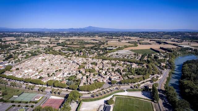
Make your way gently to the Provençal village of Caderousse surrounded by dykes protecting it from the unpredictable Rhone.