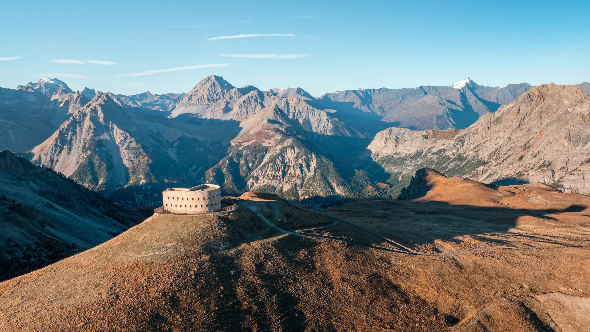
This steep hike winds through forest and scree to reach two 19th-century military buildings perched on the Cime des Ruines ridge, with incomparable views over the Cols du Granon, des Acles and de l'Échelle.
From the parking lot on the outskirts of Plampinet, cross the road to take the wide path on the right, which rises up and skirts the heights of the cemetery.
Above the cemetery, continue left along the edge of the wood; the path gradually rises through the forest to reach a crossroads: turn left onto the small, steeply-sloping path: you then begin a steady, tightly-laced climb.
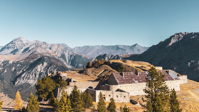
After this steep climb, the path comes to a flat area and a magnificent wooded clearing: the Sapet de l'Olive. This clearing gives you a chance to catch your breath before starting the final climb and crossing a steep scree slope: the fort is just above the route. The scree quickly leads to a small restored outpost; a hundred metres or so after this outpost, leave the main route and take the path on the right: this will take you quickly to the Fort de l'Olive.
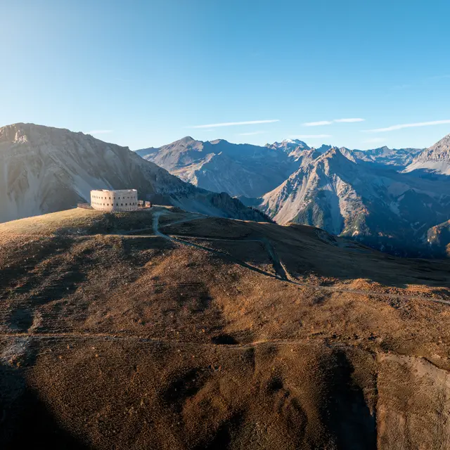
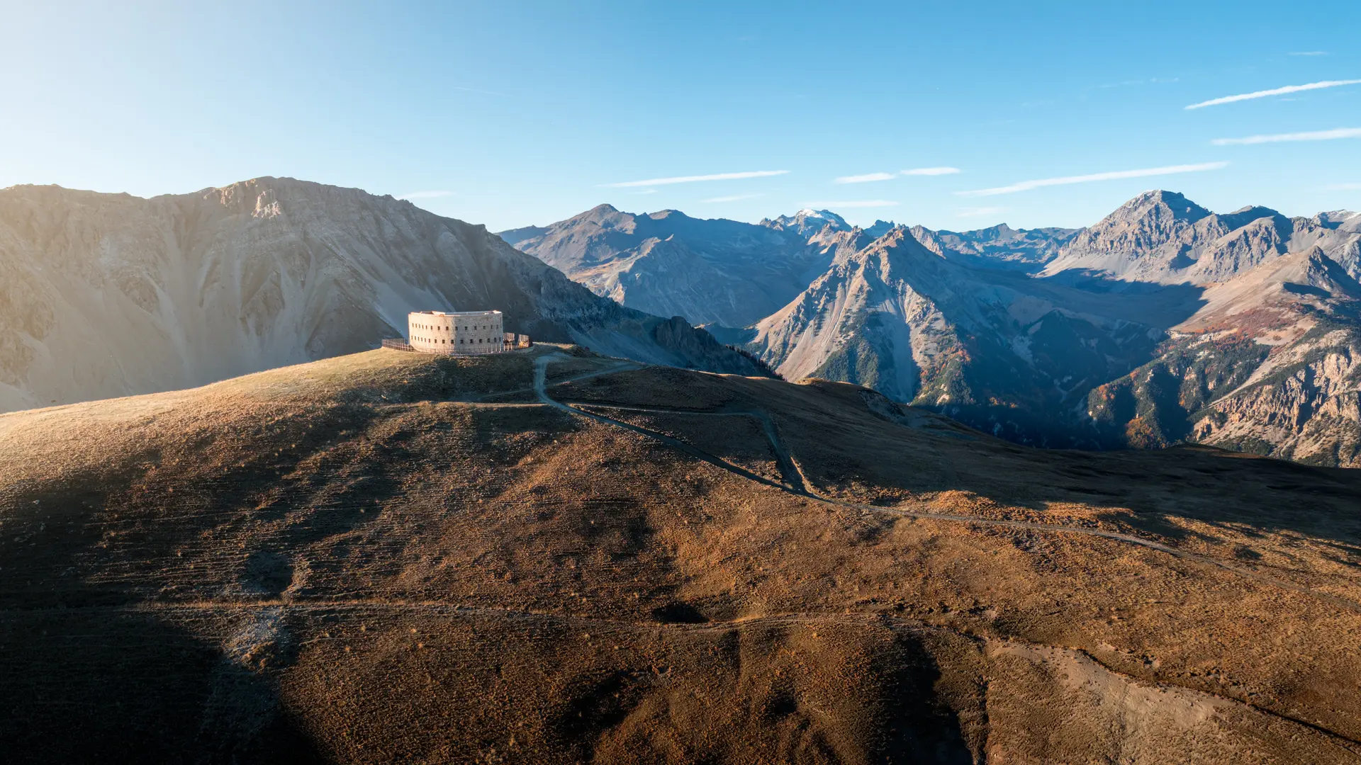
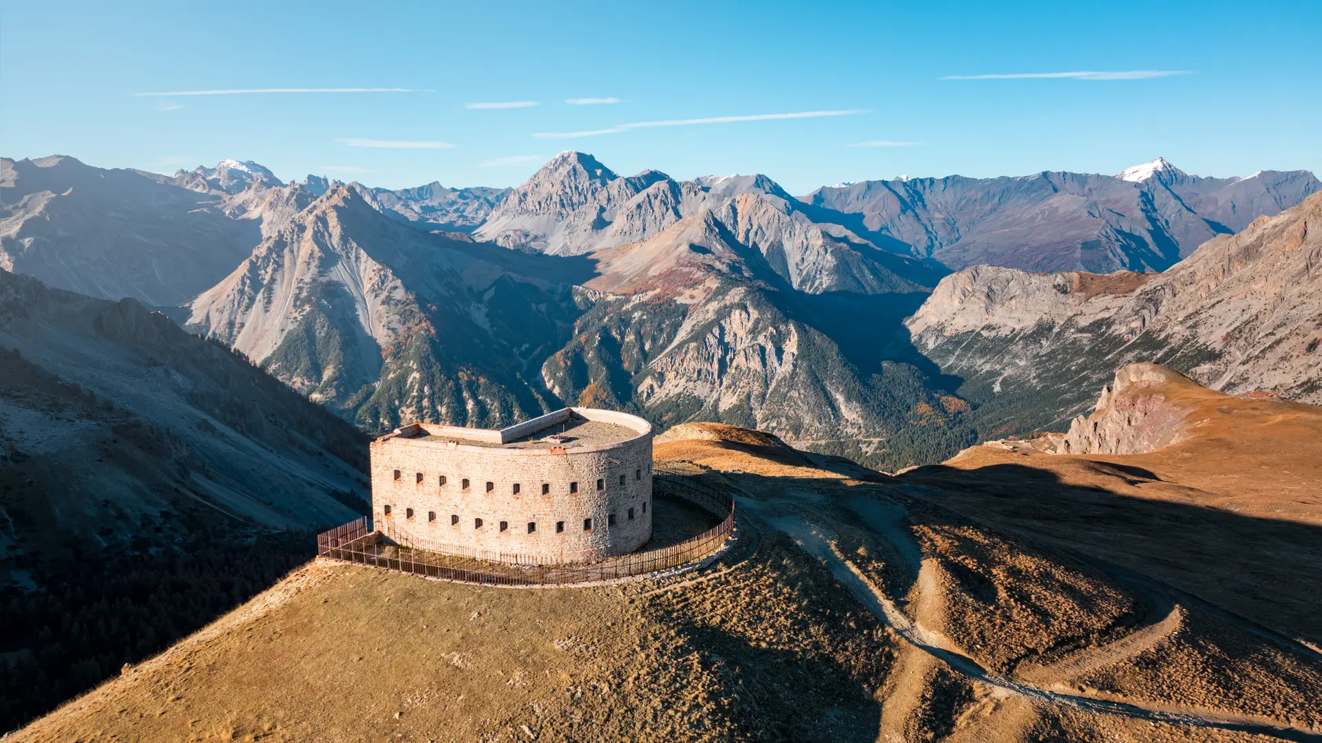
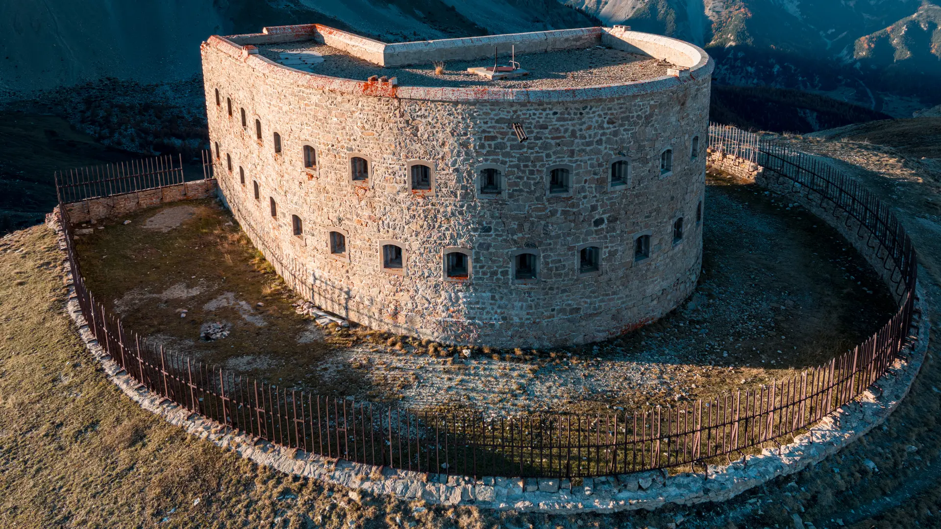
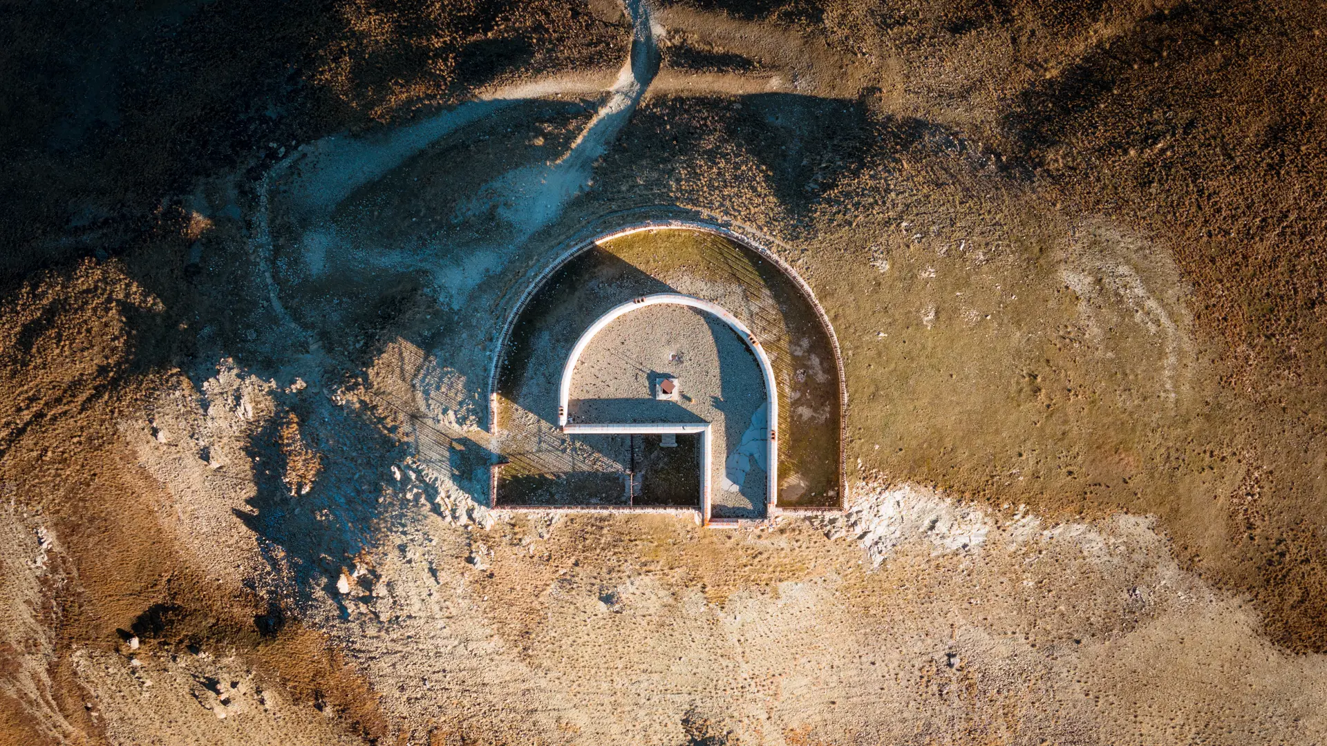
Once at the Fort de l'Olive, ignore the wide military track and continue your ascent along the mineral path that runs along the edge of the Cime des Ruines ridge: the ravine below (Fonts du Creuzet) is impressive. The trail leads directly to Fort Lenlon, with its distinctive circular shape.
The return journey takes the same route.
Entering the forts is at your own risk. Rocks may fall.