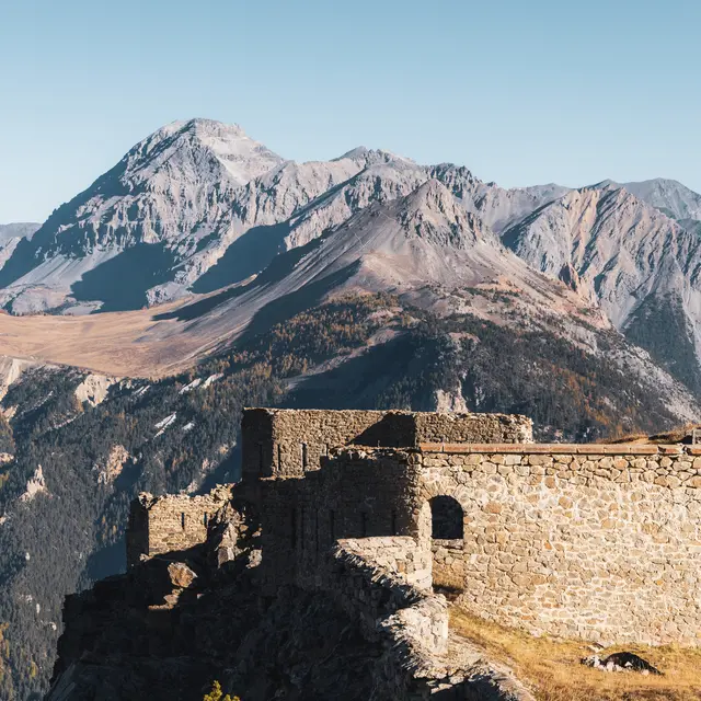
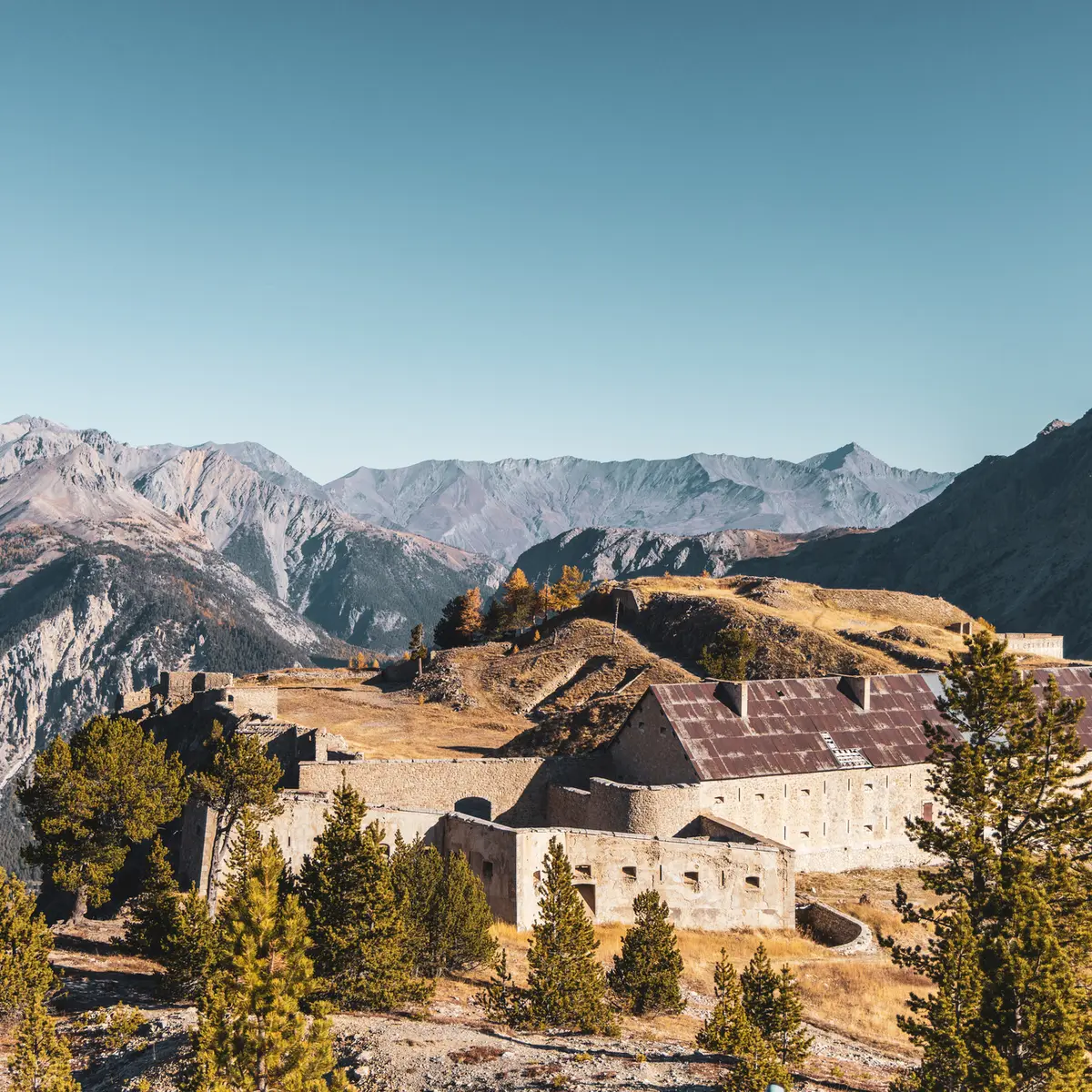
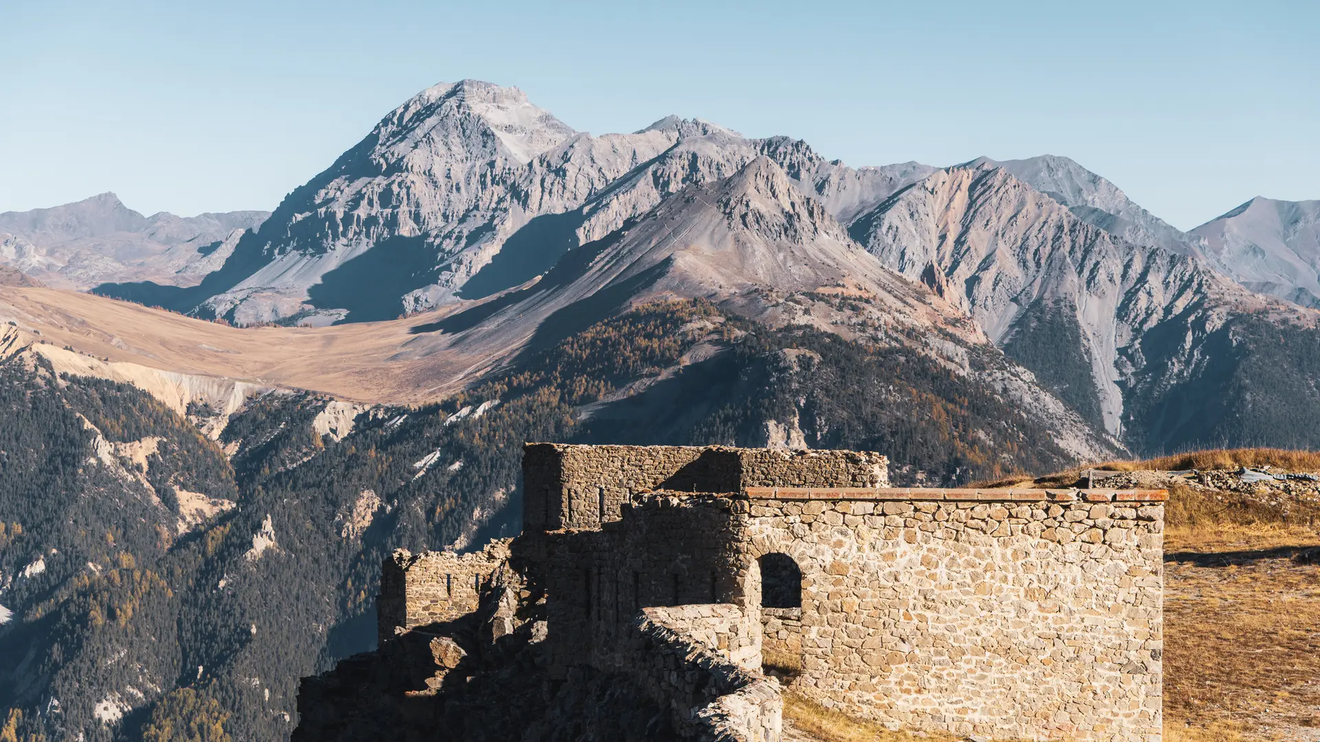
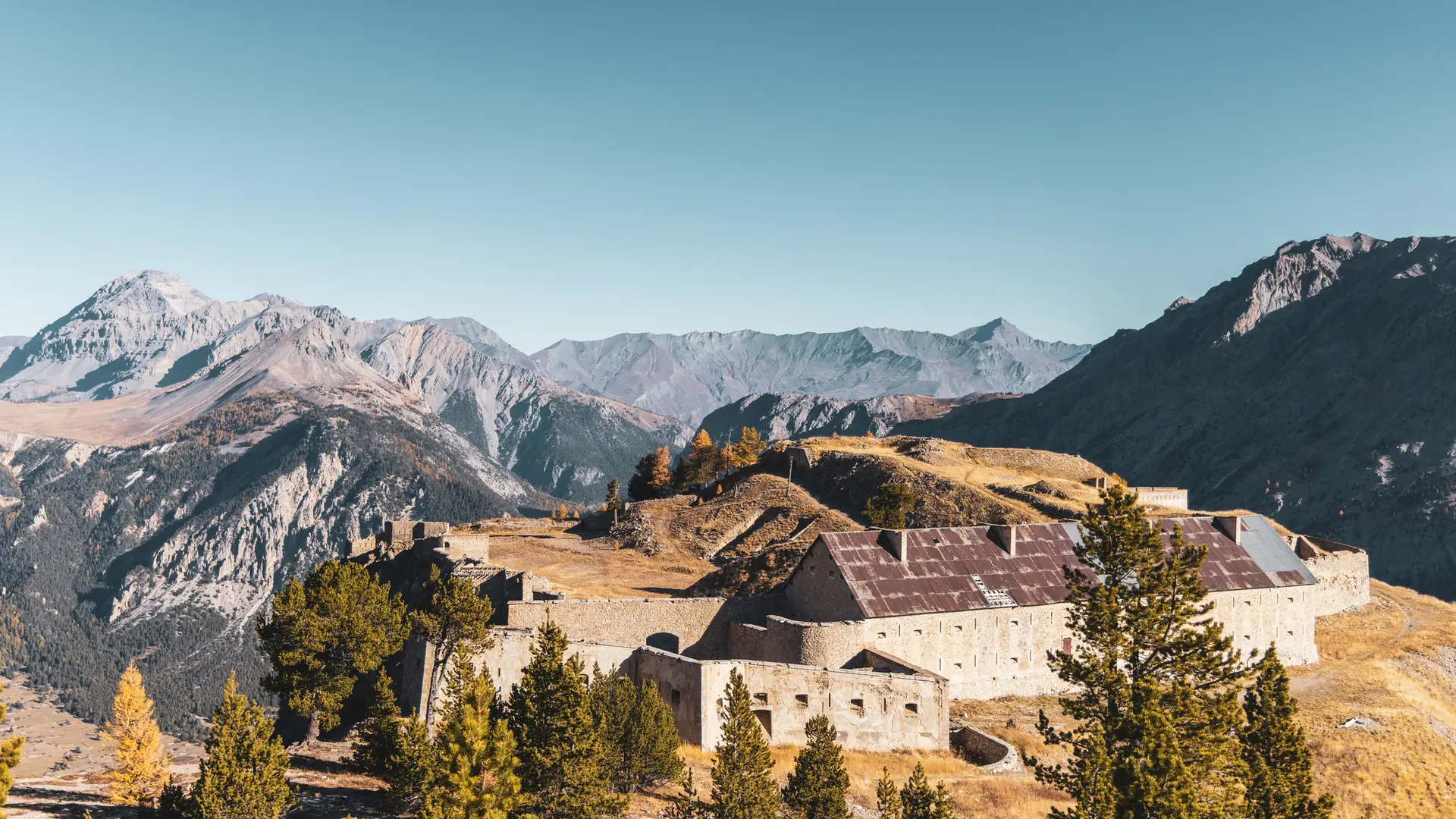
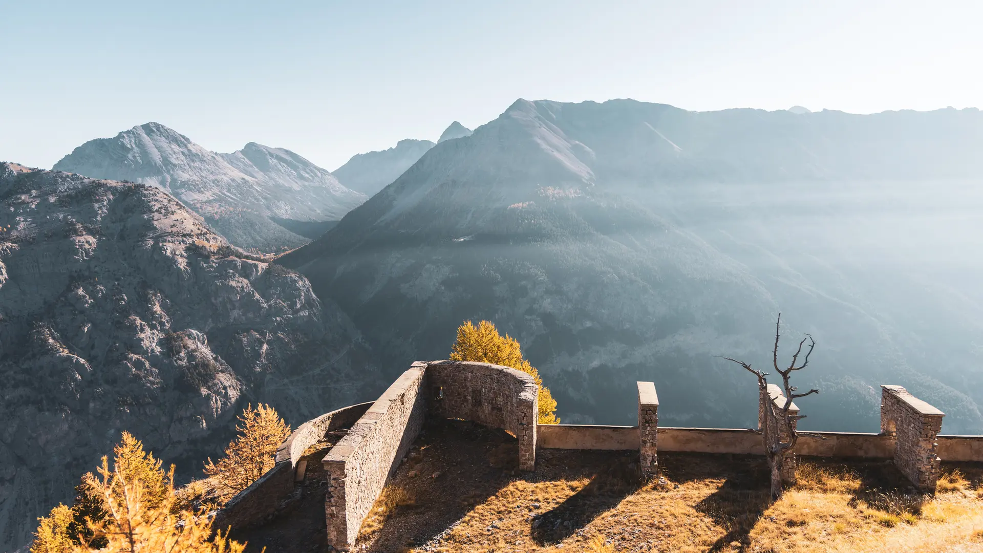
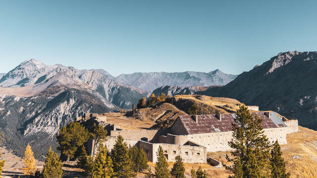
Access to this 19th-century fort perched on the Rocher de l'Olive is well worth the effort. It's a tough climb through the woods, but your efforts will be amply rewarded with an incomparable panorama of the Clarée, Granon, Acles and Echelle passes.
From the parking lot on the outskirts of Plampinet, cross the road to take the wide path on the right, which rises to skirt the heights of the cemetery.
Above the cemetery, continue along the edge of the wood, then turn left at the intersection. The path gradually rises through the forest, then becomes steep: you're now on a short, steady climb.
The path leads to a flat area. This part of the route is relatively hilly.
At an intersection on the left, a large cairn marks the start of the winding climb to Fort de l'Olive. This is the first and most sustained part of the route.
You then reach a magnificent, cool, wooded clearing: the Sapet de l'Olive. Here you can catch your breath before starting the second climb.
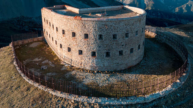
Cross a steep scree slope: the fort is just above the route. The scree quickly leads to a small restored outpost. The path skirts the rocky outcrop to join the wide military track that leads to the entrance of Fort de l'Olive. However, it is possible to shorten this detour by leaving the itinerary on the right, and branching off a hundred or so metres after the outpost: a short path through the alpine pasture leads directly to the entrance of the Fort.
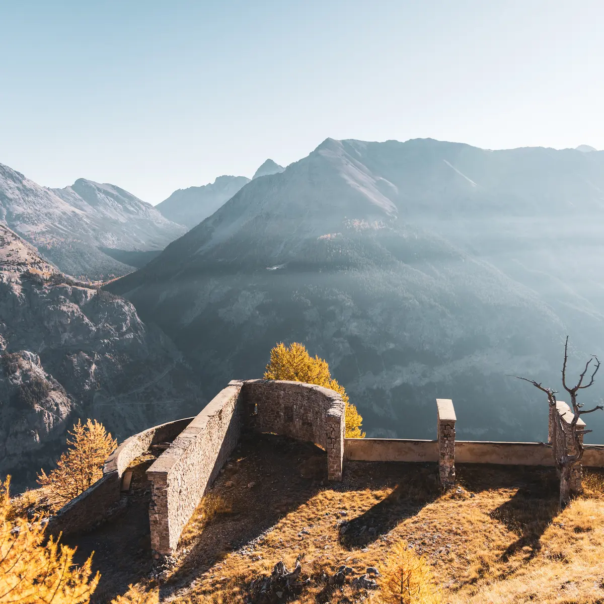
The fort, perched on the Rocher de l'Olive, offers a remarkable panorama of all the surrounding passes. The ravine below (Fonts du Creuzet), above which the Fort is built on the crest of the cime des Ruines, is just as impressive.
Return by the same route.
Option to continue towards Fort de Lenlon.
Entering the forts is at your own risk. Rocks may fall.