
- Voir les favoris
See photos (2)
From Villard-Saint-Pancrace to Col du Galibier
Sport, Cycling sports, Cycle tourism route
in Villar-Saint-Pancrace
79.9
km
3h 45min
Very difficult
-
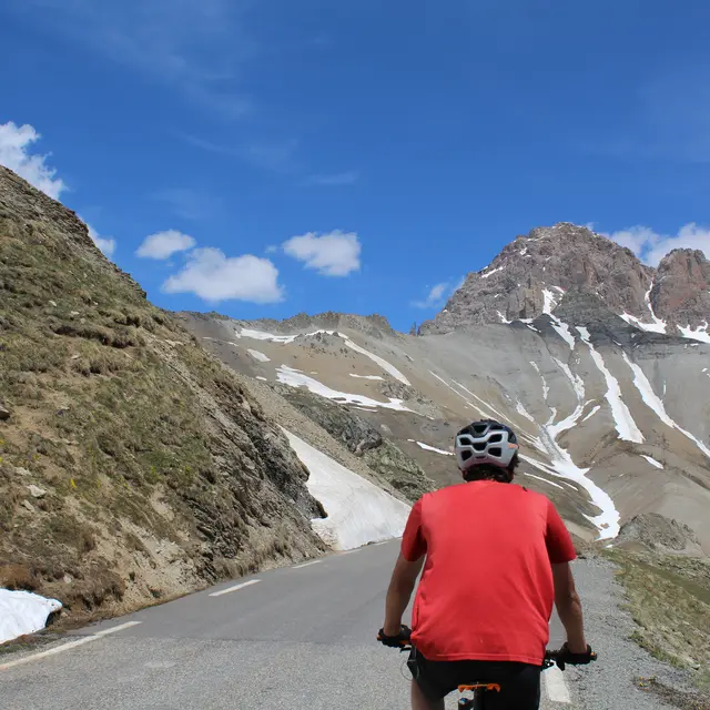
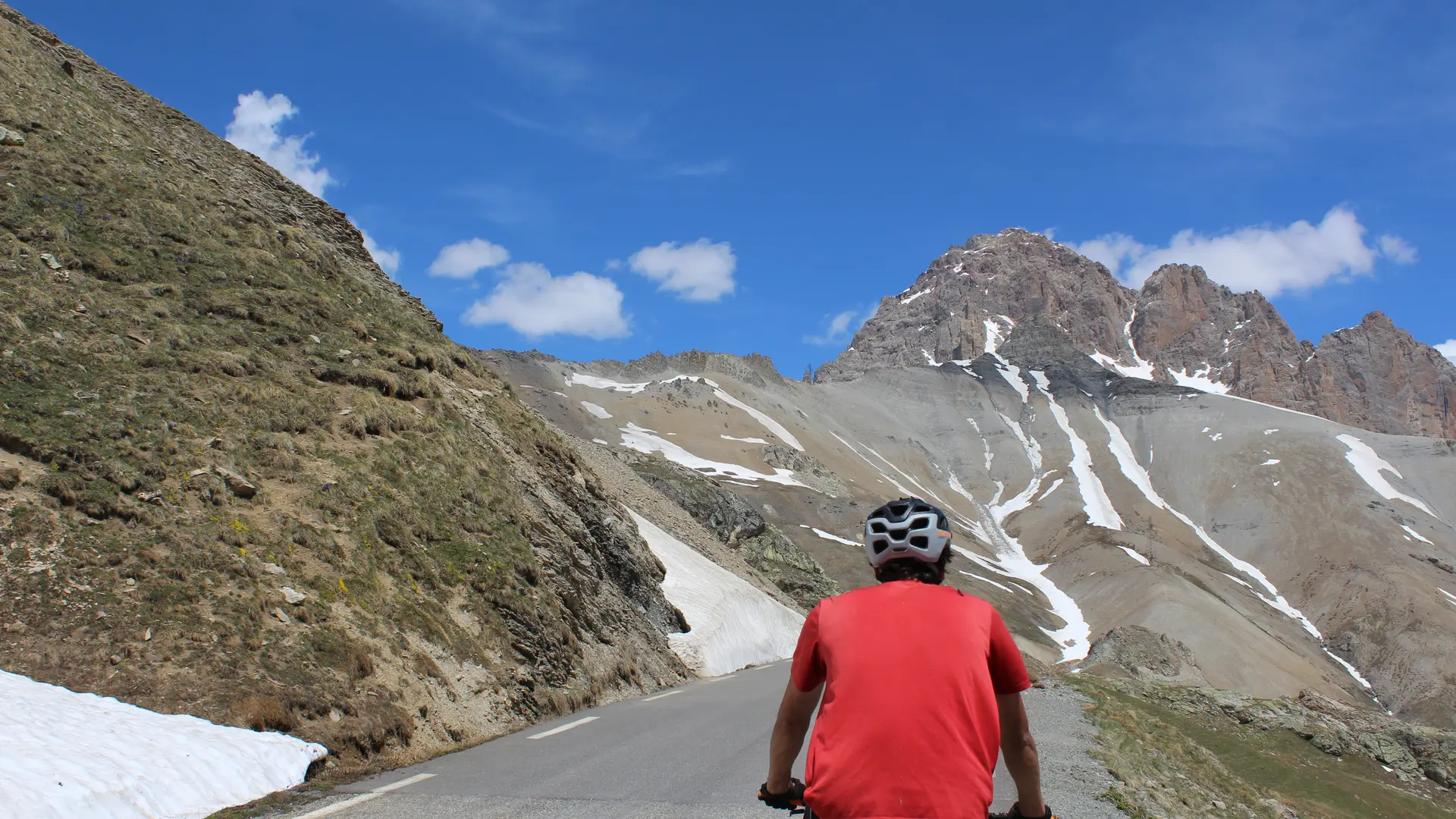
Take on one of the most legendary passes in the Alps: the Col du Galibier!
-
From the Centre Montagne parking lot, take the road on the left, then take the first road on the left again to reach the village center.
Continue straight ahead at the next two stop signs.
At the traffic circle next to the Bialler factory, take the leftmost exit to cross the bridge. At the next traffic circle, take the 1st right and continue straight ahead. Drive through the traffic lights towards Grenoble.
At the next traffic circle, above Géant Casino, take the left-hand exit, heading...From the Centre Montagne parking lot, take the road on the left, then take the first road on the left again to reach the village center.
Continue straight ahead at the next two stop signs.
At the traffic circle next to the Bialler factory, take the leftmost exit to cross the bridge. At the next traffic circle, take the 1st right and continue straight ahead. Drive through the traffic lights towards Grenoble.
At the next traffic circle, above Géant Casino, take the left-hand exit, heading for Grenoble.
At the Briançon exit, take the second exit off the traffic circle, heading for Grenoble, then drive up the Serre Chevalier valley to the Col du Lautaret, for about 23 km.
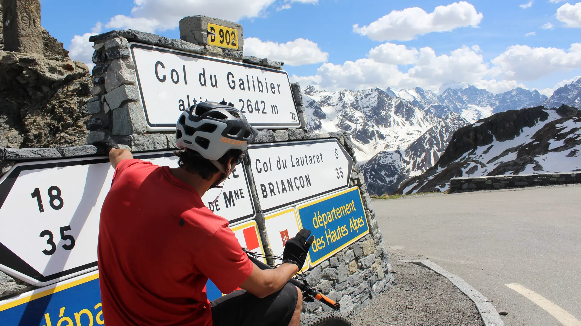
At the pass, turn right towards the Col du Galibier and drive up the pass.
At the traffic lights in the Galibier tunnel, turn right to complete the ascent of the pass.
- Departure
- Villar-Saint-Pancrace
-
-
Difference in height
- 1876.42 m
-
-
-
Plain text period
-
From 01/06 to 30/09 daily.
Subject to snow conditions.
-
-
-
Environment
-
-
-
Spoken languages
-
-
-
Documentation
- GPX / KML files allow you to export the trail of your hike to your GPS (or other navigation tool)
-
-
-
Accepted customers
-
- See all reviews
- 1876 meters of difference in height
-
- Maximum altitude : 2607 m
- Minimum altitude : 1190 m
- Total positive elevation : 1876 m
- Total negative elevation : -1876 m
- Max positive elevation : 168 m
- Min positive elevation : -276 m
Services
-
-
Equipment
-
