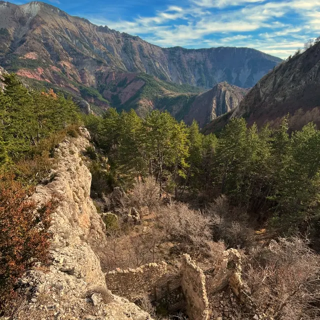
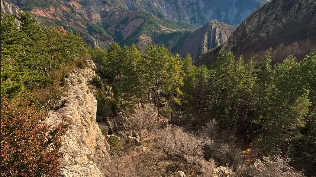
Numerous passages in the bed of torrents or small watercourses. Do not take this route in case of rain or risk of storm. It is possible to shorten the route and avoid crossing the Galèbre by following the "schoolmaster's path" between Saume Longe and Pié Fourcha.
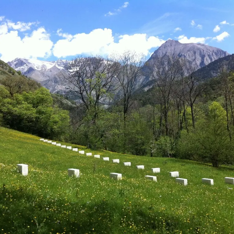
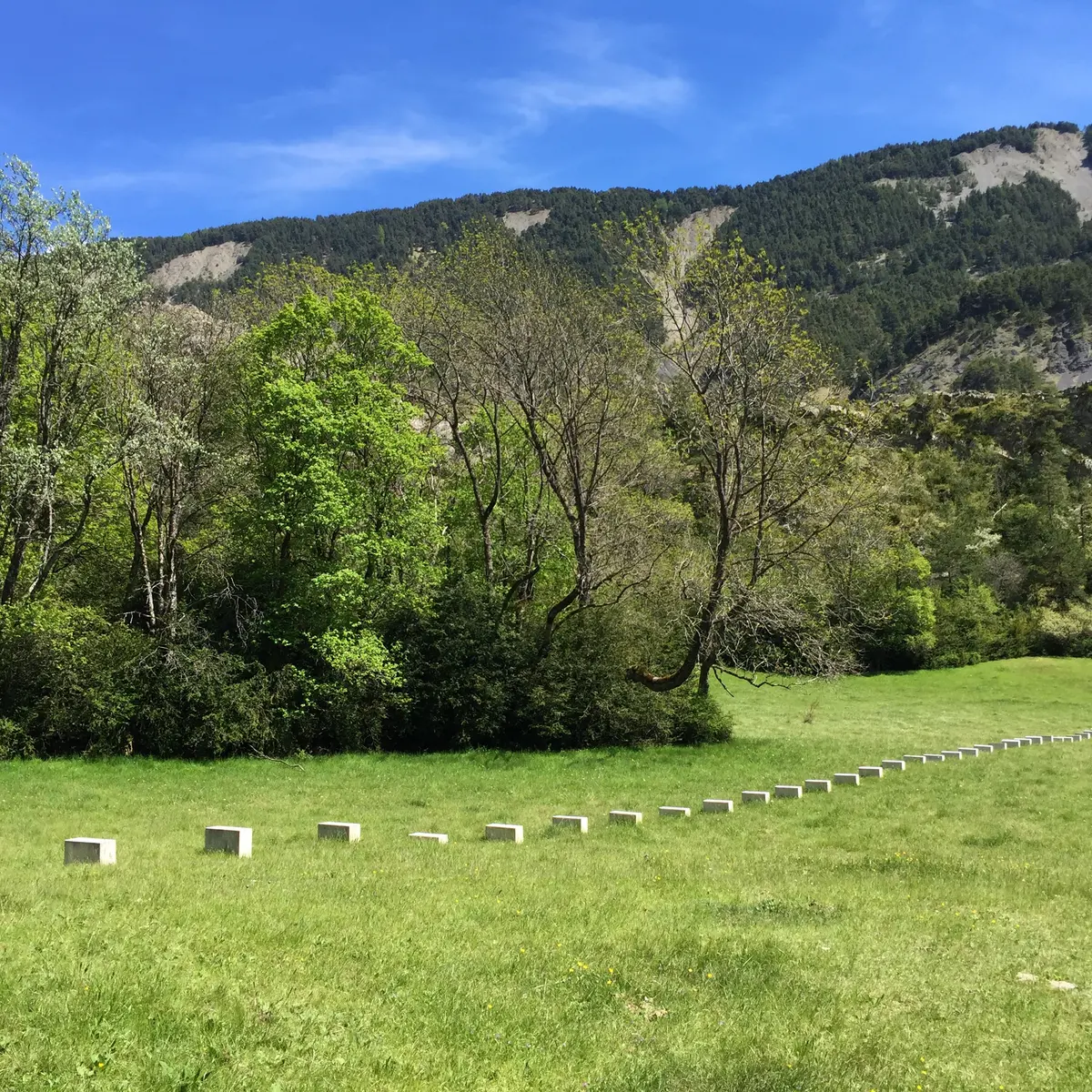
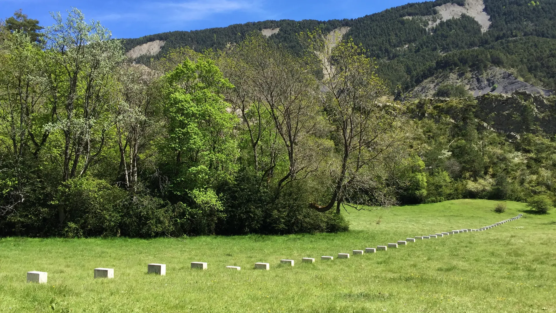
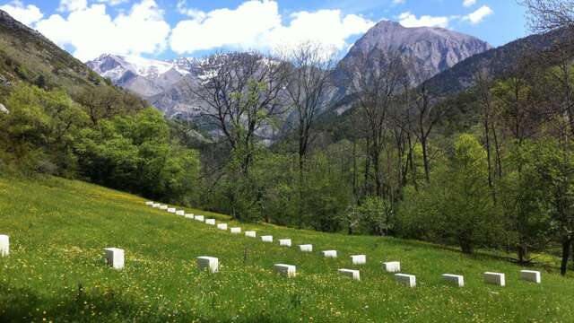
After walking through woods, meadows and black marls, you will arrive at the old hamlet of Pié-Fourcha. Across the meadows, not far from the torrent, you will find the path that soon crosses the Galèbre. On the other bank, the path moves away from the river a little, passes through woods, joins a first meadow, then a second where you can discover the first alignment of rock blocks by Richard Nonas*: Edge-Stones : Vière et les moyennes montagnes (2011), a work from the L'Art en montagne collection of the Gassendi museum.
Richard Nonas here adopts the motif of the alignment of cut blocks to highlight links and circulations. Seen from afar, the stones placed on the ground, in the meadow, form a line of suspension points. An integral part of the territory, they seem to indicate a direction, rather than calling for contemplation. Made with white limestone that contrasts with nature, they carry the memory of those who lived and worked here.
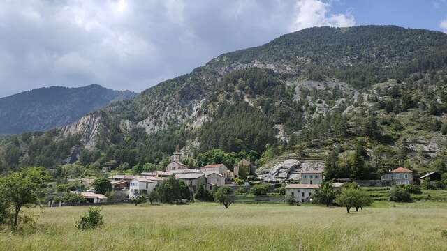
At the end of this alignment, turn right across the meadow and go around a rocky spur by passing through the bed of the torrent to arrive at the hamlet of Vière, at an altitude of 1,200 meters. This hamlet in ruins, abandoned and forgotten since 1936, is located in one of the most remote parts of the Haute-Bléone territory.
A second alignment is in the field below on the right (direction Les Eaux-Chaudes). To access the third alignment, continue straight ahead and pass behind the church of Saint-Étienne de Vière, a dependency of the abbey of Saint-Ruf de Valence. Dating from the end of the 12th century, it consists of a single nave whose barrel vault made of plaster-coated slats has gradually completely disappeared. Richard Nonas*'s intervention went as far as installing a partial larch roof covering on the ruined Romanesque church, aimed at stopping the process of destruction and providing shelter for hikers at night.
*Richard Nonas (New York, United States, 1936–2021). His work, mainly sculptural, attempts to highlight the way in which peoples' identities are constructed through contact with nature and its constraints. His in situ projects are always sensitive to the given territory, its history, its wealth and its inhabitants. The artist has enjoyed international recognition since the 1980s.
Find the full description of the routes in the L'Art en montagne collection in the Topo guide "L'Art en montagne, 22 hikes to discover contemporary art in the Haute-Provence Geopark" (€15), available at the Gassendi museum reception, at the Maison Alexandra David-Neel and at the Tourist Office.
Read more