This itinerary links Fort Central, Fort Tabourde and Fort Pépin via a pretty loop starting from the geographical Col de Tende.
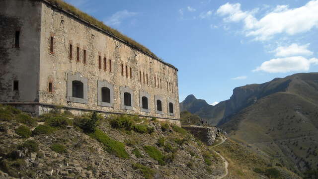
From the Trois Amis road in Italy, walk to the Col de Tende géographique (1,871m - b.340), climb up a wide track to the east and turn right around the large barracks to reach the forecourt of Fort Central (1,910 m - b.339).
Continue eastwards to find a strategic track. Follow it to a pass (1,880 m - b.338) and cross over to the French side, where you follow a wide track to Fort Tabourde (1,982 m - b.335), sheltering a flock of sheep (watch out for patous dogs!).
The trail continues due east to reach (b.335a), then north to join the track leading to the alpine dwelling.
Leave it near the latter and head up the whole Framoursoure valley, first on the left, then cross it and continue due north to join the military track below the border ridge (b.337a).
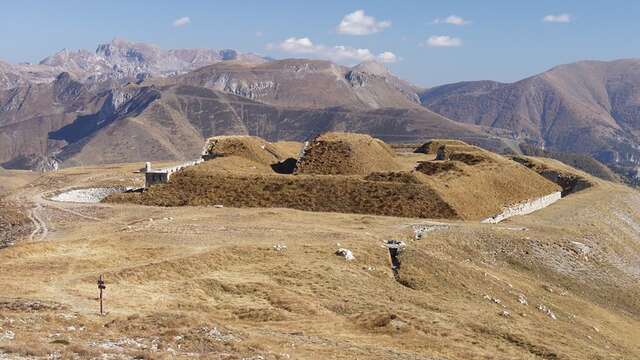
A return trip due south on the latter will take us to Fort Pépin. Retracing our steps, continue west (b.337) slightly below the summit of Bec Roux (2,214 m) to descend directly along a path that soon reaches marker b.338 (1,880 m), where we return to the outward route. Continue downhill on the track without passing Fort Central.