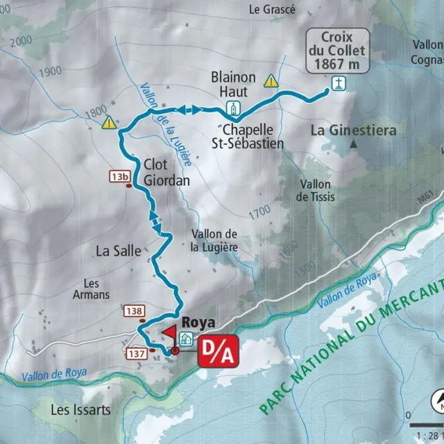
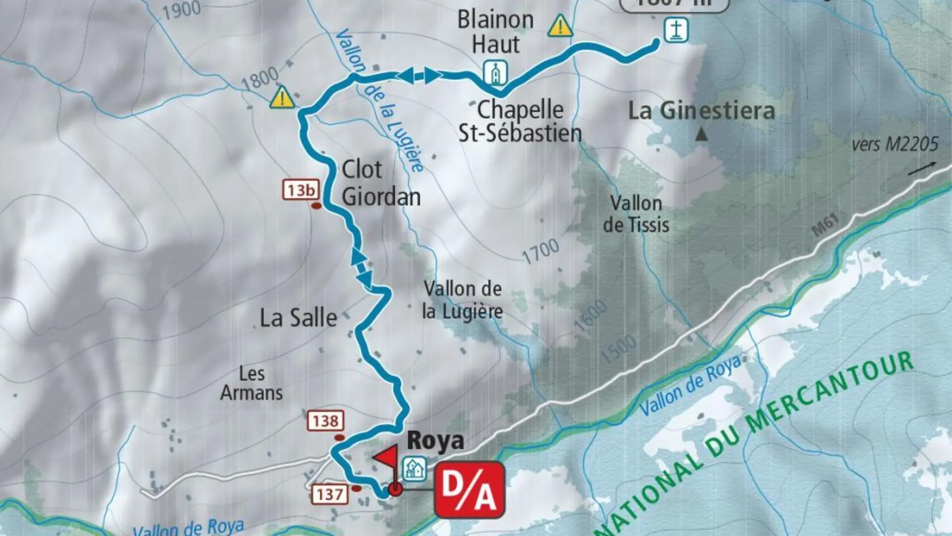
Peaceful stone barns clad in lime and larch cladding roofs mark the initial climb towards the Saint-Sébastien chapel and its bell tower restored in 2012. The impromptu arrival at the collar cross allows the discovery of a magnificent panorama which extends to the south over the Mercantour National Park and in particular the ridge of Mont Mounier, Peyre de Vic and Mont Rougnous, which is articulated on both sides another from the Sallevieille valley whose gentle snowy slopes inspire contemplation. Note that the area visited is a wintering place for ungulates; it will not be uncommon to observe chamois, deer or wild boar there.
Elevation gain: +430 meters / -430 meters
Distance: 6 kilometers round trip
Duration: 4 hours
Recommended period: December to March
Avalanche risk depending on conditions: Simple
Cartography: TOP 25 n° 3639 OT
Itinerary :
From the place of the hamlet of Roya (1,500 m - b.137) take the small road behind the stopover lodge, to find the path which goes up between the houses until reaching marker 138. Continue by turning right direction the Col du Blainon, and gradually rise to the La Salle plateau and its characteristic barns (1,667 m).
Shortly after, the route arrives at a place called “Clot Giordan” (1,779 m - b.13b); the trace of the snowy path goes off the slope and joins the Lugière valley, which you will have to cross quickly without parking to avoid exposing yourself to the dominant slopes. By a large movement turning towards the east, reach the chapel of Saint-Sébastien (bell tower) and continue in an easterly direction to easily reach the ridge of the collar and its cross (1,867 m), the high point of the route .
The return takes place via the route taken on the outward journey.
Read more