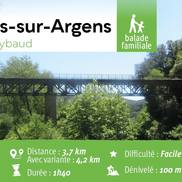
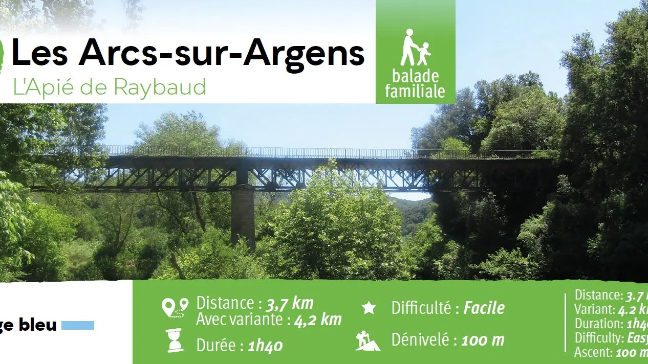
• Family outing
• 2.79 miles
• 1 hour 40 minutes
• Ascent: 100 meters
• Waymarked trail (yellow orientation arrows)
Access to the waymarked trail
•On the secondary road DN7,south of Les Arcs city centre, go onto Chemin du Bac pathway ( signpost “Terrier des Menhirs”) and keep ahead for about 1.86 miles.
•La Tournavelle carpark. The walk starts after the Argens bridge, and just before the Ailles bridge.
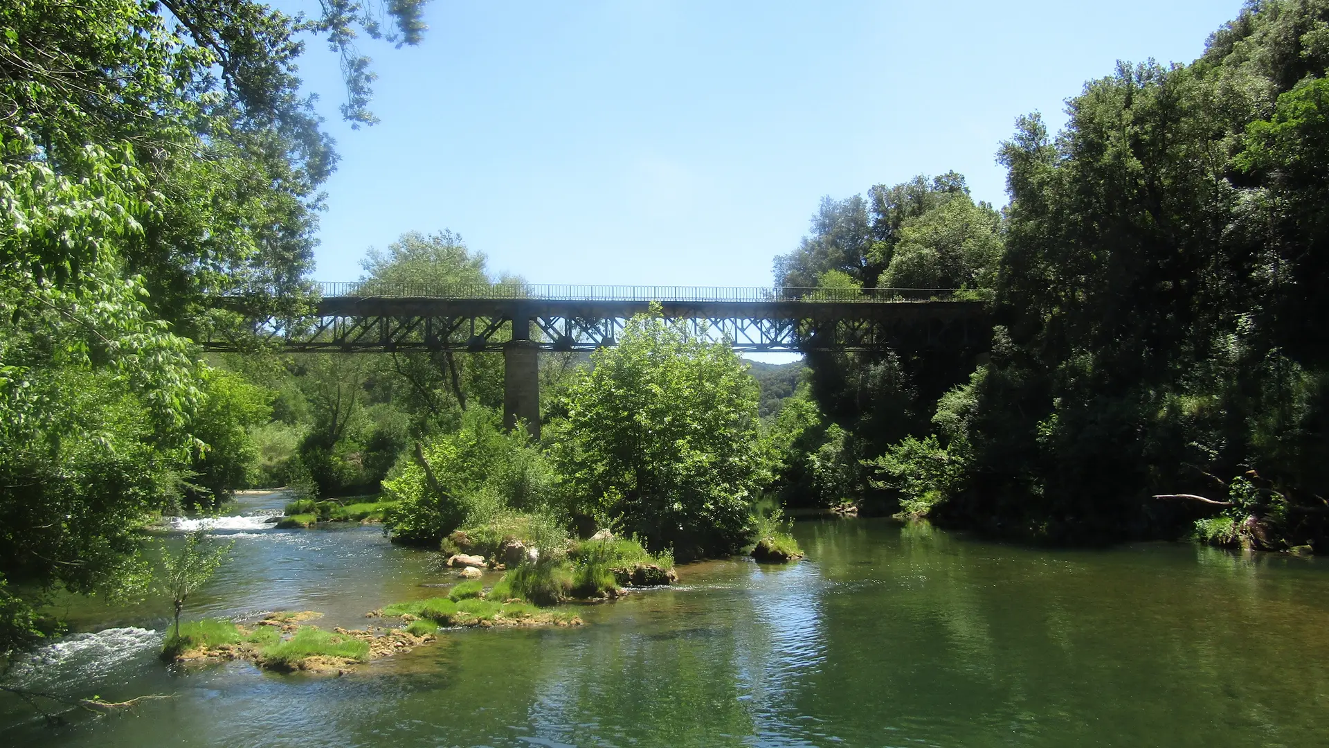
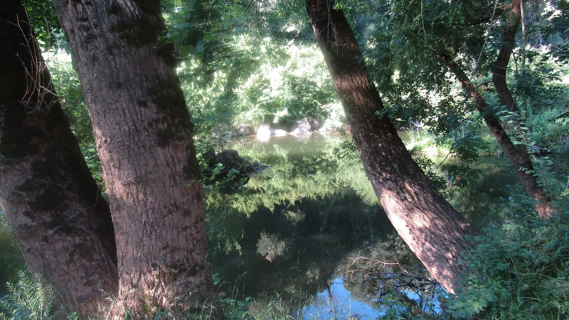
•From the carpark, follow the well-worn path until the Aille bridge is met (Eiffel iron bridge)
Waymarked trail
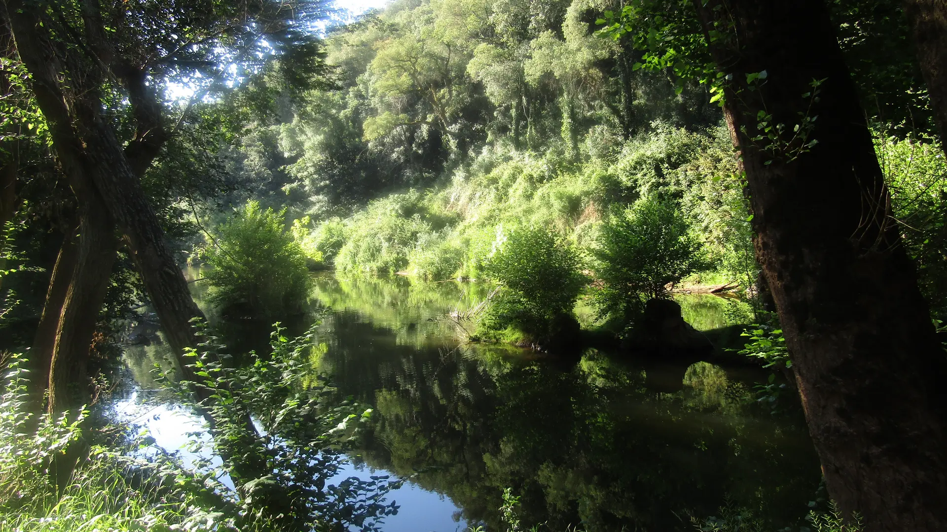
•Just before the Aille iron bridge, turn right onto the path going alongside the River Aille, for about 0.93 miles
•Take a sharp right turn onto a pathway going uphill, through the woods, until a tank is met (after about 872 yards)
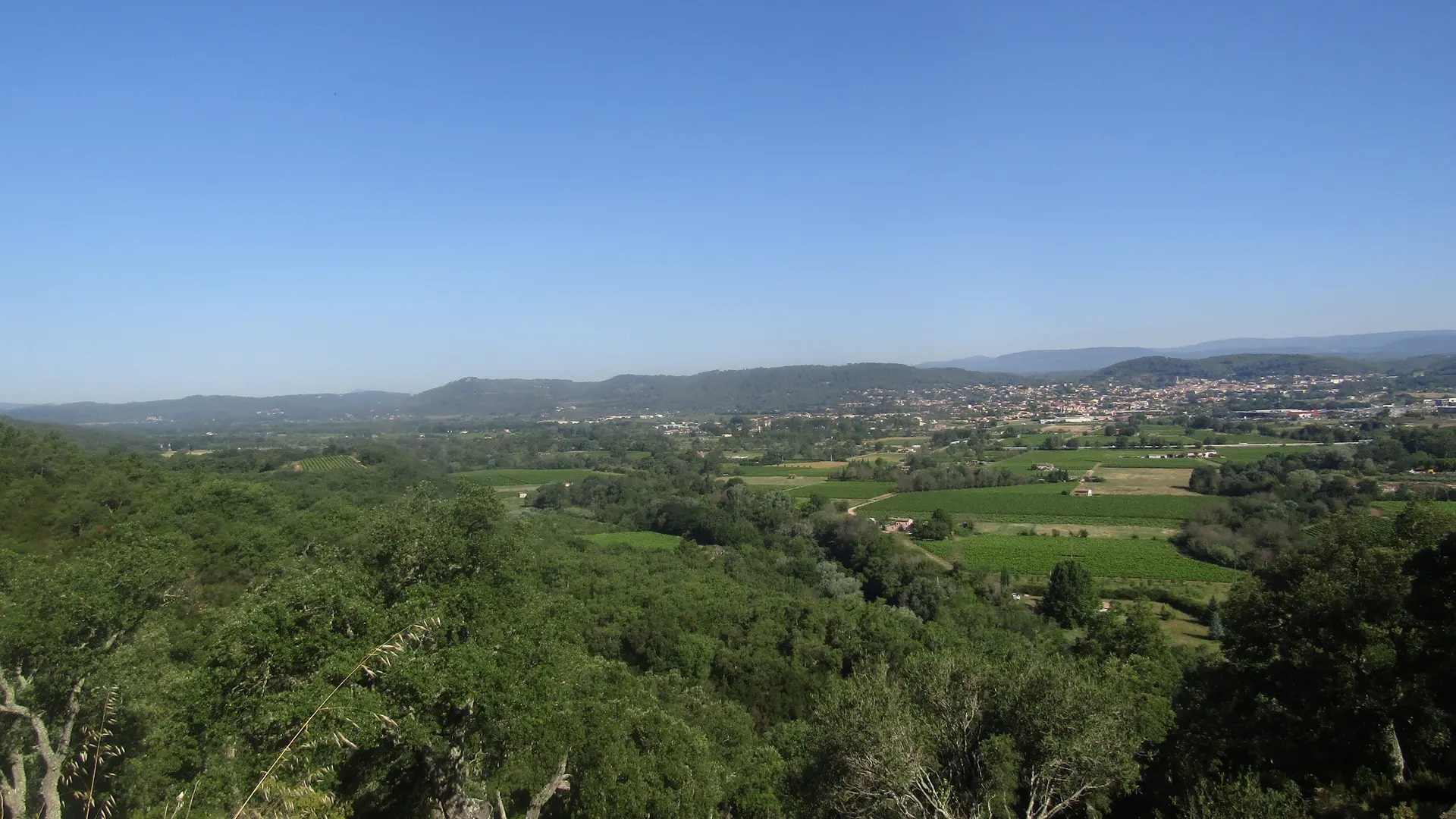
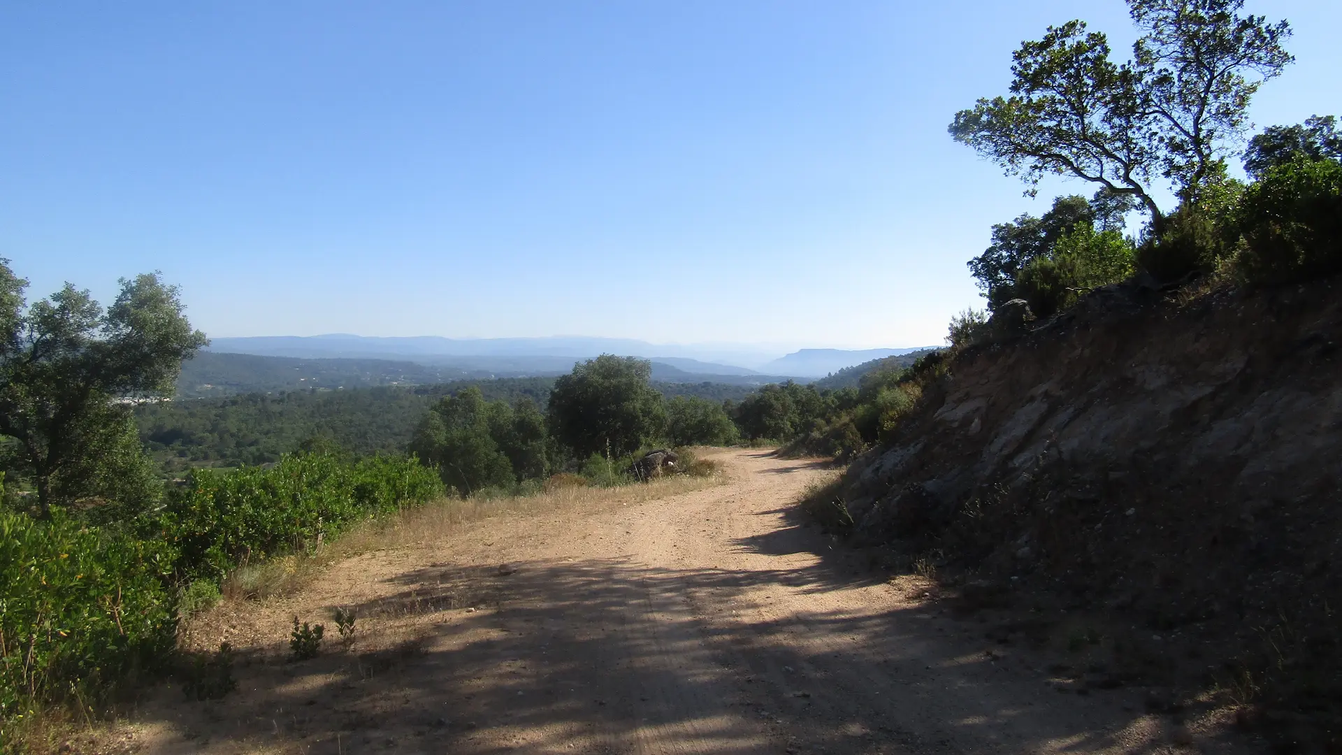
•At the junction, follow the trail heading downwards. You can pause and admire the overhanging view on the Argens river
•Outstanding viewpoints on Argens plain and Les Arcs town
•A new crossroad junction will be met after about 0.93 miles: At this point, turn right onto the road up Tournavelle carpark
Respect the security rules :
http://www.mairie-les-arcs-sur-argens.fr/associations-culture/tourisme/patrimoine.html
Pompiers • 112 • Info Massif • 04 98 10 55 41 • var.pref.gouv.fr/massifs • ddaf.cdig-83.org
Read more