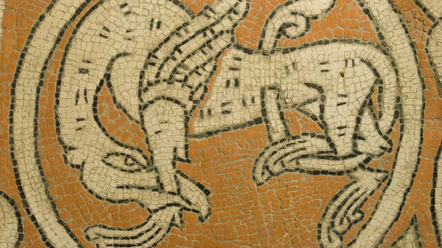
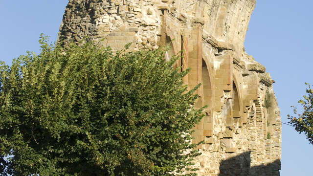
- Voir les favoris
See photos (4)
Hiking trail "Le Serre de Bout"
Sport, Pedestrian sports, Hiking itinerary
in Saint-André-de-Rosans
7.2
km
2h 30min
Medium
-
An easy familial stroll for everyone. A mountain trail will let you have a view overlooking the valley of Eygues before going up 50 m on the Serre de Bout. A beautiful ridge trail will take you back to the start in an oak and pine forest.
-
Starting point at Saint André de Rosans' village square. The path follows a small road toward "Mange Fèves" (D425) and quickly take the first right.
At the calvary, take the small road on the left...
... then exit it on the right path (toward Serre de Bout).
After the "Font Giraud" house, follow the path on the left and proceed forward (ignore the trails on the right). This path becomes a smaller trail, and will proceed toward mountain paths giving you a view overlooking Eygues.
At the...Starting point at Saint André de Rosans' village square. The path follows a small road toward "Mange Fèves" (D425) and quickly take the first right.
At the calvary, take the small road on the left...
... then exit it on the right path (toward Serre de Bout).
After the "Font Giraud" house, follow the path on the left and proceed forward (ignore the trails on the right). This path becomes a smaller trail, and will proceed toward mountain paths giving you a view overlooking Eygues.
At the ridge, go right until reaching the Serre de Bout. You will have to go through a difficult part through rocky area, thankfully it is very short.
This trail follow the ridge below on the right until a relay mast.
After reaching the relay, turn right to get back to the starting path.
Retrace your stps until Saint André, where you can visit the old priory from the 12th century.
- Departure
- Saint-André-de-Rosans
-
-
Difference in height
- 259 m
-
-
- Starting point at Saint André de Rosans' square.
-
-
Plain text period
-
All year round.
Subject to favorable weather.
-
-
-
Documentation
- GPX / KML files allow you to export the trail of your hike to your GPS (or other navigation tool)
-
-
-
Accepted customers
-
- See all reviews
- 259 meters of difference in height
-
- Maximum altitude : 929 m
- Minimum altitude : 726 m
- Total positive elevation : 259 m
- Total negative elevation : -259 m
- Max positive elevation : 112 m
- Min positive elevation : -196 m

