See photos (4)

Ichtyosaure de la Robine

Cultural, Pedestrian sports, Course, Hiking itinerary in La Robine-sur-Galabre
Unresolved hours
4.3 km
1h 30min
Very easy
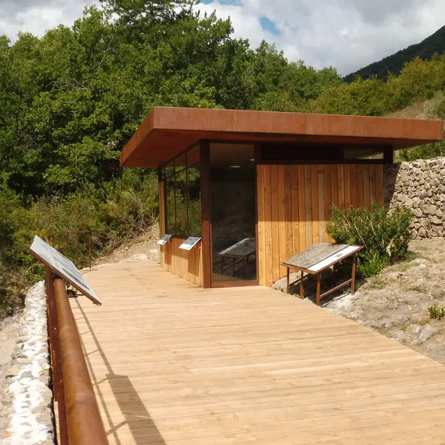
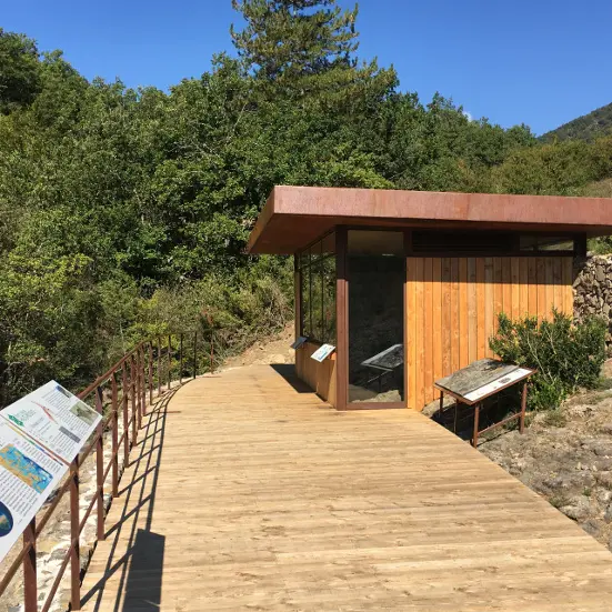
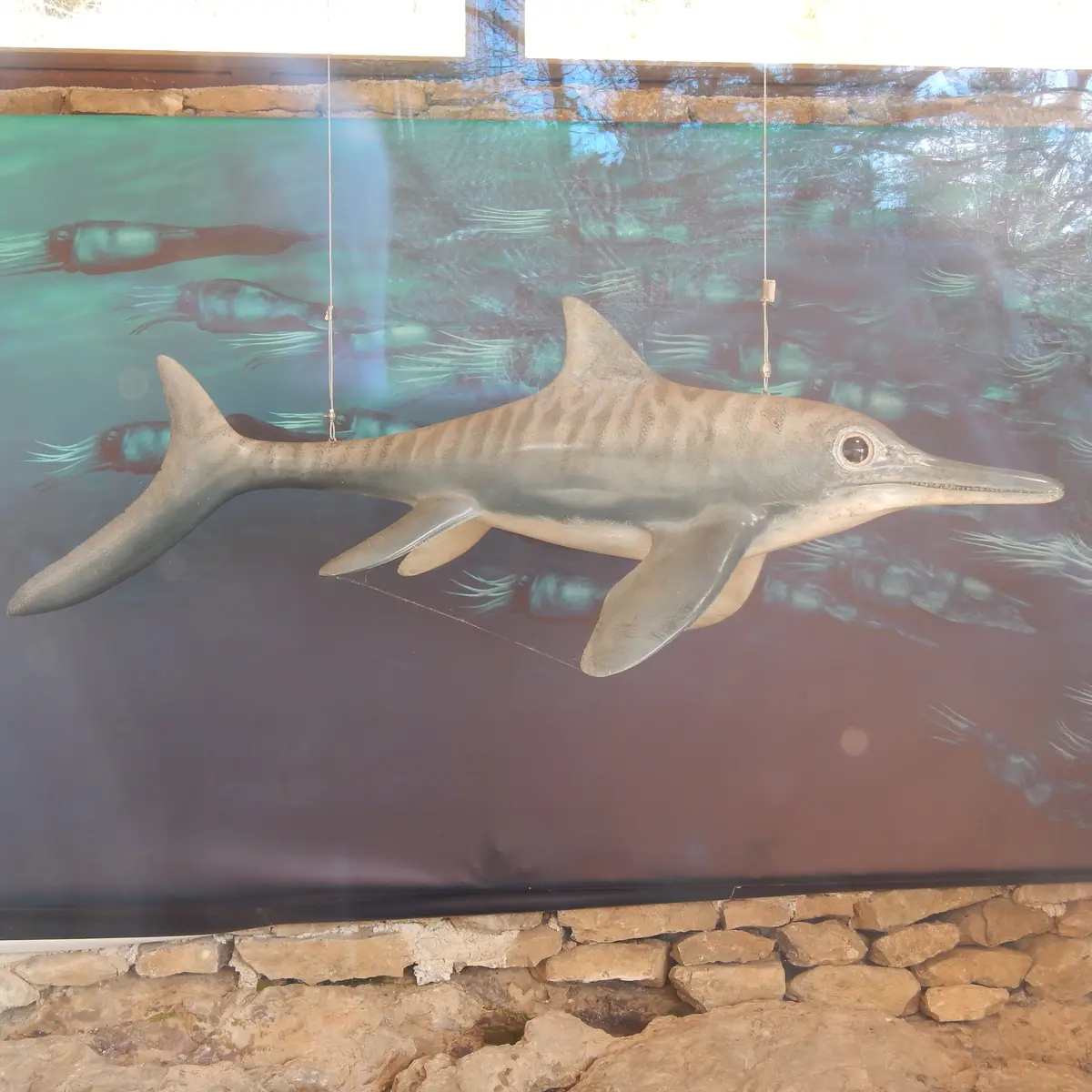
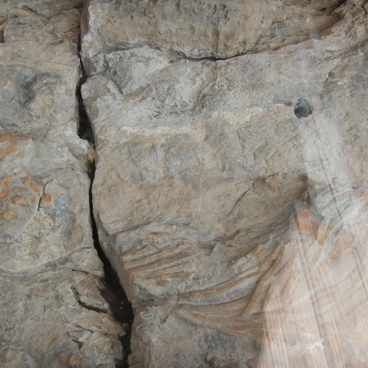
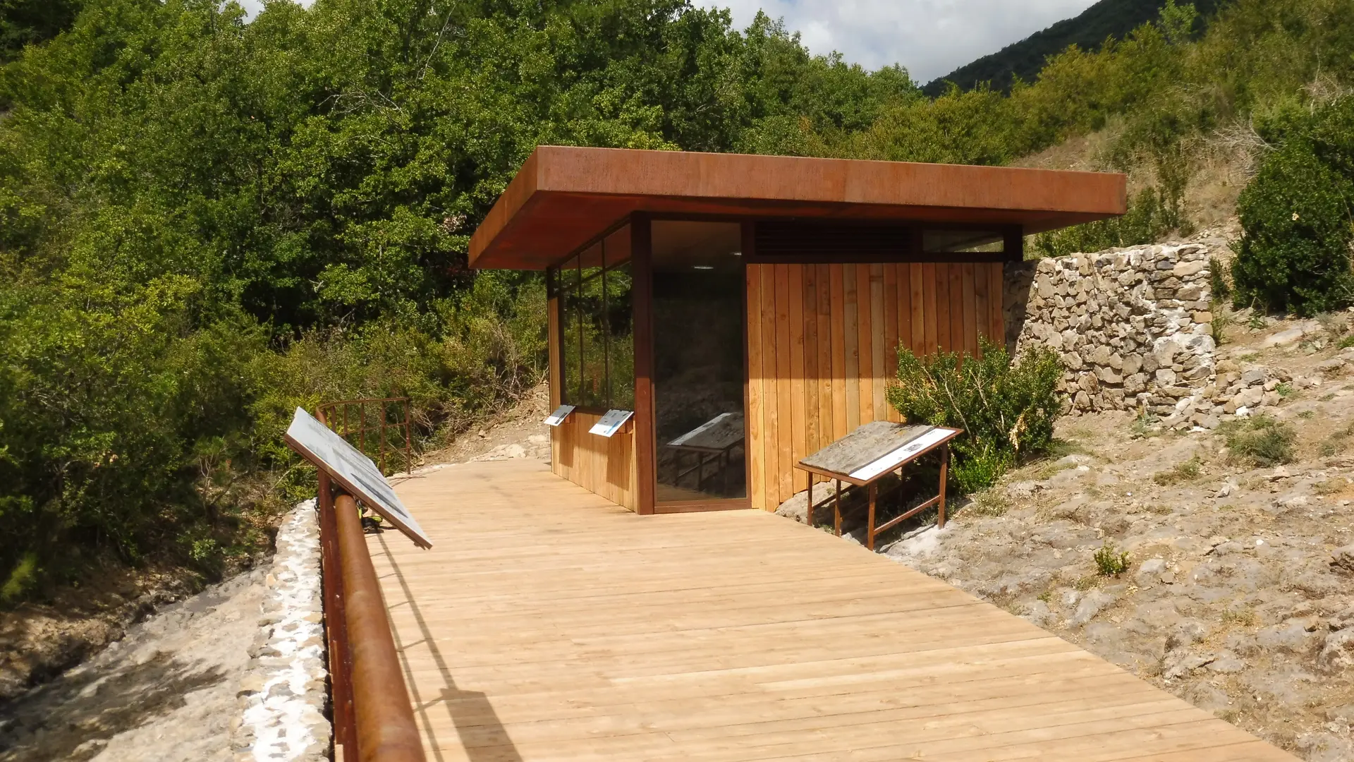
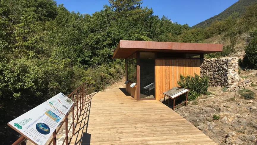
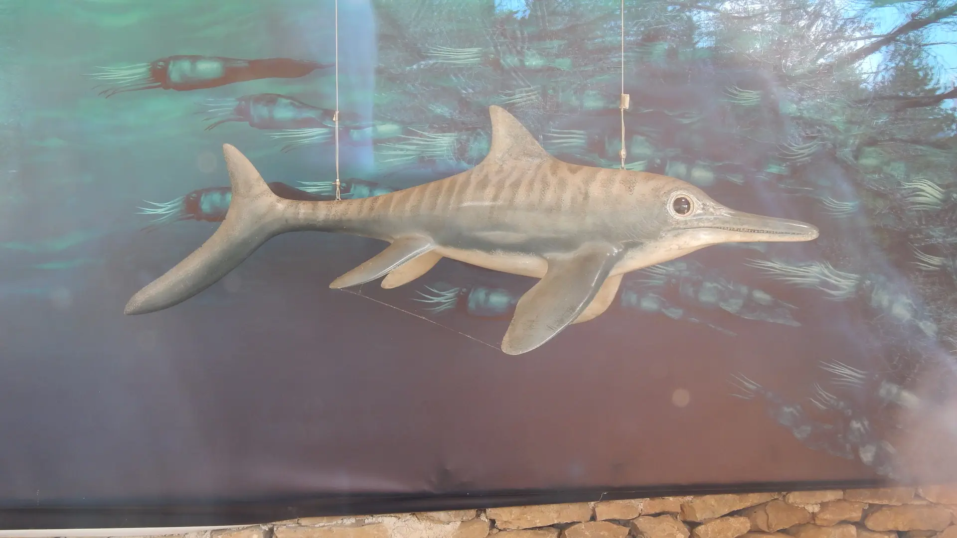
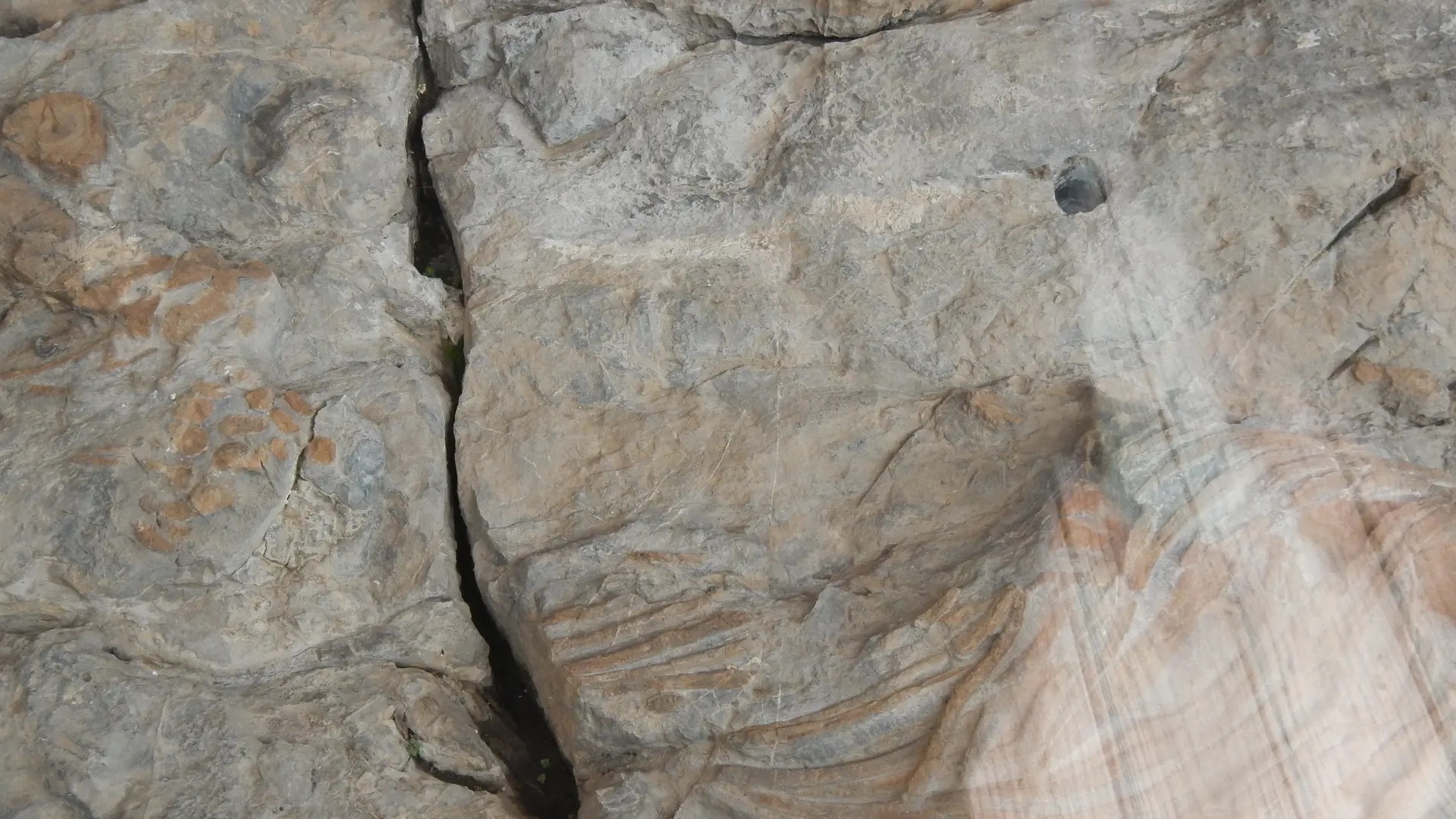
  • The shaded path leads to the fossil skeleton of an ichthyosaur (a 4m long marine reptile) preserved and protected at the discovery site. The path runs along the Bélier ravine and rises in a wooded slope of oaks and beeches to the Col du Jas.

  • The ichthyosaur site is located 200 meters below after the pass, it is one of the eighteen sites classified as a national geological nature reserve. Since 2018, it has benefited from brand new equipment that ensures its physical protection and allows its discovery. It is the skeleton of a large marine reptile that lived in the Jurassic sea about 180 million years ago.
  • Departure
    La Robine-sur-Galabre
  • Difference in height
    188.493 m
  • Environment
    • Mountain view
    • Forest location
  • Spoken languages
    • French
  • Documentation
    GPX / KML files allow you to export the trail of your hike to your GPS (or other navigation tool)
188 meters of difference in height
Created with Highcharts 6.2.0Distance (km)Altitude (m)0 km0.25 km0.5 km0.75 km1 km1.25 km1.5 km1.75 km2 km2.25 km2.5 km2.75 km3 km3.25 km3.5 km3.75 km4 km4.25 km700 m725 m750 m775 m800 m825 m850 m875 mHighcharts.com
  • Maximum altitude : 865 m
  • Minimum altitude : 702 m
  • Total positive elevation : 188 m
  • Total negative elevation : -188 m
  • Max positive elevation : 162 m
  • Min positive elevation : -162 m
Services
  • Equipment
    • Free car park
    • Car park
Close