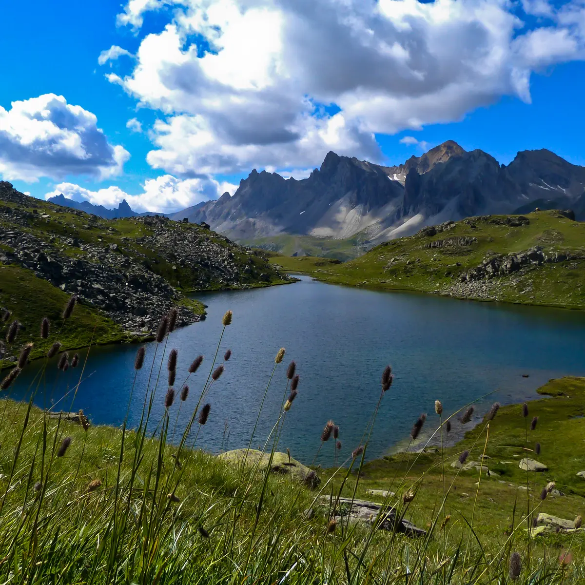
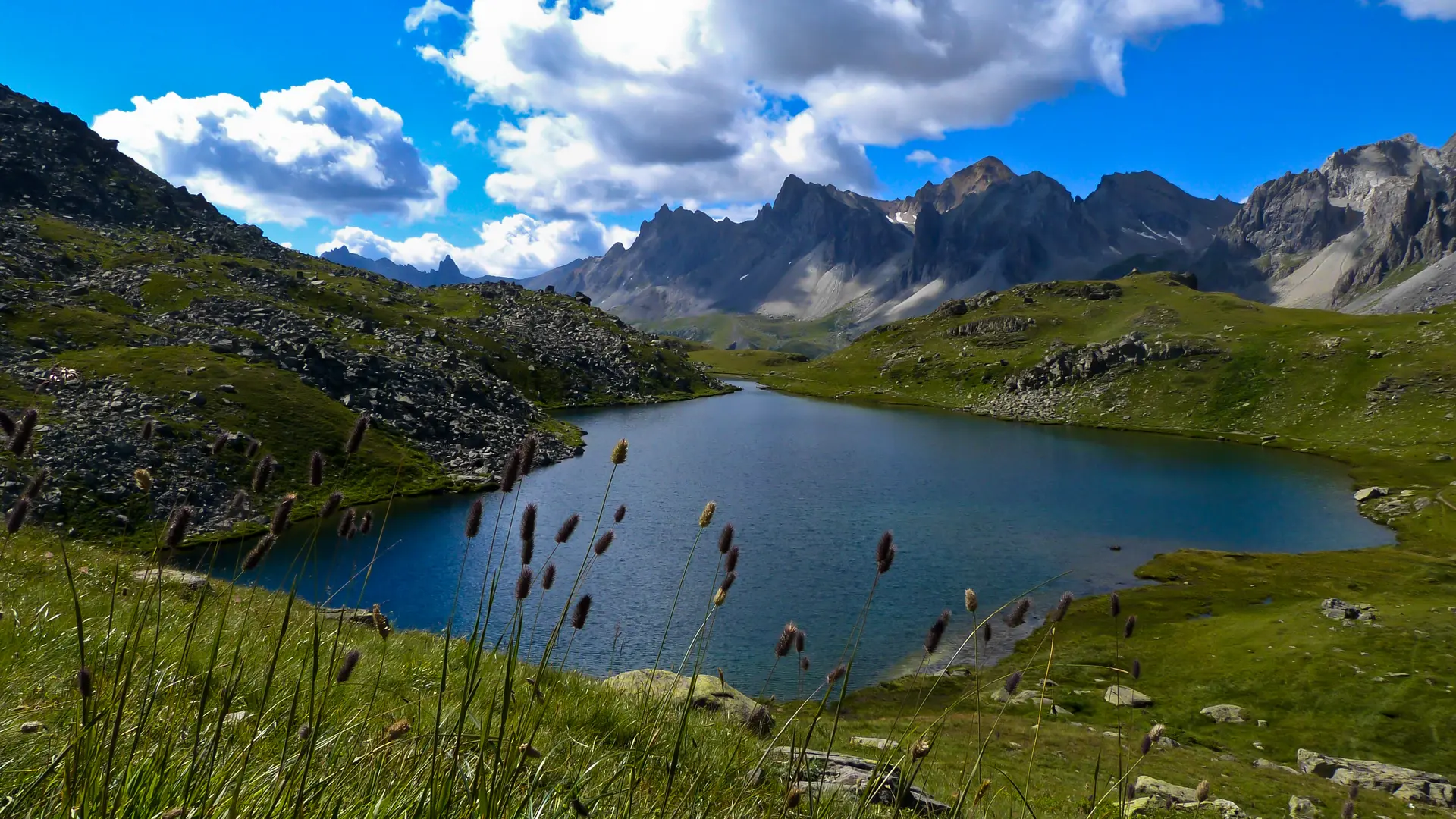
A family hike par excellence in an exceptional setting. The Lac Long itinerary lets the whole family discover all the attractions of a high-altitude lake trail: marmots, blueberries, alpine flora... and views of the Cerces massif.
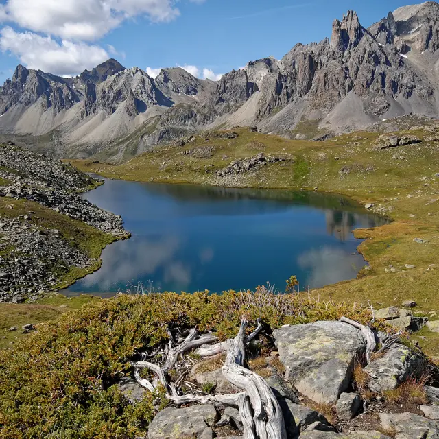
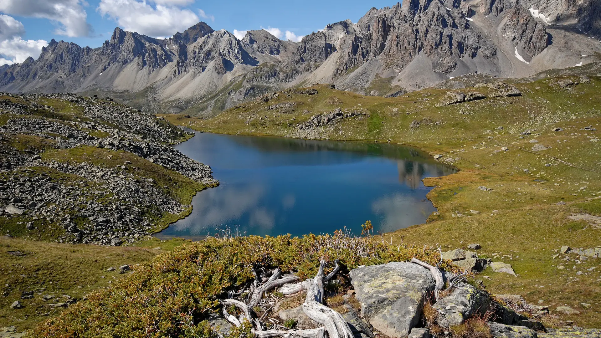
With its 370-meter vertical drop, the Lac Long is the easiest to access in the Clarée. Deep in the heart of the Haute Clarée, this family-friendly hike offers a remarkable view of the Massif des Cerces, the Main de Crépin and the Pointe des Cerces.
From the Laval parking lot, take the wide, stony track heading towards the bottom of the Clarée valley (GR de Pays Tour du Mont Thabor), which overlooks the Clarée river on its left bank: continue on this track for just over a kilometer to the Lac Long sign.
At this point, leave the track and take the small path on the right: this small mountain path gradually rises through alpine meadows and rhododendrons, before crossing a rock bordering the path. The route then quickly joins the Riou Sec stream as far as the Lac Long weir.
The return journey takes the same route.
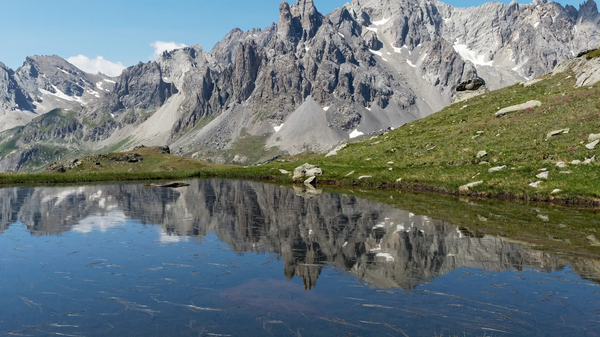
It is possible to continue towards Lac Rond des Muandes 2446 m above sea level:
To do this, continue for around twenty minutes and cross a "rocky field". Keep as far to the left as possible, as the route becomes less visible through the rocks.
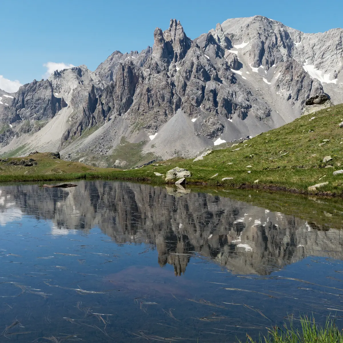
Once you've reached the lake, the spectacle of the Cerces is all yours: Pointe des Cerces, Col des Béraudes, Tête de la Cassille...
This hike, which is very popular in summer, leads to a deterioration of the vegetation near the route. We ask you to stay on the main itinerary.