- Voir les favoris
Le Clot de l'Aigue
Sport, Pedestrian sports, Hiking itinerary
in Saint-Sauveur
11.7
km
-
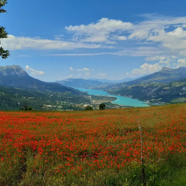
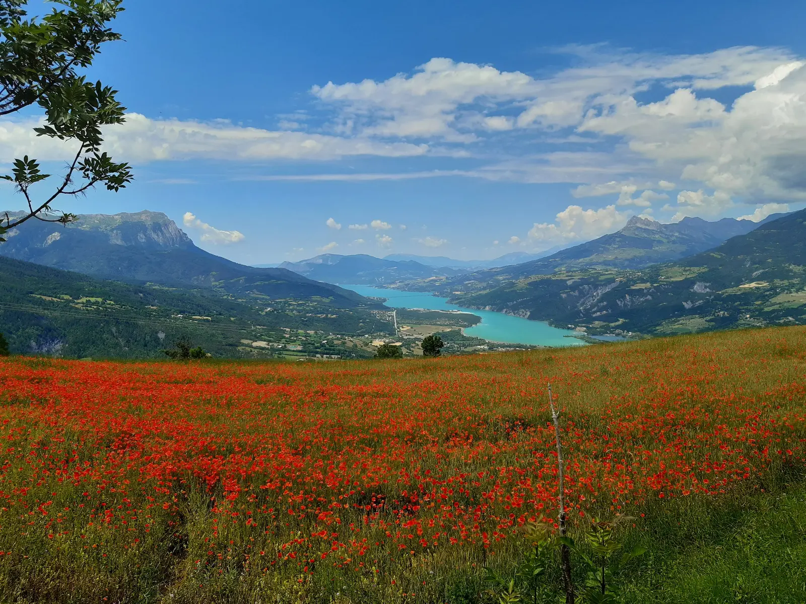
Head off on a relaxing hike in the shade of the larches. The only time you'll emerge from the Méale forest is to gaze out over Lac de Serre-Ponçon from the colourful meadows that bedeck the village from spring to early summer.
-
From the church square of Saint Sauveur, head up the minor road towards Les Gaillards. In front of the sign marking the entrance to the hamlet of Les Gaillards, turn right onto a path rising up between houses (yellow markings), then turn right back onto the road. At the next intersection, just 20m further on, take the track opposite and then turn left onto the road after ascending for 50m.
Head back down the road to a hairpin bend where you need to turn right towards Méale. Turn right at the...From the church square of Saint Sauveur, head up the minor road towards Les Gaillards. In front of the sign marking the entrance to the hamlet of Les Gaillards, turn right onto a path rising up between houses (yellow markings), then turn right back onto the road. At the next intersection, just 20m further on, take the track opposite and then turn left onto the road after ascending for 50m.
Head back down the road to a hairpin bend where you need to turn right towards Méale. Turn right at the next junction, staying on a wide carriageway. The track gradually rises through the larches and must be followed again at the next junction, a few kilometres further on.
At the sign for Faravelle, turn left towards Crévoux on a small track that passes through a scree slope, the Clos de l'Aigue water catchment area. Continue straight ahead shortly after along a steep grassy path. Cross a stream and continue climbing.
Once back on the track, take the path that rises opposite then continue straight on at the intersection shortly after. Then turn left. Once you reach an area that has been artificially levelled for wood storage, take a path to the right and continue along this wide track, passing a sign for Le Méale and Saint Sauveur. The road becomes flat after this sign.
Turn left at the next intersection to take an uphill section. At the new signs, turn right onto a narrow path heading towards Saint Sauveur via Les Gaillards. Follow the narrow, winding path, then when it splits in two at the Le Canal sign, turn left. Continue straight ahead a little further down until you come to another signpost. Follow Saint Sauveur via les Gaillards at the new signpost.
Return to the track at the Les Graves. sign. Cross the track and descend on a path that immediately turns right and winds through the forest before joining a wider path that needs to be descended. Cross some meadows then take a small path to the right, at the Pré de QuiQuiou. Continue straight on to the next intersection at the sign for Le Lot. Join and descend a passable path to the hamlet. Follow the road and turn left towards Saint Sauveur shortly afterwards. Then descend the carriageway to the neglected road. Return by the same path.
Medium
- Departure
- Saint-Sauveur
-
-
Difference in height
- 733.895 m
-
-
-
Departure : Saint-Sauveur.
Arrival : Saint-Sauveur.
Road access : Follow the N94 to Embrun, then the D40 towards Les Orres. After climbing for a few kilometres, take the D39a to Saint-Sauveur..
Parking recommended : Church car park .
Public transport : Public transport : ccserreponcon.com .
- See all reviews
- 734 meters of difference in height
-
- Maximum altitude : 1938 m
- Minimum altitude : 1211 m
- Total positive elevation : 734 m
- Total negative elevation : -734 m
- Max positive elevation : 433 m
- Min positive elevation : -625 m
