-Departure point. Parking des Encanaux.
From the parking lot, descend to La Vède and Les Encanaux
- (Post SB 23). Follow signs for "Pic de Bertagne". Yellow markings. Take the trail on the left bank of the torrent.
-Piste des Encanaux (post SB 68). Follow signs for "Pic de Bertagne".
Yellow markings.
- (Post SB 24) Follow signs for ''Pic de Bertagne''.
Take the path leading off to the right uphill. Progress into the Vallon de l'Infernet. The route leaves the Vallon de l'Infernet on the left and enters the Vallon de la Coutronne. Reach the RD 45 A. Yellow markings.
-RD 45 A (post SB 25). Yellow markings. Turn left onto RD 45 A.
Follow for 1 Km 2. Caution: busy road. Use the path behind the guardrails.
-Department boundary 13 / 83 (post SB 26). Follow signs for "Pic de Bertagne".
Turn right onto the Cros trail for 700 m. Leave it on the left and reach the croupe de Bayounette. Yellow markings.
Meet a "Green" trail (Plan d'Aups Sainte-Baume OT loop; common "Yellow" and "Green" itinerary). Go right up to the Source du Cros.
-Source du Cros. Continue up the track for 300 m. Fork: the "Green" route stays on the left-hand track. Follow the path off the track to the right and reach the Col du Cros. The Cros spring is on the left of the track. Yellow markings.
-Col du Cros (post SB 27). Follow signs for "Pic de Bertagne".
Cross the plateau and reach the Col de Bertagne. Yellow markings.
-Col de Bertagne (post SB 28). Follow signs for "Pic de Bertagne".
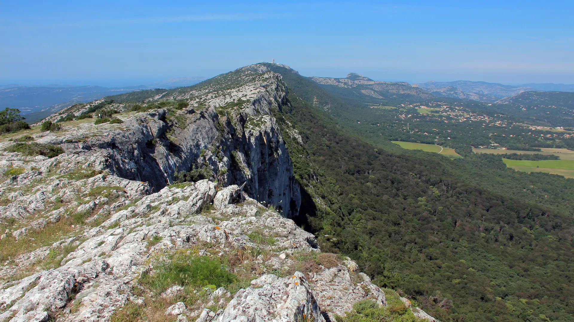
Follow the path up a steep ascent over rocky outcrops.
rocky outcrops. The trail ends at the road leading to the civil aviation radar.
Be careful to stay on the marked route. Rocky spurs requiring use of hands. Yellow markings.
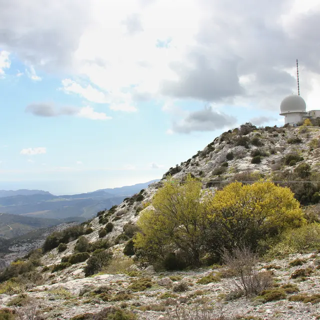
-Radar road (post SB 29). Follow signs for "Pic de Bertagne".
Follow the road to the right towards the radar. Just before the entrance gate to the installations, take the path leading off to the left to reach the edge of the cliff. Be careful to stay on the marked route. Yellow markings.
-Pic de Bertagne lookout .
Highest point in the Bouches du Rhône département
Altitude 1043m. Panorama ½ lap route
Parking des Encanaux Finish.
Read more