See photos (6)

Le Pont de Tusset - Entreverges - FERMETURE

Sport, Pedestrian sports, Hiking itinerary in Rougon
Unresolved hours
9.3 km
4h 30min
Hard
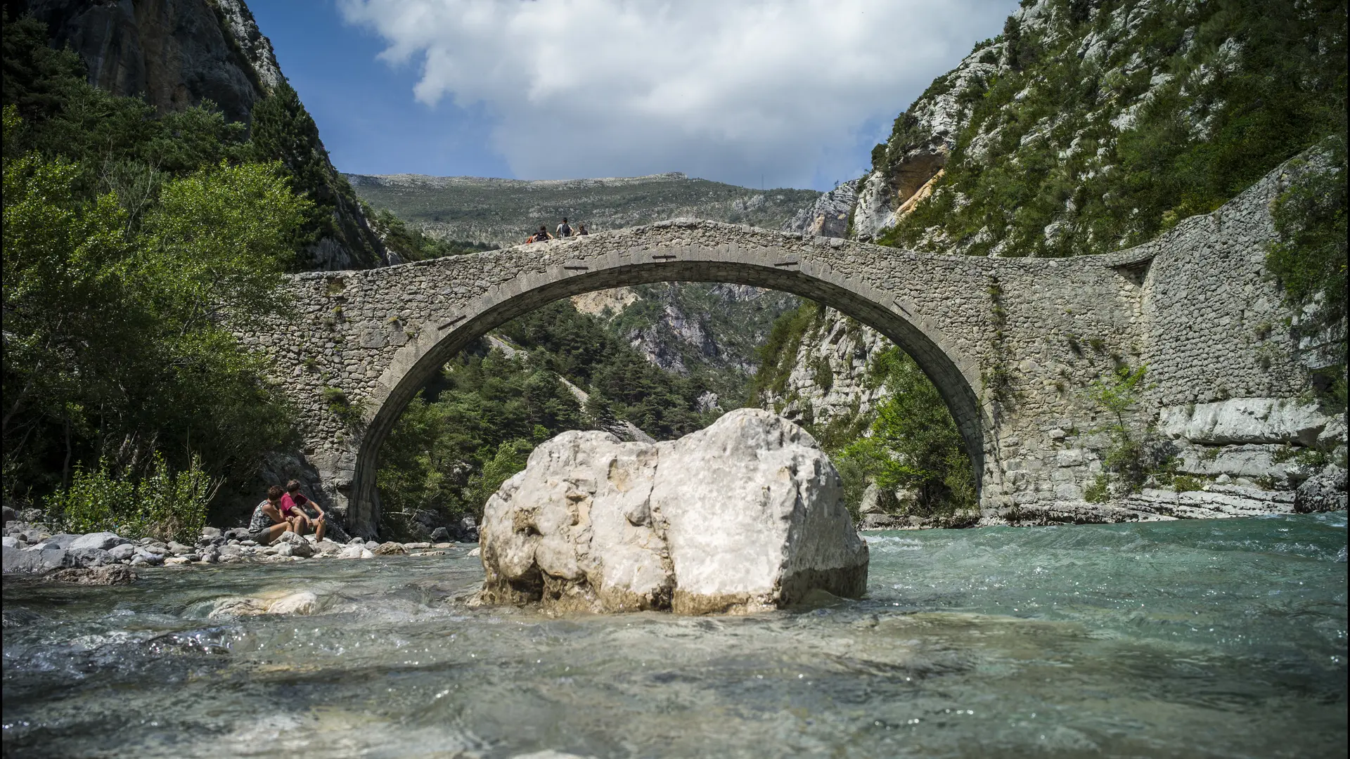
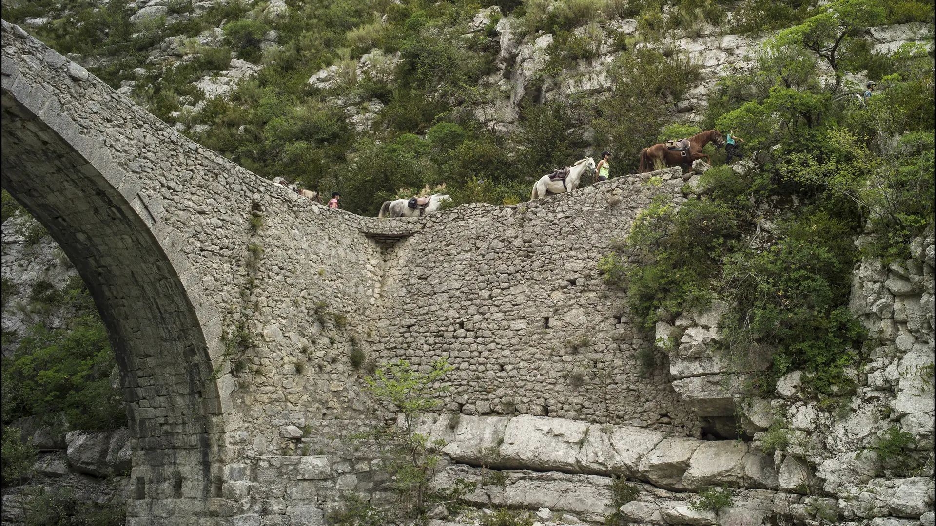
  • Dating from the 17th century, this pretty bridge over the Verdon is well worth the detour... It's an ideal walk for a special moment in the heart of the Verdon: a calm, unspoilt place, far less crowded than the Gorges.

  • At the end of the Couloir Samson parking lot (opposite the road), you'll find the Pont de Tusset path, which follows the GR 49. After a short but steep descent through the undergrowth, you come to the Pont de Tusset: one of the most beautiful bridges spanning the Verdon.
    The presence of a bridge here is not recent: the first construction dates back to the 11th century!
    Take the same path for the return journey, but beware: it's very stony and slippery.
  • Departure
    Rougon
  • Difference in height
    690.333 m
  • Plain text period
    All year round.

    Canceled or closed.
  • Environment
    • Mountain view
    • Close to a public transportation
    • Close to GR footpath
    • Bus stop < 500 m
    • Overview on river
    • Panoramic view
    • Presence of livestock and guard dogs
  • Spoken languages
    • French
  • Documentation
    GPX / KML files allow you to export the trail of your hike to your GPS (or other navigation tool)
690 meters of difference in height
Created with Highcharts 6.2.0Distance (km)Altitude (m)0 km1 km2 km3 km4 km5 km6 km7 km8 km9 km600 m700 m800 m900 m1000 m1100 m1200 mHighcharts.com
  • Maximum altitude : 1157 m
  • Minimum altitude : 628 m
  • Total positive elevation : 690 m
  • Total negative elevation : -690 m
  • Max positive elevation : 511 m
  • Min positive elevation : -493 m
Services
  • Services
    • Pets welcome
      • Keep dogs on a leash and pick up after them.