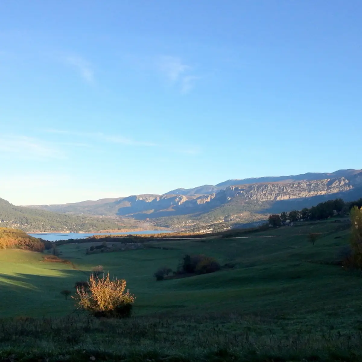
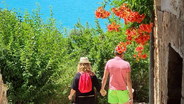
Discover 2 neighbouring villages: one in the sky and the other by the water.
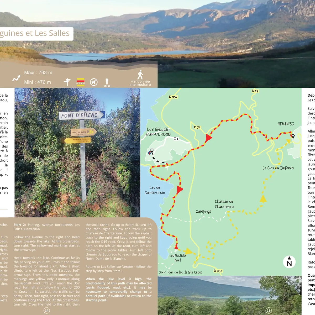
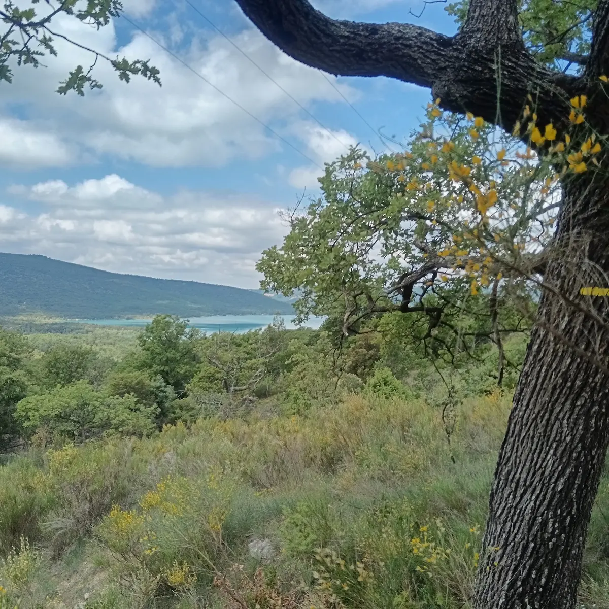
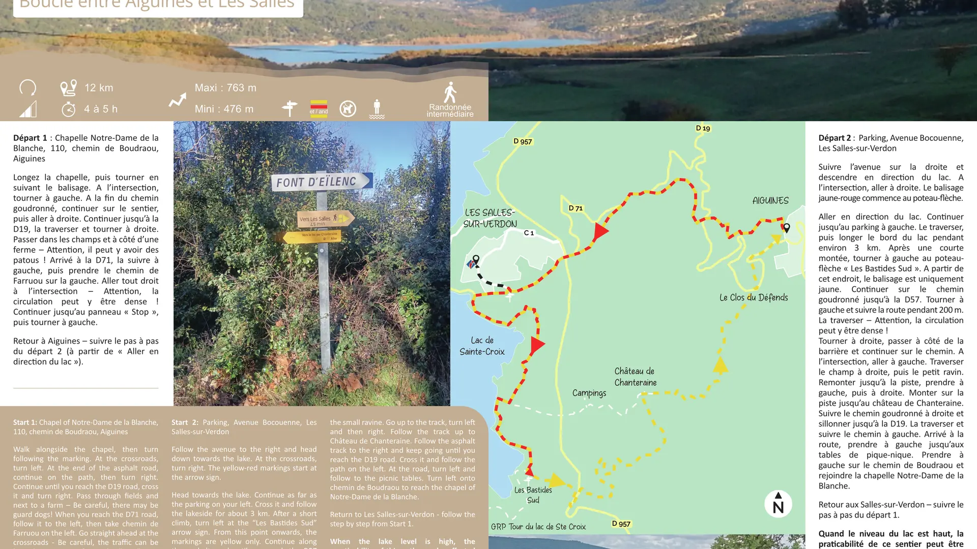
Walk alongside the chapel, then turn right. At the crossroads, turn left. At the end of the asphalt track, continue on the path, then turn right. Continue until you reach the D19 road, cross it and turn right. Pass through fields and next to a farm – Be careful, there may be guard dogs! When you reach the D71 road, follow it to the left, then take chemin de Farruou on the left. Go straight ahead at the crossroads - Be careful, the traffic can be heavy! Continue as far as the ''Stop'' sign. Head left towards the lake. Continue as far as the parking on your left. Cross it and follow the lakeside for about 3 km. After a short climb, turn left at the ''Les Bastides Sud'' arrow sign. From this point onwards, the markings are yellow only. Continue along the asphalt road until you reach the D57 road. Turn left and follow the road for 200 m. Cross it - Be careful, the traffic can be heavy! Then, turn right, pass the barrier and continue along the track. At the crossroads, turn left. Cross the field to the right, then the small ravine. Go up to the track, turn left and then right. Follow the track up to Château de Chanteraine. Follow the asphalt track to the right and keep going until you reach the D19 road. Cross it and follow the path on the left. At the road, turn left and follow to the picnic tables. Turn left onto chemin de Boudraou to reach the chapel of Notre-Dame de la Blanche.
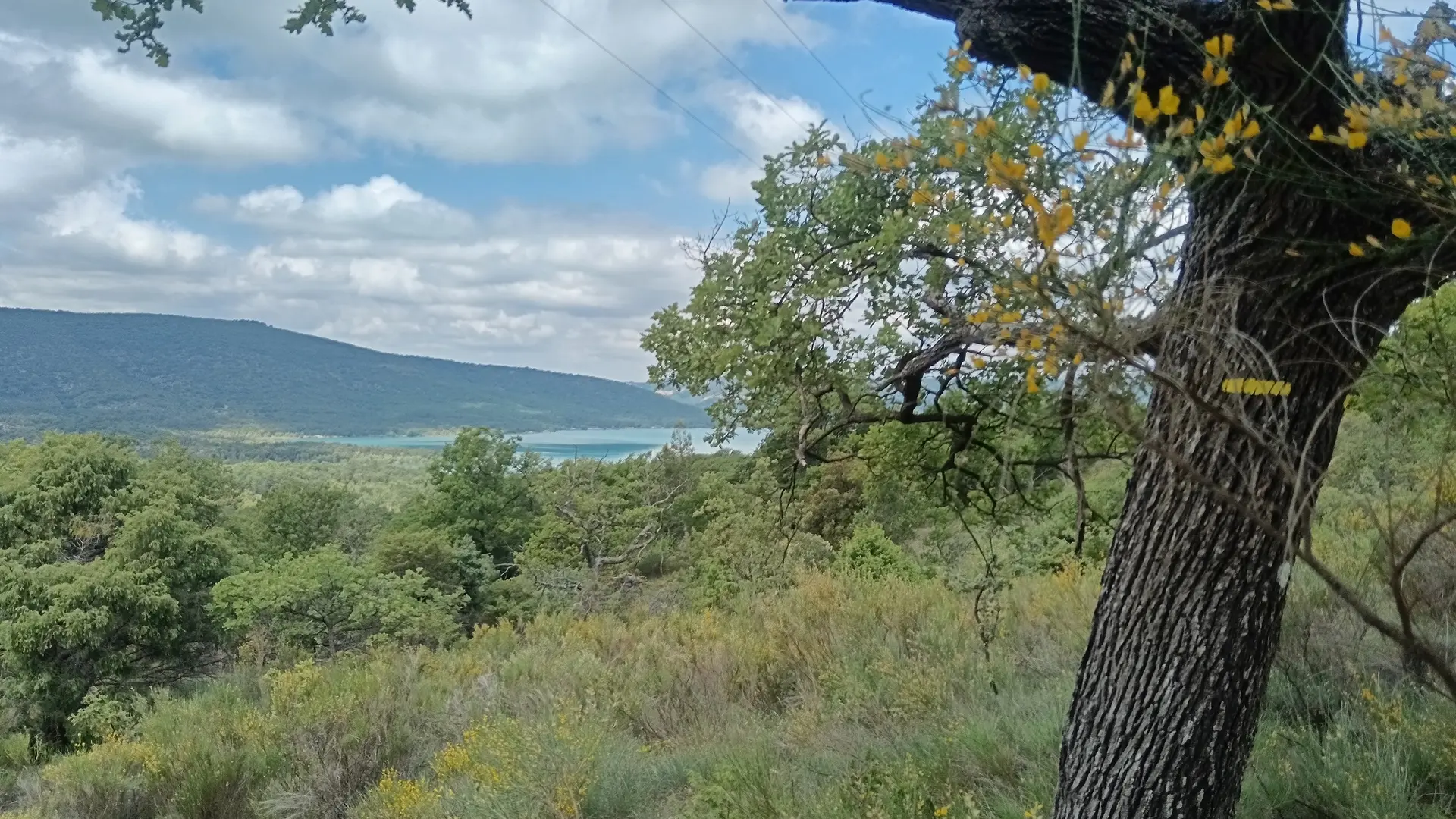
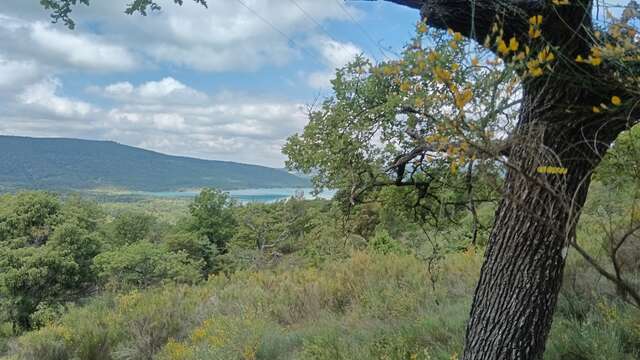
When the lake level is high, the practicability of this path may be affected (parts flooded, mud, etc.). It may be necessary to temporarily change to a parallel path (if available) or return to the starting point.
To see the hike on the map, click here: https://shorturl.at/lalXa
Read more
Plain text rates
Free
Plain text period
All year round daily.
Before hiking, check whether access to forest areas is authorised: https://www.risque-prevention-incendie.fr/var/.