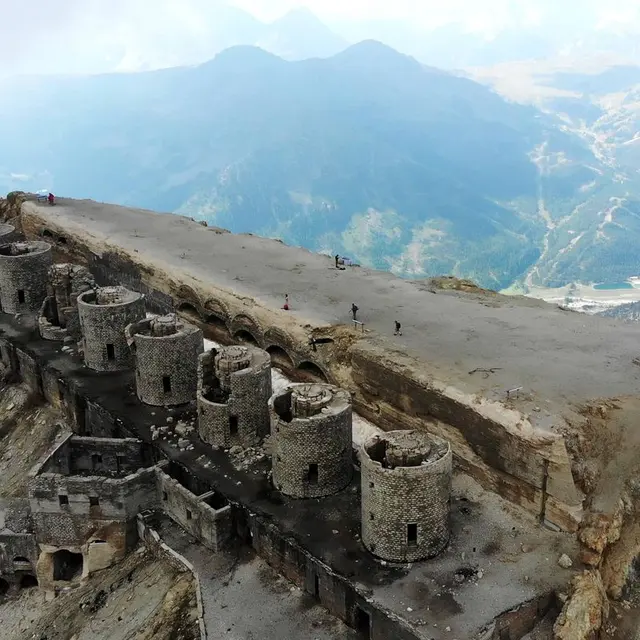
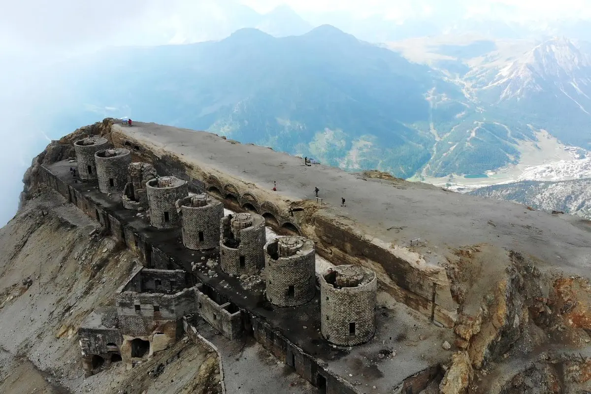
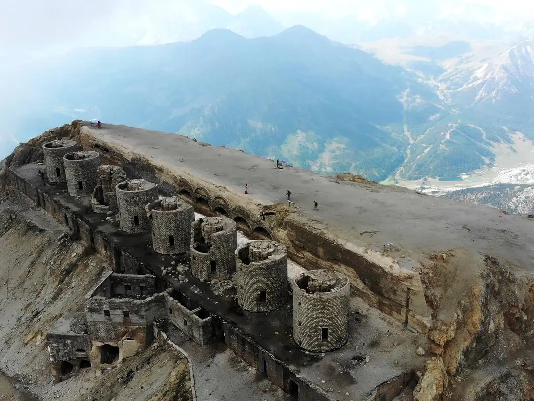
This beautiful hike, with its steep gradients, is not technically very difficult. Renowned as the highest and most powerful of the Italian forts, the Fort du Chaberton, culminating at 3131m, is a must-see hike in the Briançonnais region.
Park in the Chalvet parking lot.
From the tourist office, turn right (opposite the office) towards the Obélisque. Cross the road to reach the Saint Anne chapel. At the chapel, take the path along the road leading to the Village Club du Soleil (towards Le Chaberton). When the path joins the road, continue along the road.
Leave the road and take the track rising to the left (towards Le Chaberton).
At the next junction, leave the track and take the left-hand path (ETM 6 markings). Follow the path up to overlook the Rio Secco. The path becomes a track, continue to follow it.
Cross the Rio Secco and follow the ETM signs.
The trail splits in two. Take the left-hand path.
At the Col du Chaberton, turn right towards Le Chaberton to begin the steepest part of the route.
At the summit, enjoy the 360° view, the many orientation tables and the fort. A little anecdote: to build the fort, the engineers "shortened" the mountain by 7 m in height. Take the same route back.
Hard
Read more