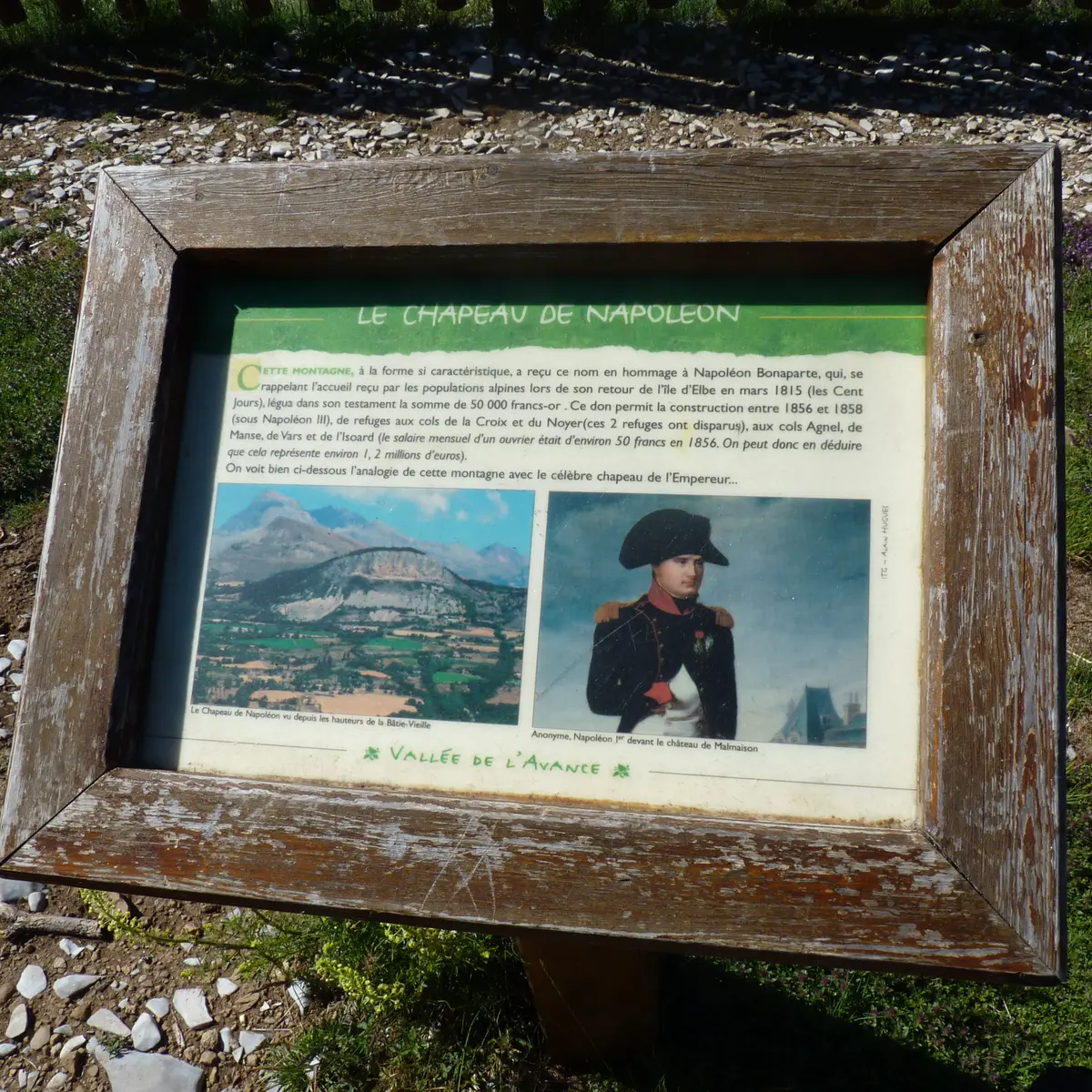
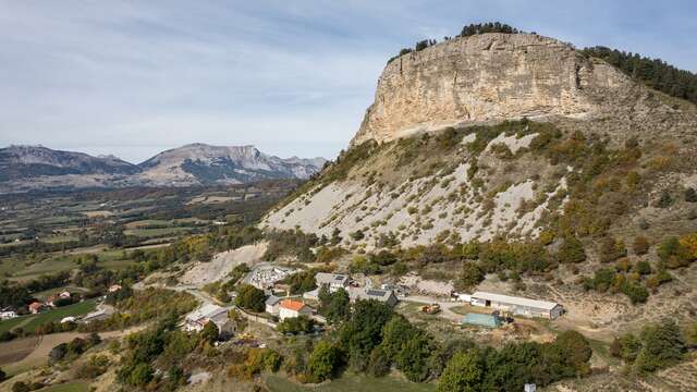
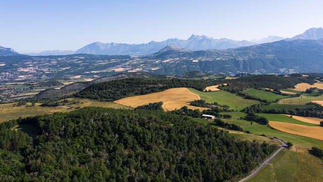
Emblematic cliff of the Gapençais, this itinerary approaches Napoleon's hat from all angles by walking up to its summit to offer you a breathtaking view of the Avance Valley and Gap. A shaded walk, accessible to all.
Start and finish: Hameau des Guérins, information panel, at the exit of the village of La Rochette.
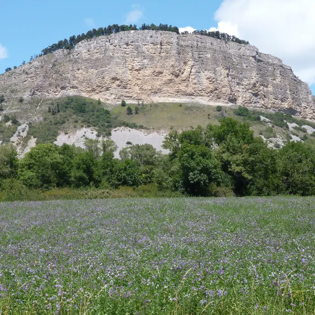
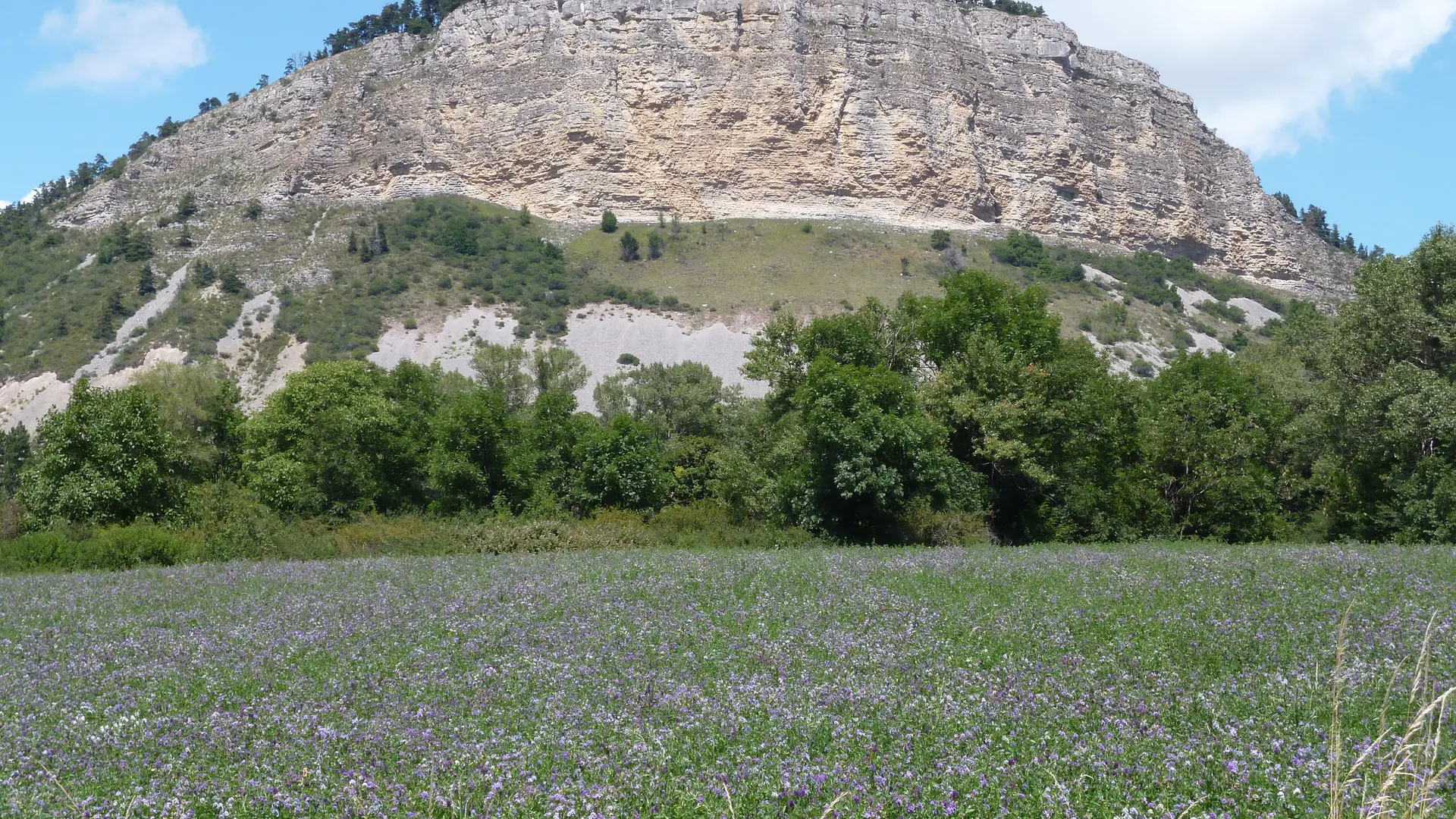
Located at an altitude of 1,426 metres, this emblematic limestone cliff is an integral part of the landscape. Visible for miles around, it's easy to see why it's known locally as 'Napoleon's Hat'.
1. Go up the road towards the village of La Rochette. After two hairpin bends, go past the cemetery and only 200 metres further on, take a path rising to the left. Follow this path following the yellow markings and join the road. Follow the road to the next intersection
2. Turn left and take the forest track for about 150 m.
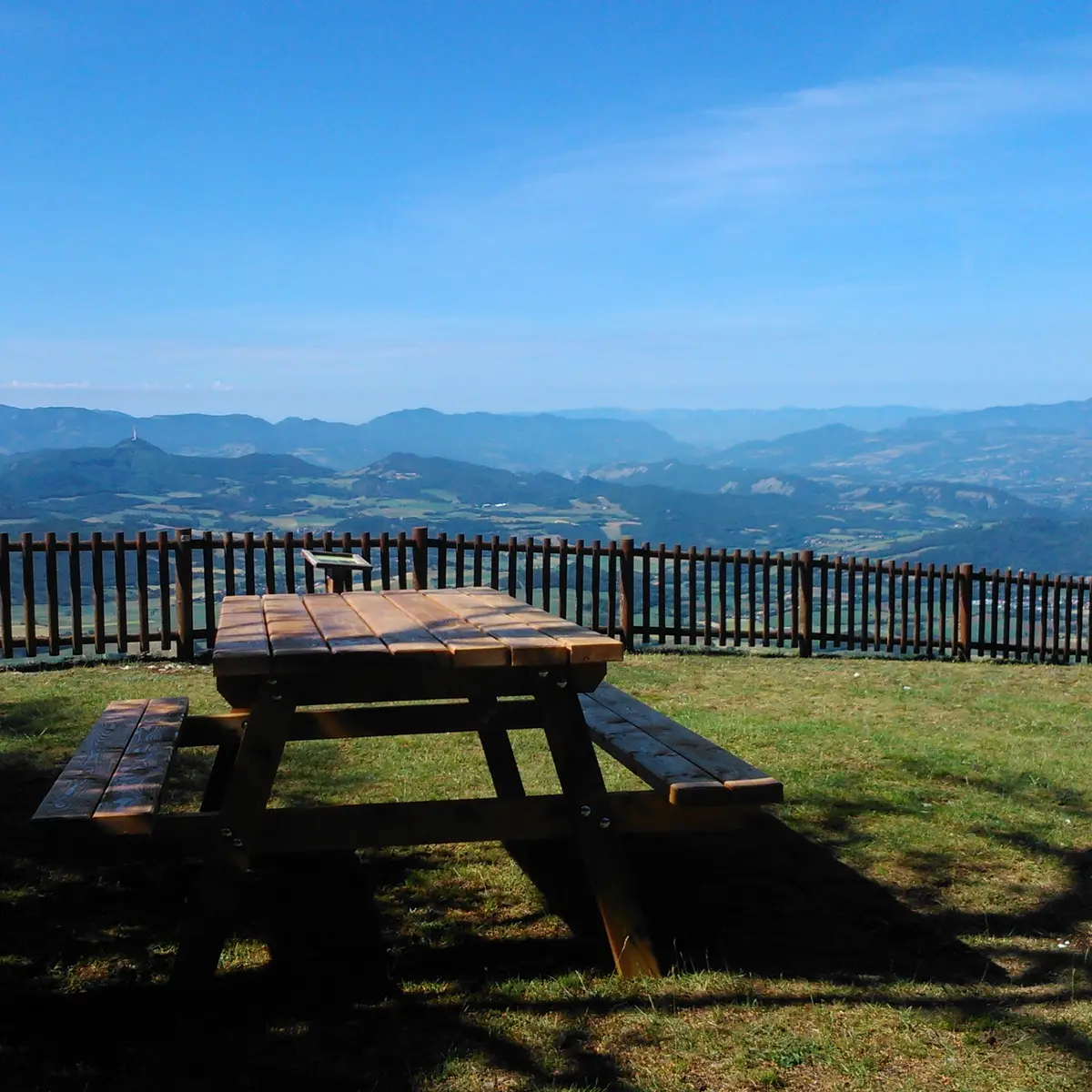
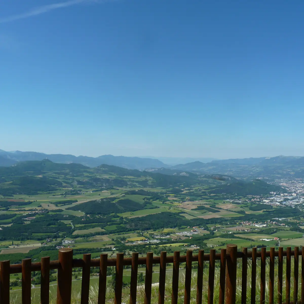
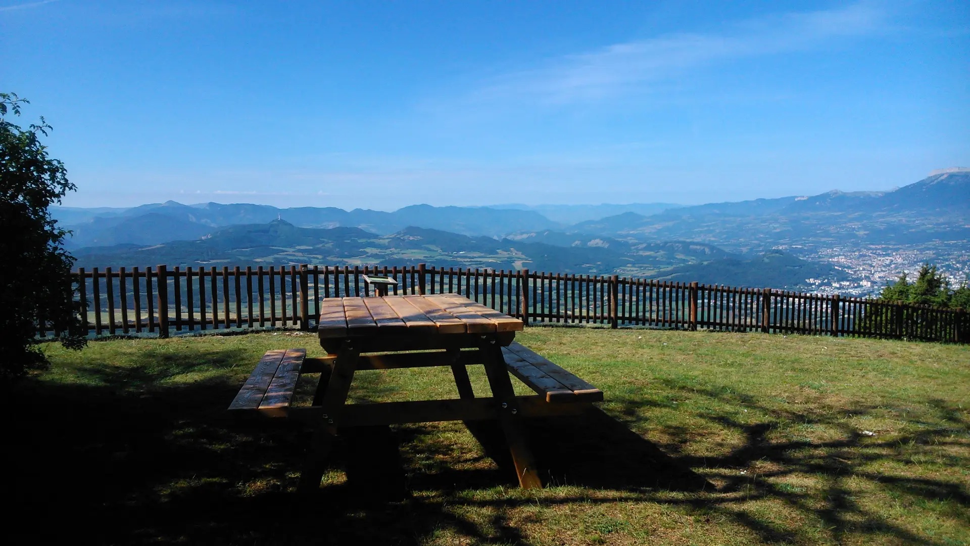
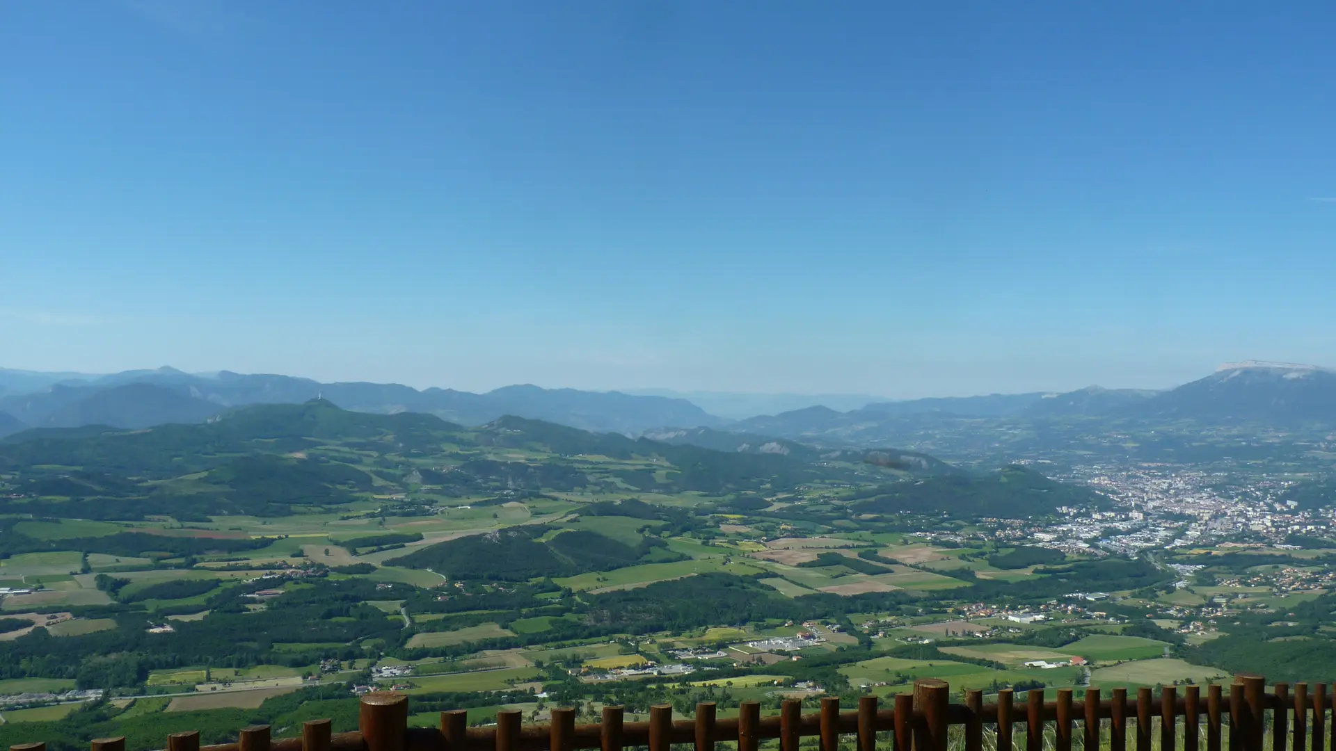
3. Continue to the left and pass the gate. Finish the climb to the top of the Chapeau de Napoléon, 600 m further on. Enjoy a grandiose panorama of the Gapençais basin, the Avance Valley, the Ceüse cliffs, the mountains of Charance, Puy Maurel, Grand Morgon and Mont Colombis. Start the descent by turning back to the previous intersection. Take the left-hand path below towards Les Guérins, then turn left again after 500 metres. Continue on the track which becomes a path under the cover of trees. The path then runs alongside pastures and cultivated fields. When you reach the RD14a, go down for 200 m to reach the starting point.