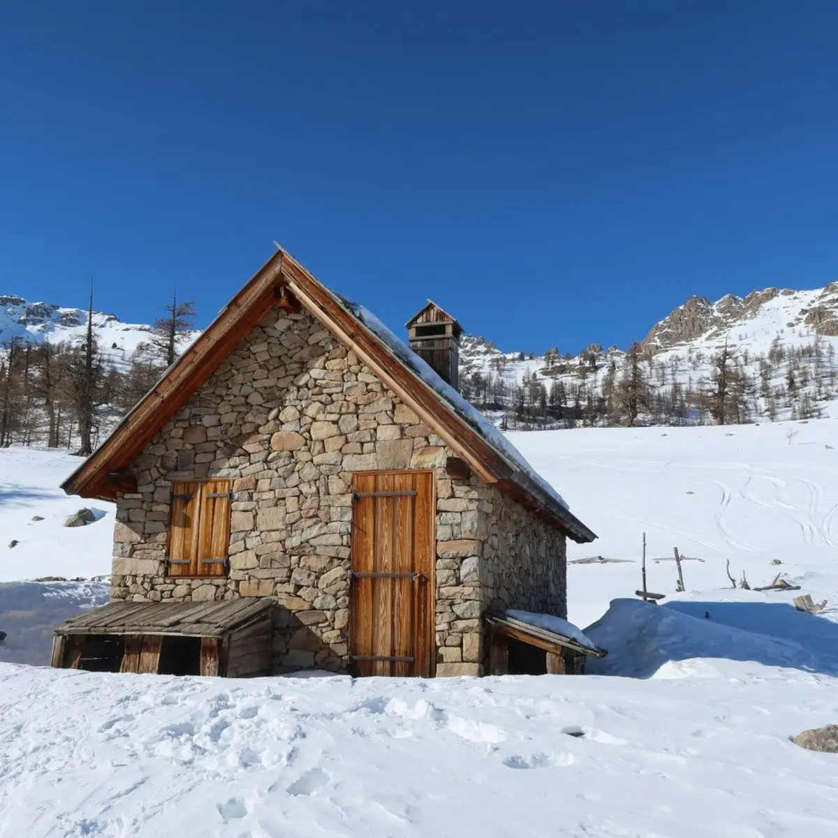
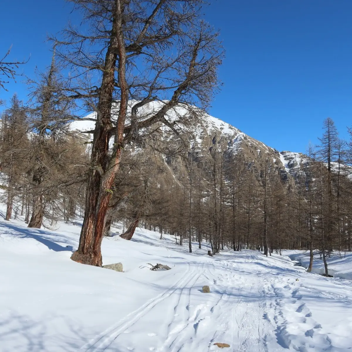
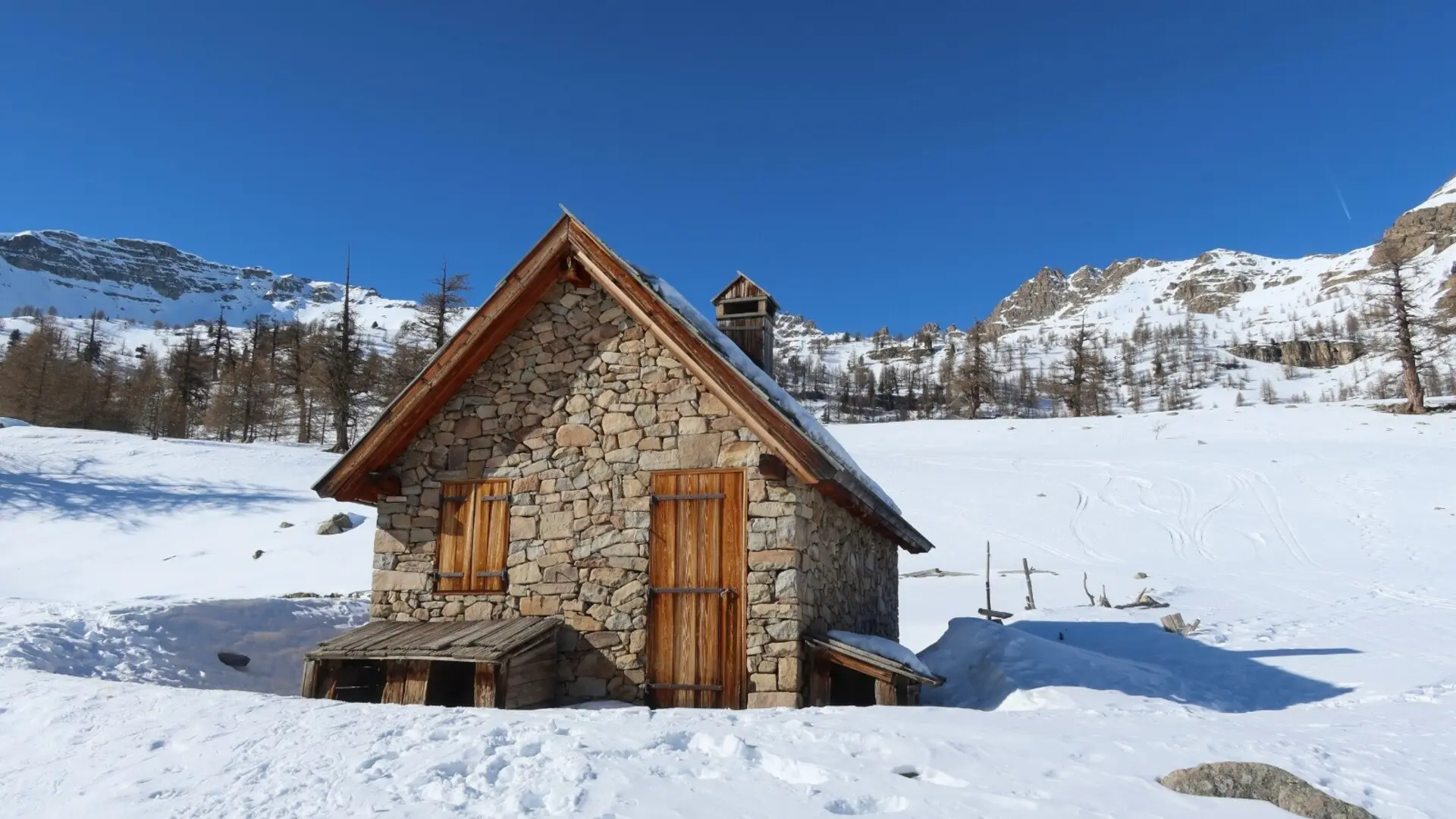
This hike offers a comfortable route in the best snow-covered sector of Haute Tinée with the theme of interest being the centuries-old larch tree of La Braisse and the pastoral hut built in 2001.
On this route, the Mercantour National Park wanted to promote the tranquility of black grouse during winter. Marking has been put in place encouraging you to go around the quiet areas. Please respect it and thus contribute to the survival of this species during the winter.
Elevation gain: +720 meters / -720 meters
Distance: 11 kilometers AR
Duration: 4 hours
Recommended period: December to April
Avalanche risk depending on conditions: Requiring
Cartography: TOP 25 n° 3639 OT
Regulations: Mercantour National Park
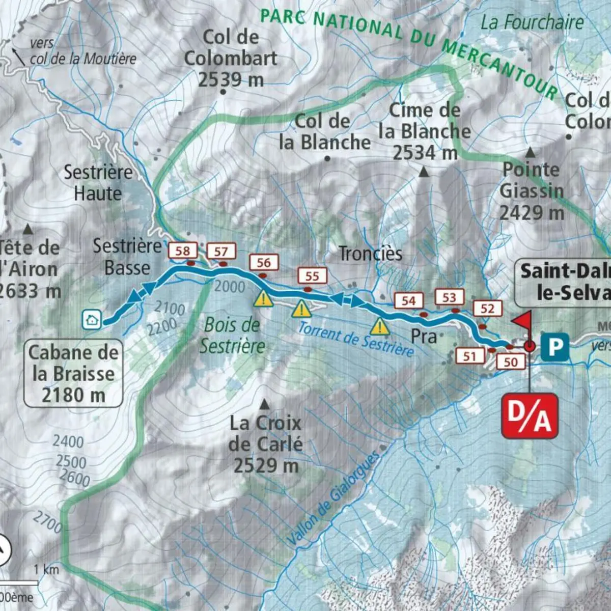
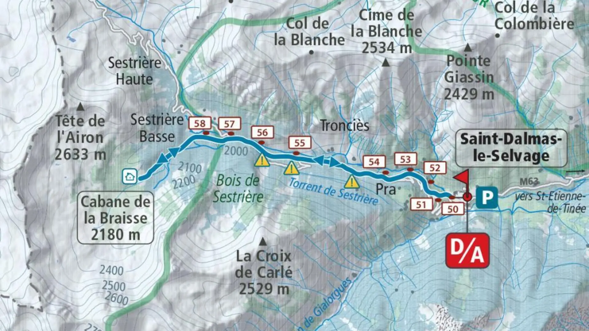
Itinerary :
From the village car park, follow (b.50) the path which cuts the bends of the Sestrière road (b.51); continue on this for approximately 500 m before again avoiding three bends via markers 52, 53 and 54.
Then walk on the route of the road to cut further a final bend (b.55, 56) at the level of the avalanche corridors coming from the Croix de Carlé; we soon reach the footbridge over the Braisse valley which we cross just before the Sestrière plateau.
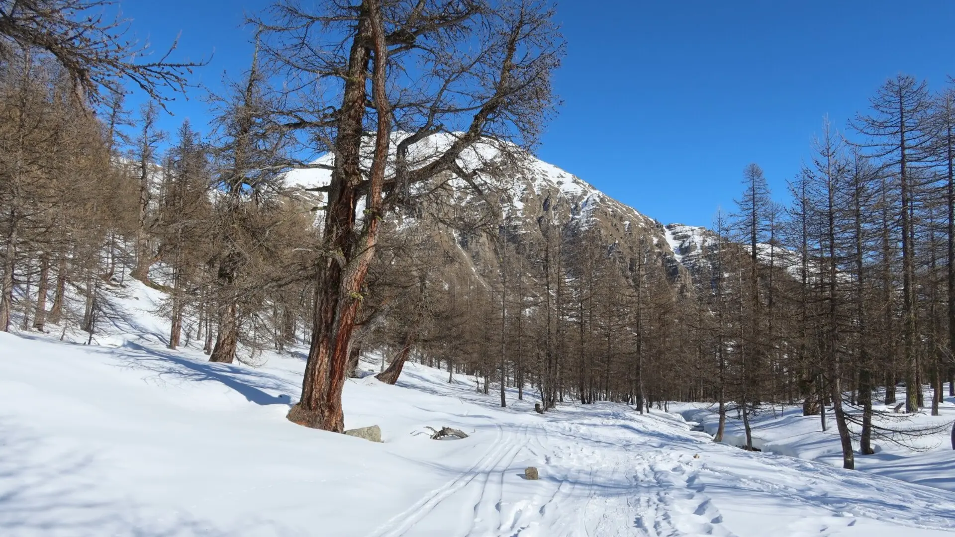
Go up to the left (b.57) the wide and placid valley of La Braisse (south-west), and let yourself be carried by the moderate slopes which lead to the closed pastoral cabin (2,180 m), just above the the head of Cristel (2,726 m). Go back down as you wish among the gigantic larches to the Sestrière plateau (2,000 m) where you find the road to the Col de la Moutière.
Follow this to the village or cut the last bends using the uphill shortcuts.
Read more