- Voir les favoris
See photos (2)
St. Mark's Chapel
Sport, Pedestrian sports, Hiking itinerary
in Allemagne-en-Provence
3.8
km
-
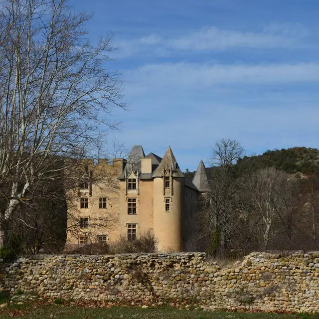
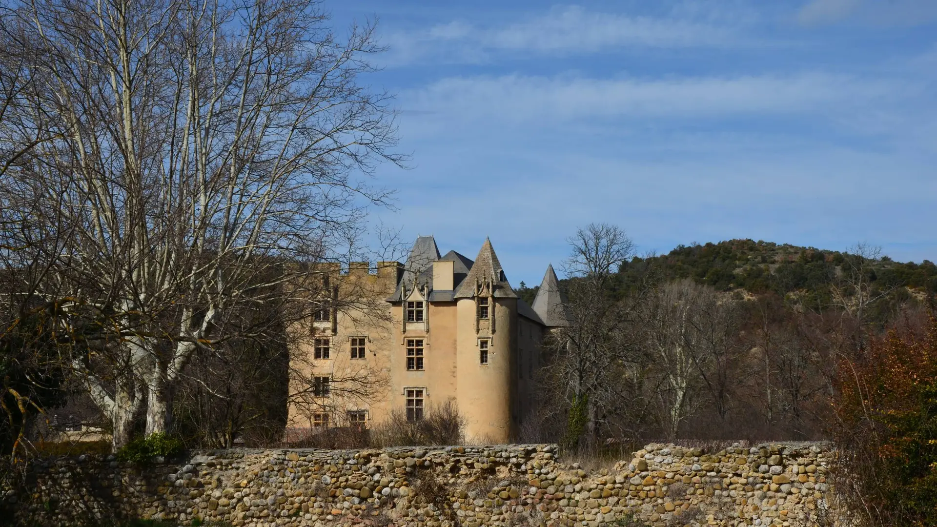
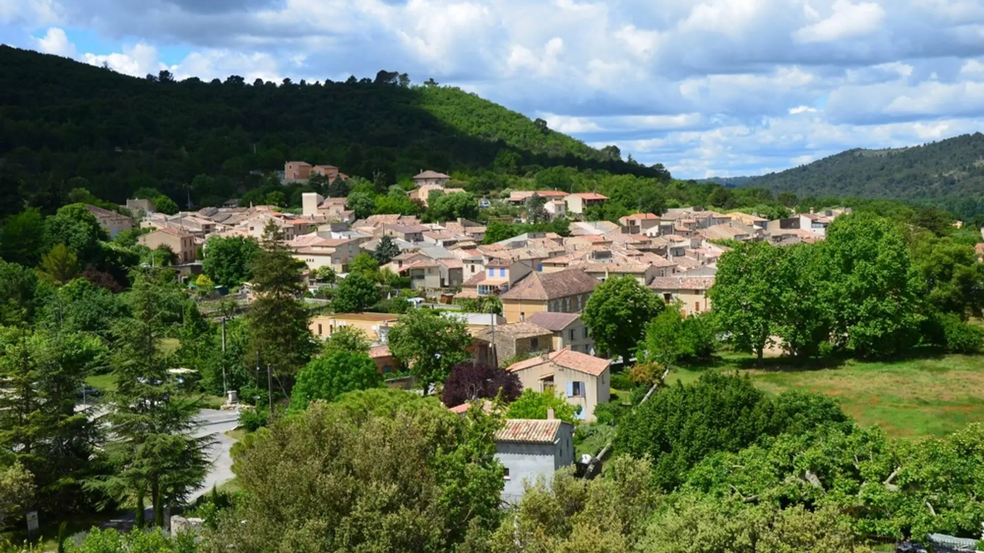
At Allemagne-en-Provence, follow the trail of a past rich in knightly history!
-
From the Place du 16 Juin 1944 (square), at the foot of the castle of Allemagne, follow the D952 towards Riez. Immediately after the bridge of the Tartavel valley, take the small path on the right, marked in yellow.
1- Go up by the footpath, under the oaks, amidst the thyme, boxwood and broom. Halfway up, pass at the foot of a column and continue in the woods until the chapel (equipped picnic area).
2- From the top, go back down through Allemagne-en-Provence by a wider path behind the chapel...From the Place du 16 Juin 1944 (square), at the foot of the castle of Allemagne, follow the D952 towards Riez. Immediately after the bridge of the Tartavel valley, take the small path on the right, marked in yellow.
1- Go up by the footpath, under the oaks, amidst the thyme, boxwood and broom. Halfway up, pass at the foot of a column and continue in the woods until the chapel (equipped picnic area).
2- From the top, go back down through Allemagne-en-Provence by a wider path behind the chapel until the Route de Riez. The end of the trail follows the D952 for 500m (watch out for cars, walk to the right of the road!). Go past the old mill village, now converted into a hotel and restaurant. Reach the car park of the starting point.
Very easy
- Departure
- Allemagne-en-Provence
-
-
Difference in height
- 236.333 m
-
-
-
Departure : From the Place du 16 Juin 1944 (square).
Arrival : At the Place du 16 Juin 1944 (square).
Road access : At 8.5km Southwest of Riez, through the D952..
Parking recommended : Car park of the Place du 16 Juin 1944 (square) .
Public transport : Limitons les déplacements en voiture, pensons aux transports en commun et au covoiturage. Tous les transports en commun sur www.pacamobilite.fr .
- See all reviews
- 236 meters of difference in height
-
- Maximum altitude : 542 m
- Minimum altitude : 422 m
- Total positive elevation : 236 m
- Total negative elevation : -124 m
- Max positive elevation : 114 m
- Min positive elevation : -68 m
