- Voir les favoris
Stage 5: St-Saturnin-les-Apt/Vitrolles-en-Luberon Vaucluse Mountain bike trail - e-bike
Sport, Cycling sports, Espace VTT, Electric mountain bike route
in Saint-Saturnin-lès-Apt
45.9
km
-
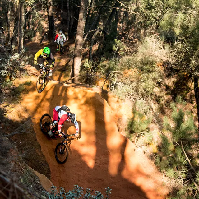
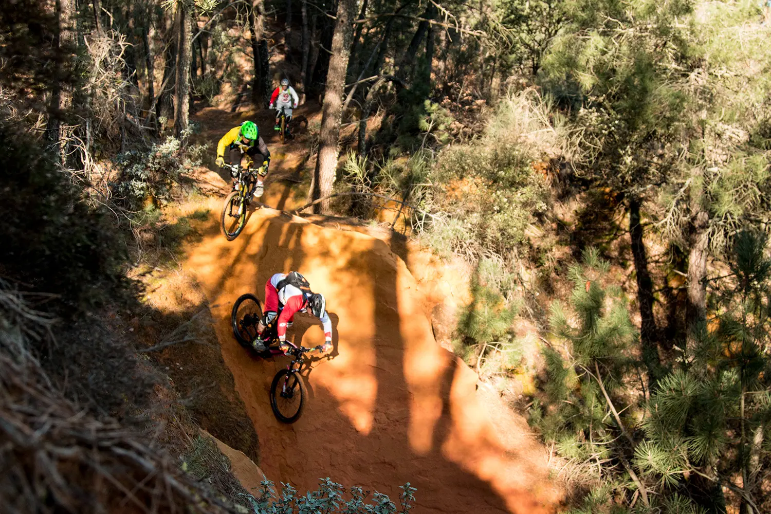
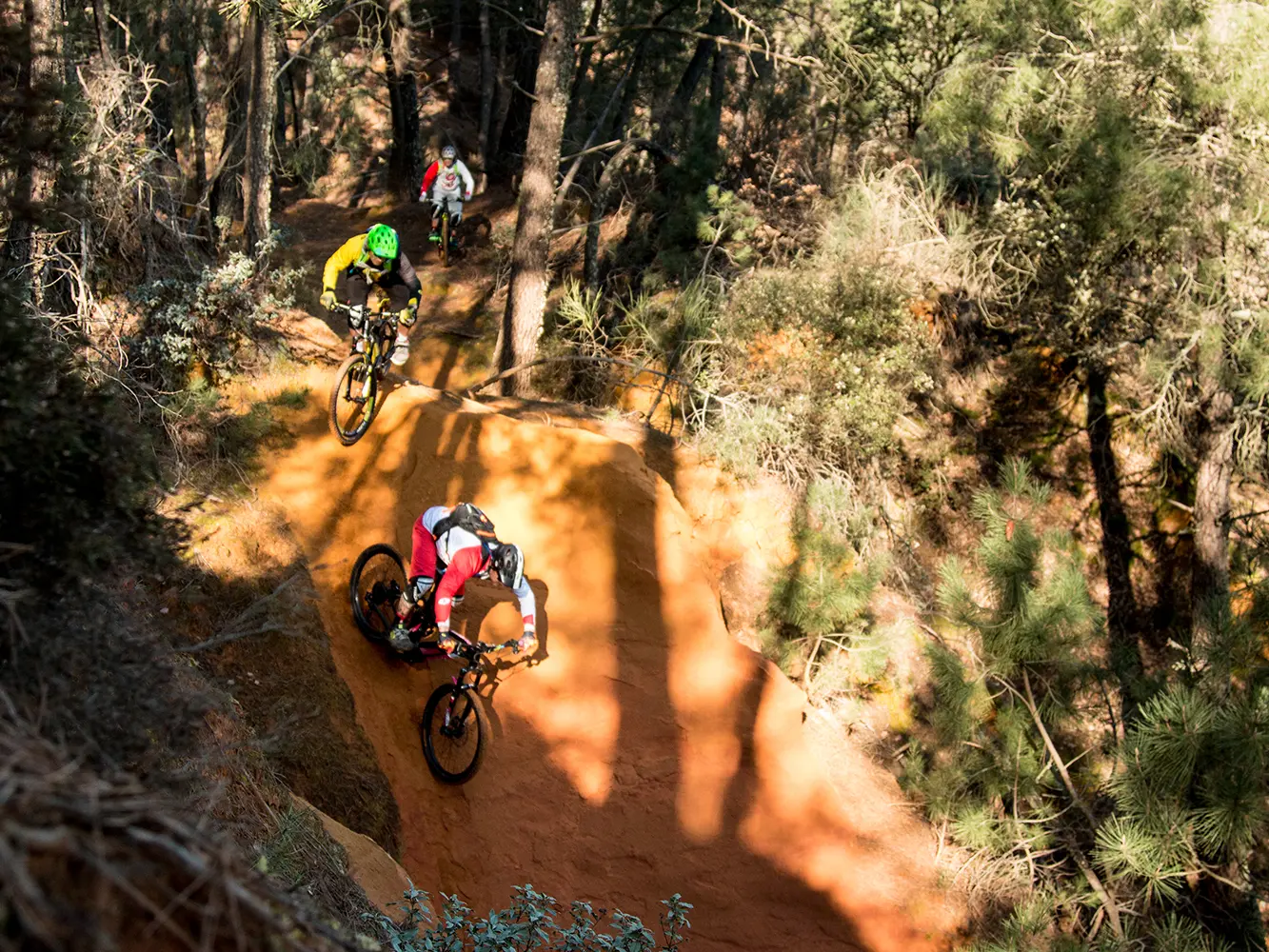
Magnificent entrance into the Parc du Luberon which begins with beautiful single tracks through the ochre landscape, the Provençal Colorado. The route continues with an assault on the Alpes de Haute Provence, before reaching the heart of the Massif du Luberon.
-
You now enter the ochre massif with its shimmering colours.
The earthy and sandy single-track trails give way to rocky roads that lead you to Rustrel. You then cross the Colorado Provençal to climb a series of tracks leading to beautiful ridge paths.
The rest of the route takes you to the banks of the Calavon River, then, through an old railway tunnel, to Céreste.
You continue your assault on the Alpes-de-Haute-Provence through the peaks of Montjustin and climb up to the gentle slopes of...You now enter the ochre massif with its shimmering colours.
The earthy and sandy single-track trails give way to rocky roads that lead you to Rustrel. You then cross the Colorado Provençal to climb a series of tracks leading to beautiful ridge paths.
The rest of the route takes you to the banks of the Calavon River, then, through an old railway tunnel, to Céreste.
You continue your assault on the Alpes-de-Haute-Provence through the peaks of Montjustin and climb up to the gentle slopes of the Grand Luberon.
- Departure
- Saint-Saturnin-lès-Apt
-
-
Difference in height
- 1177.25 m
-
-
-
Spoken languages
-
-
-
Documentation
- GPX / KML files allow you to export the trail of your hike to your GPS (or other navigation tool)
-
- See all reviews
- 1177 meters of difference in height
-
- Maximum altitude : 663 m
- Minimum altitude : 281 m
- Total positive elevation : 1177 m
- Total negative elevation : -1059 m
- Max positive elevation : 202 m
- Min positive elevation : -275 m
Services
-
-
Activities
-
