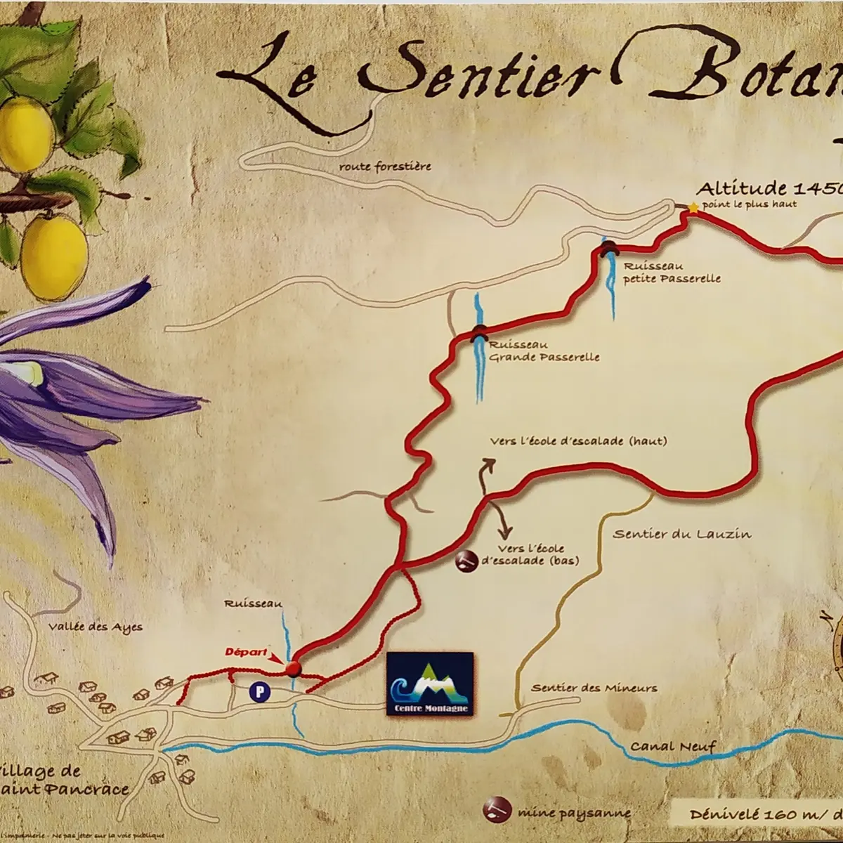
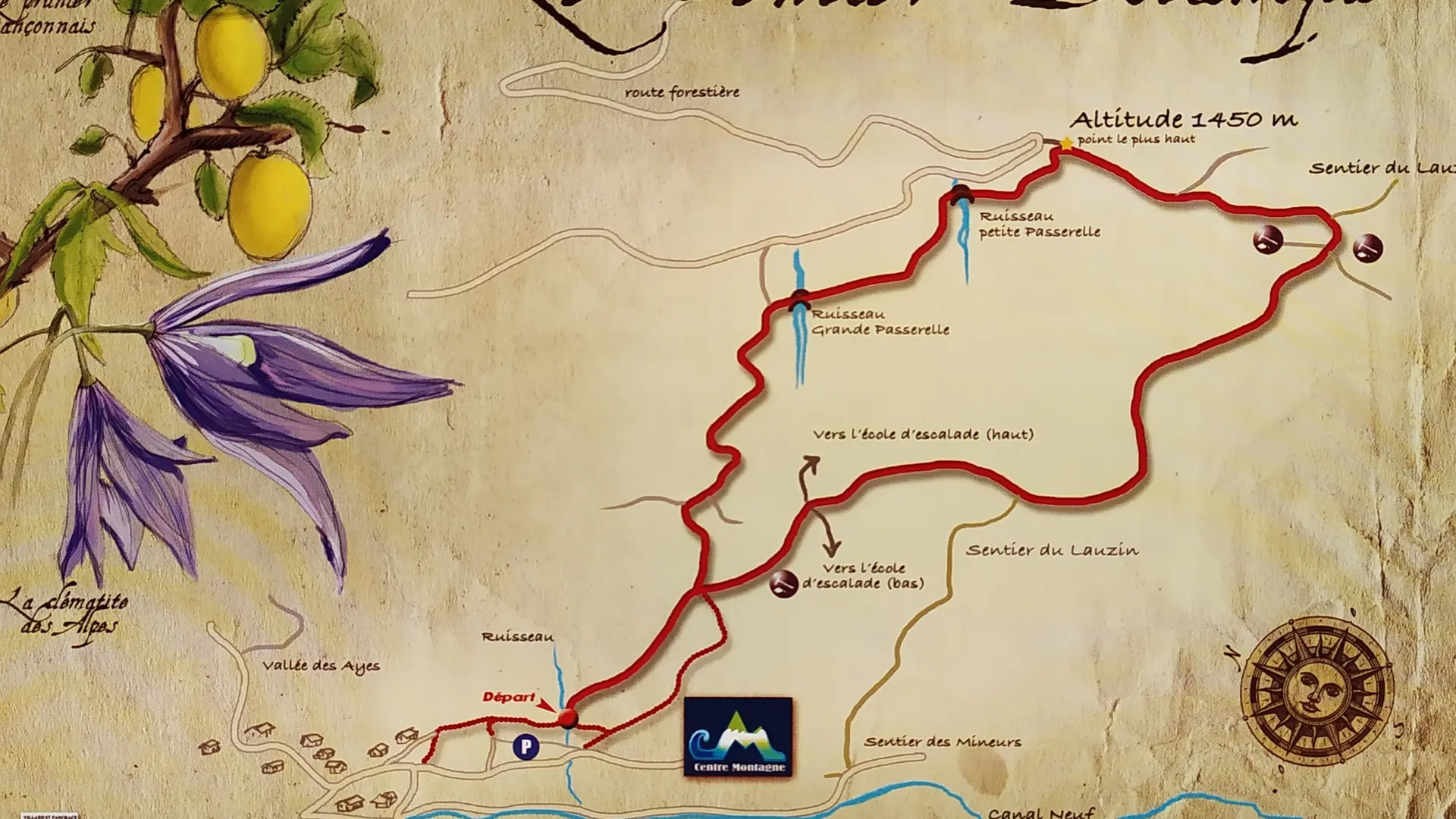
From the Centre Montagne parking lot, the path starts at the bottom of the parking lot on your left and is signposted with wooden "Sentier Botanique" signs.
A little steep at first, this access leads to a much wider, deeper path lined with trees and shrubs. After around 300 metres, the first fork in the path is obvious: take the left-hand path, which rises steadily through the woods (the right-hand path is the return path).
Shortly afterwards, there's a second fork in the road: take the right-hand path, which this time flattens out considerably, crosses a large footbridge and then rises gently, crossing a second small stream to reach the highest point of the itinerary, which gradually descends to a crossroads where the remains of two old mines can be seen.
At this crossroads, continue downhill on the right-hand path, which gradually descends towards the rock-climbing school and then rejoins the original path.
A map of the route is available free of charge from the Villard Saint Pancrace Mountain Centre.
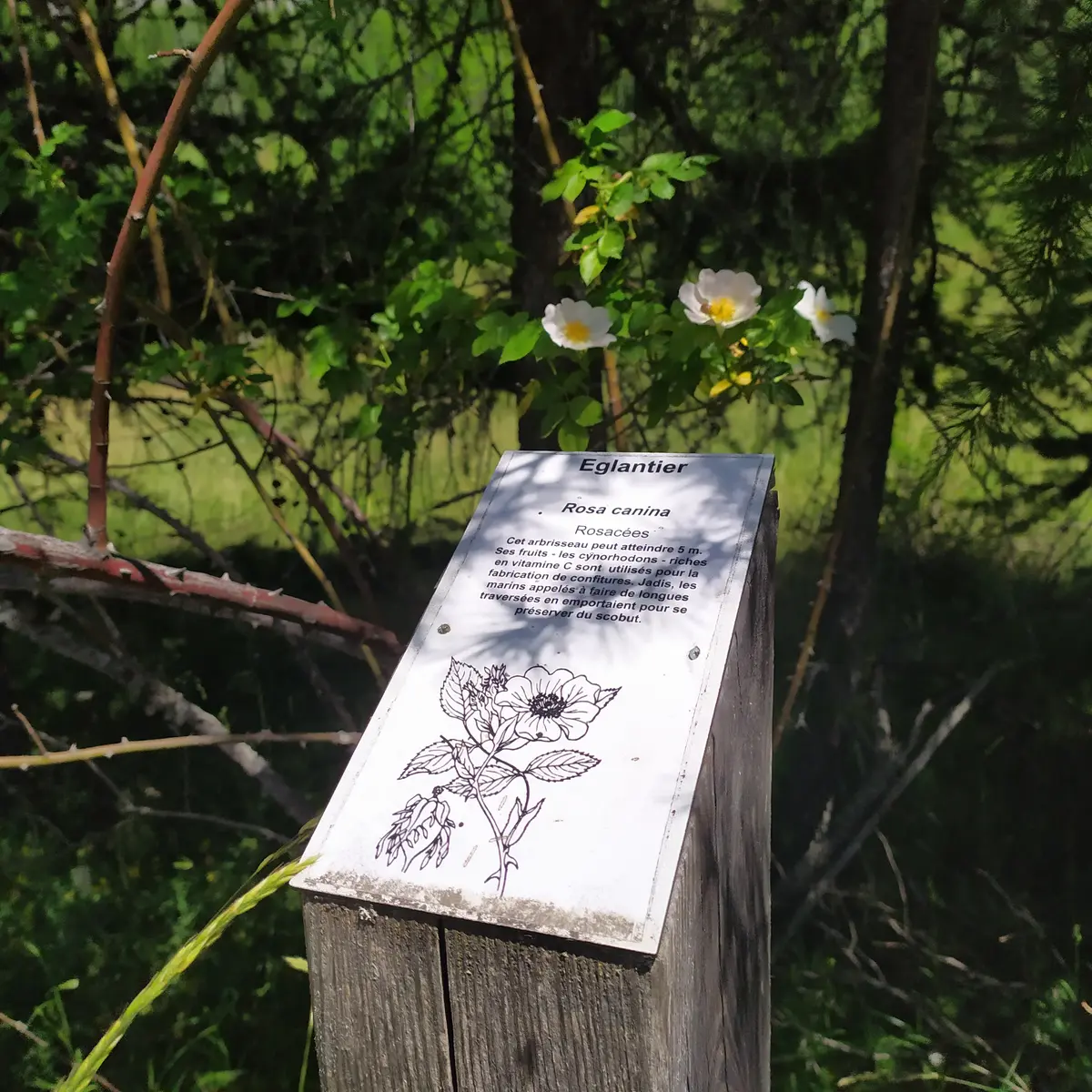
Read more