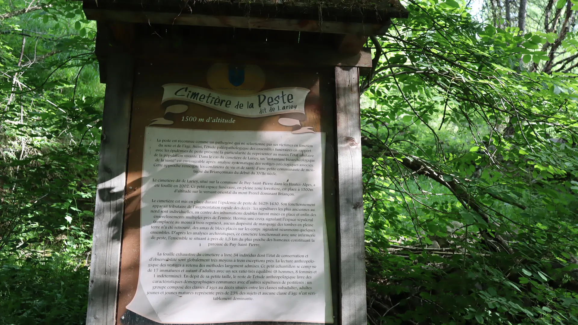
On this short walk below the village, you'll discover an unlikely little cemetery tucked away in the Bois du Ban forest: Le cimetière de la Peste, built during the plague epidemic of 1629-1631.
From the small parking lot on the last bend below Puy-Saint-Pierre, take the wide dirt track (GR50 markings, red and white) signposted Les Eduits - StChaffrey.
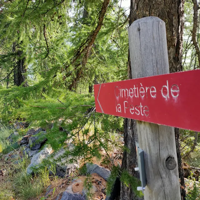
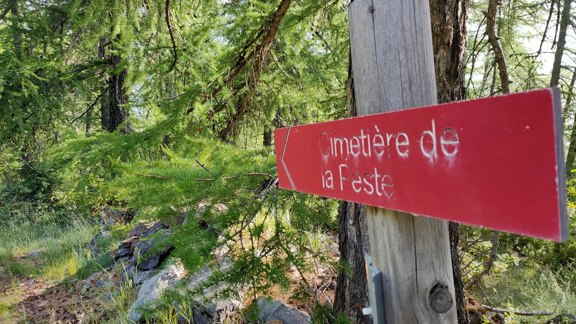
This dirt track continues flat for 600 meters, stopping at the crossroads (Les Queyrelles-Briançon - StChaffrey - Pralong-Notre dame des neiges - Prorel). Go down to the sign (Accès domaine - Briançon - Prorel) and pass under the Prorel gondola, which quickly leads to the wide Prorel ski run (Vauban). At this point, walk a few metres down this grassy stretch to pick up a small path just opposite. The route to follow is marked by a red sign indicating "Le Cimetière de la Peste".
After a few steps, a red sign indicates the location of the cemetery on the left, overlooking the path.
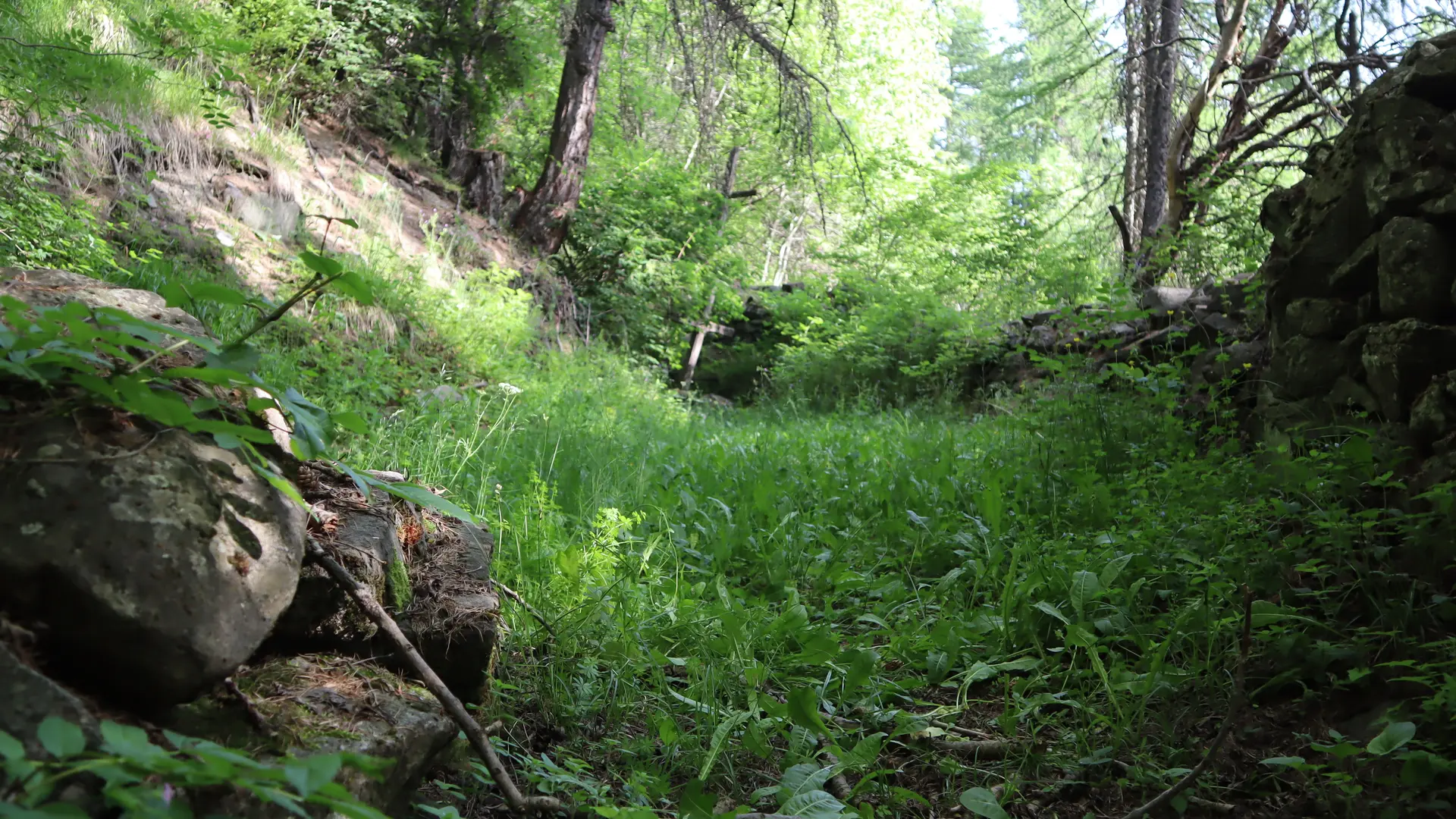
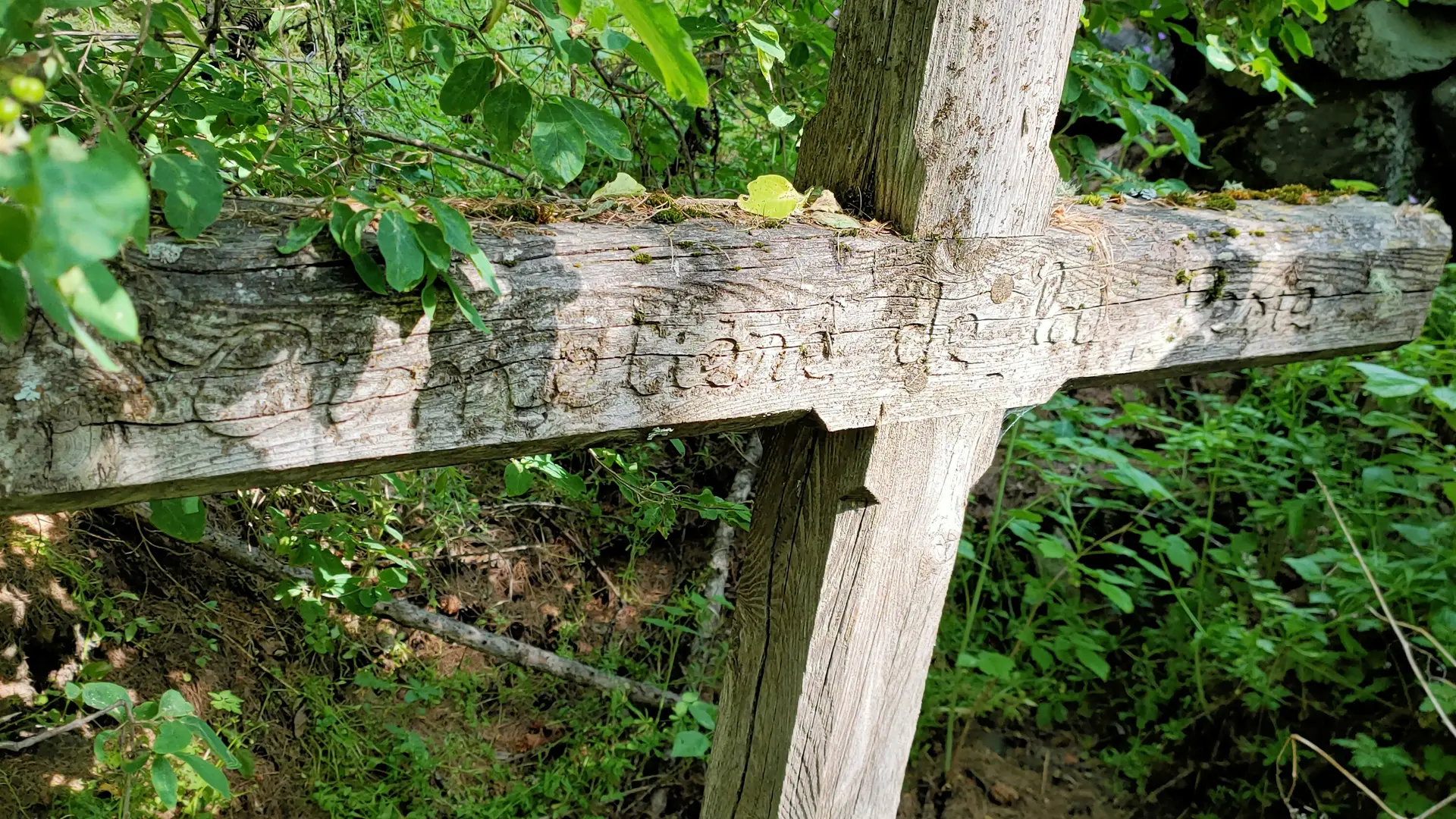
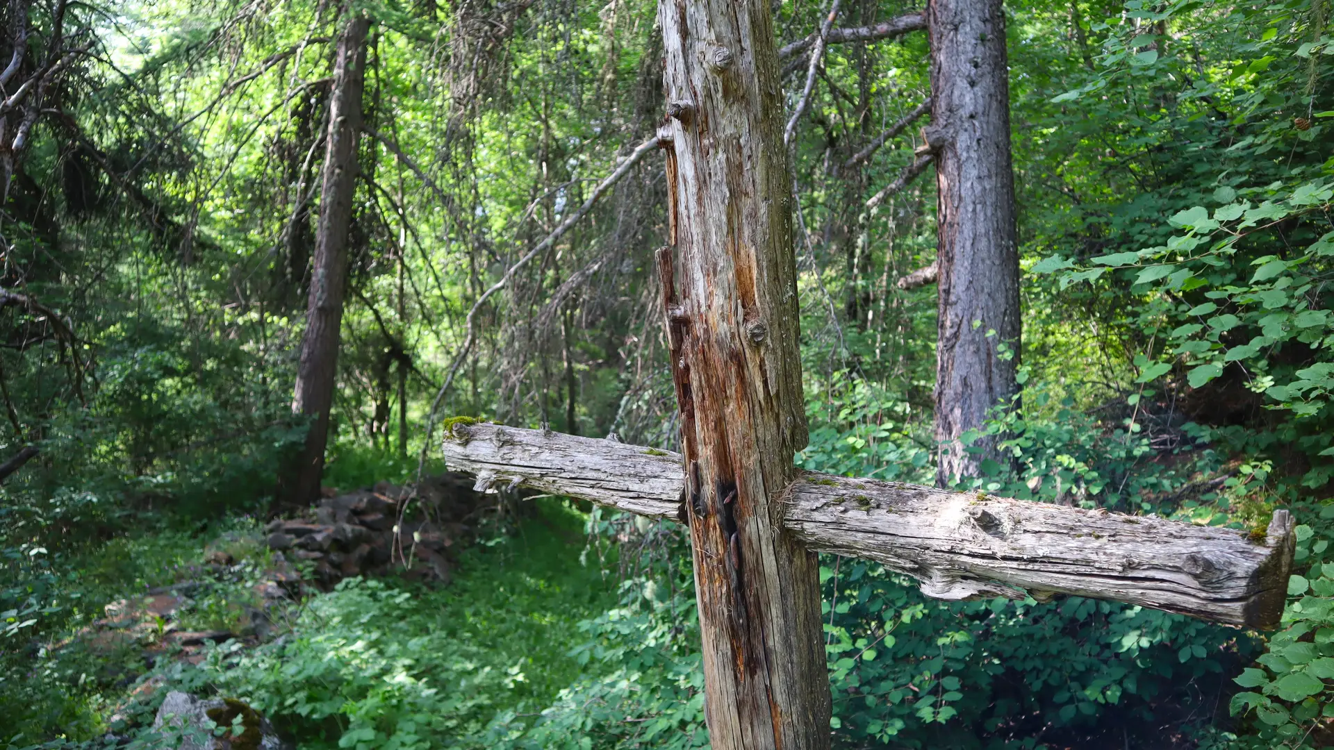
The cemetery itself, whose entrance is marked by a cross, is very modest in size, but a true testimony to a plague epidemic that struck much of Europe.
Pick up the path again, which continues through the woods, then rises steeply for a hundred metres or so, to pick up the wide GR50 track that leads back to your starting point on the left.
The many paths that dot the Bois du Prorel and Bois du Ban offer magnificent views of Briançon .