See photos (2)

The Méouge canyons by bicycle.

Sport, Cycling sports, Cycle tourism route in Ribiers
91.2 km
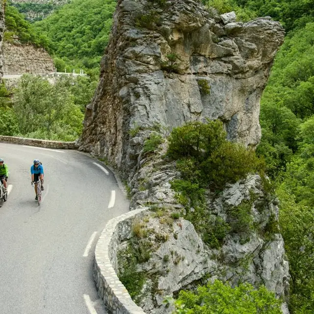
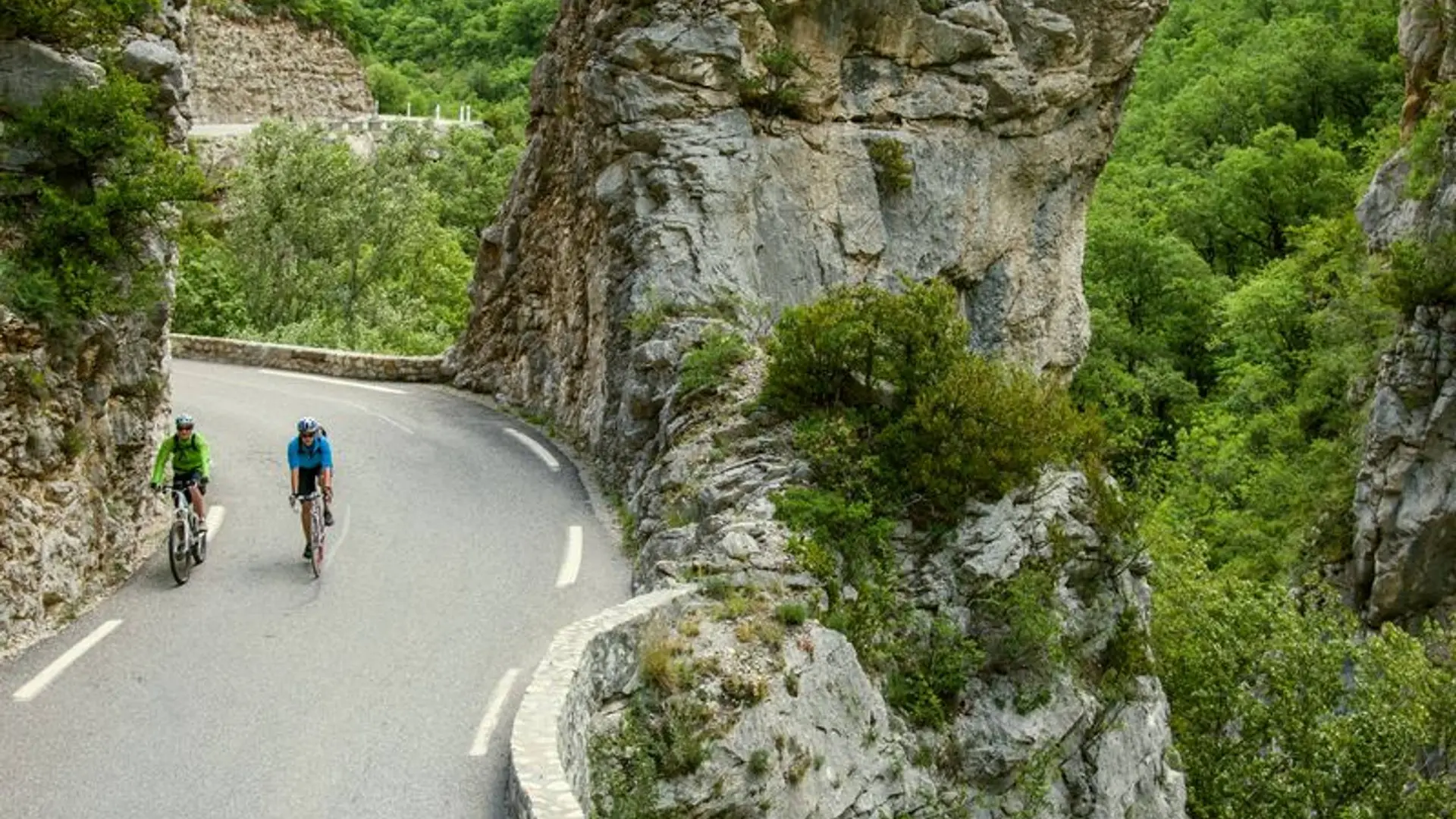
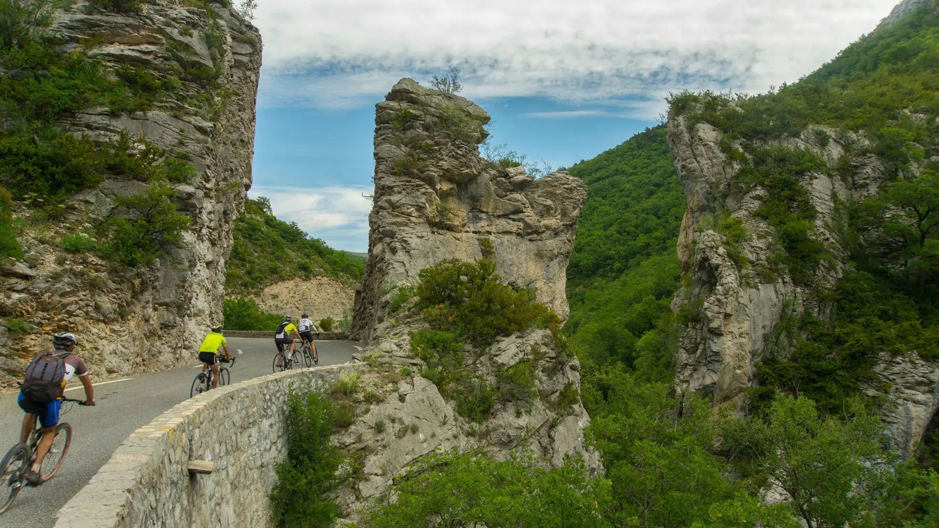
  • At the junction of the Hautes-Alpes, Alpes de Hautes-Provence and la Drôme departments, come and discover the famous Méouge canyons and the Jabron ones. Take a break in Sisteron, at the bottom of the citadel before reaching the departure point again throu

  • The village of Ribier is the starting point of this trail. Take the departmental road D 948 at the north leading to Plan / Antonaves. From there, it is possible to reach Laragne-Montéglin, a village proud of its old 17th century seigniorial castle built by Gaspar de Perrinet. You can fill your water bottles up at its pretty fountain at the central area and wander around its weekly market (on Thursday morning.)
    The path going up through the Méouge canyons allows you to reach...
    The village of Ribier is the starting point of this trail. Take the departmental road D 948 at the north leading to Plan / Antonaves. From there, it is possible to reach Laragne-Montéglin, a village proud of its old 17th century seigniorial castle built by Gaspar de Perrinet. You can fill your water bottles up at its pretty fountain at the central area and wander around its weekly market (on Thursday morning.)
    The path going up through the Méouge canyons allows you to reach Barret-sur-Méouge, at the doors of the Drôme provençale. Lachau is the first village of Les Routes de la lavande – Lavender roads - you will cross by.
    The trail makes you leave the Méouge for the Jabron valley. The valley is still quite wild and is characterised by its small successive reliefs.
    The trail crosses several small rural villages (les Omergues, Montfroc, Curel…) and reaches Saint Vincent, at the bottom of Lure Mountain a wonderful rocky mark overlooking the area.
    Ride alongside the Jabron banks towards Sisteron. A break is mandatory here, in this lovely small touristic city with its citadel sitting on its rocky spur.
    You must continue alongside the north of the Buëch valley to reach Ribiers back again.

    Medium
  • Departure
    Ribiers
  • Difference in height
    1217.26 m
  • Departure : The village’s place, Ribiers.
    Arrival : The village’s place, Ribiers.
    Road access : From Sisteron (9 km), follow the departmental road D 948 north-west towards Ribiers / Gorges de la Méouge..
    Parking recommended : Parking lot in Ribiers. .
  • Documentation
    GPX / KML files allow you to export the trail of your hike to your GPS (or other navigation tool)
1217 meters of difference in height
  • Maximum altitude : 974 m
  • Minimum altitude : 479 m
  • Total positive elevation : 1217 m
  • Total negative elevation : -1155 m
  • Max positive elevation : 117 m
  • Min positive elevation : -113 m