- Voir les favoris
See photos (2)
The summit of Destourbes
Sport, Pedestrian sports, Hiking itinerary
in Castellane
16.4
km
-
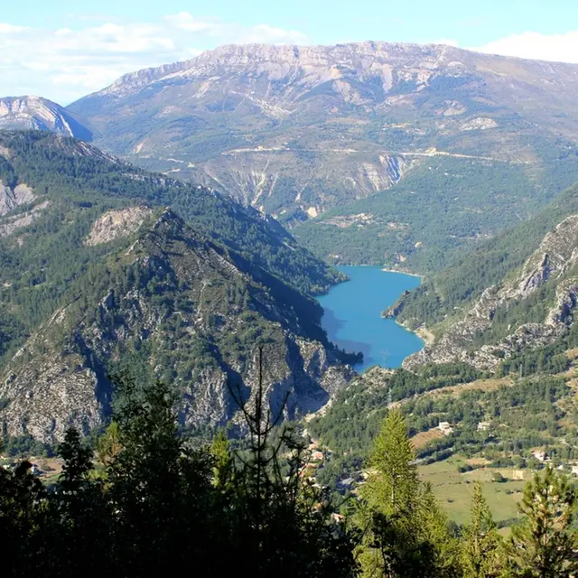
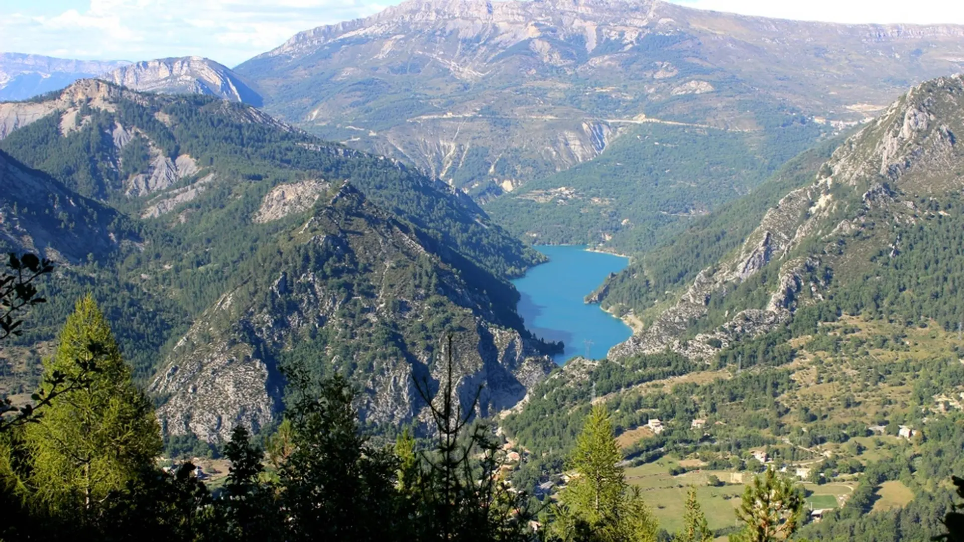
The climb to the summit of Destourbes is progressive and offers a succession of panoramas on the reservoir of Chaudanne.
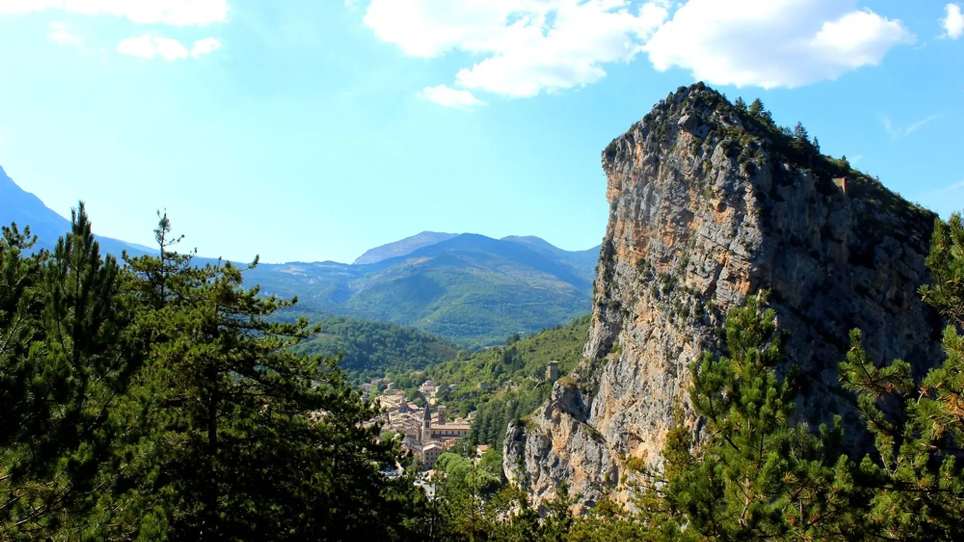
-
From the parking lot of the Boudousque cross the Verdon by the bridge of the Roc, follow the D4085 for 50m on the left, in direction of Grasse.
1- Cross the D4085 and climb the path opposite in the forest towards the summit of Destourbes. The trail rises windingly and gradually under the pines. Several passages are still walled. The road is well marked. Reach and cross a forest trail above. Climb on the wide, winding path in the northeast slope of the mountain. A further kilometer will find...From the parking lot of the Boudousque cross the Verdon by the bridge of the Roc, follow the D4085 for 50m on the left, in direction of Grasse.
1- Cross the D4085 and climb the path opposite in the forest towards the summit of Destourbes. The trail rises windingly and gradually under the pines. Several passages are still walled. The road is well marked. Reach and cross a forest trail above. Climb on the wide, winding path in the northeast slope of the mountain. A further kilometer will find an end-of-trail turn-around area.
2- Take the trail above and go back down slightly. Follow a long crossing. Continue the ascent through a series of turns before going to the ridge. Follow it towards the summit (grand cairn). Follow the markup!
3- Arriving at point 3, return to the starting point by the same route.
Difficult
- Departure
- Castellane
-
-
Difference in height
- 1623.17 m
-
-
-
Departure : From the bridge of Roc, Castellane.
Arrival : From the bridge of Roc, Castellane.
Road access : 53km southeast of Digne-les-Bains, by the N85 and D4085.
Parking recommended : Parking of the Boudousque .
Public transport : « Limitons les déplacements en voiture, pensons aux transports en commun ! Prenez la ligne régionale BV1bis entre Riez et Castellane du 1er Juillet au 11 octobre. Depuis Riez, départ 8h35, retour 16h00. Depuis Castellane, départ à 7h30, retour 16h20 et 19h30. Retrouvez tous les horaires sur https://zou.maregionsud.fr/ ». .
- See all reviews
- 1623 meters of difference in height
-
- Maximum altitude : 1530 m
- Minimum altitude : 728 m
- Total positive elevation : 1623 m
- Total negative elevation : -840 m
- Max positive elevation : 450 m
- Min positive elevation : -369 m
