Le pont du Châtelet - Saint-Paul-sur-Ubaye

The upper Ubaye

Leisure, Tourist routes in Barcelonnette
76.8 km
  • Like a lost paradise, the upper Ubaye opens up to the world. You reach it quietly, unburdened by the weight of everyday life, and you discover life-size landscapes with an arrival in a picturesque village.

  • Follow the Ubaye through mountains, forests and green valleys.

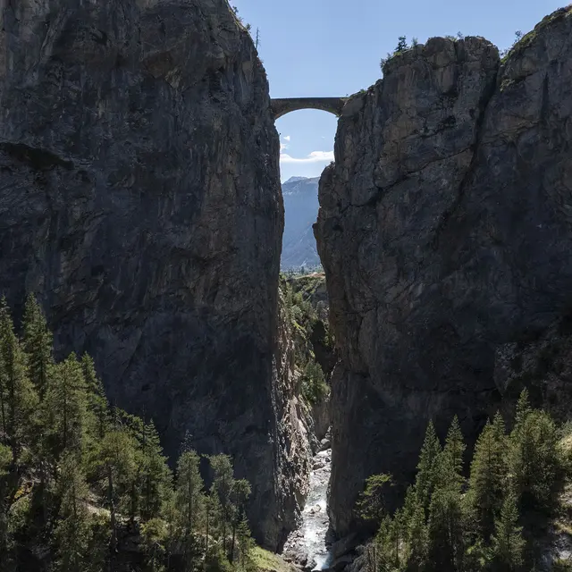
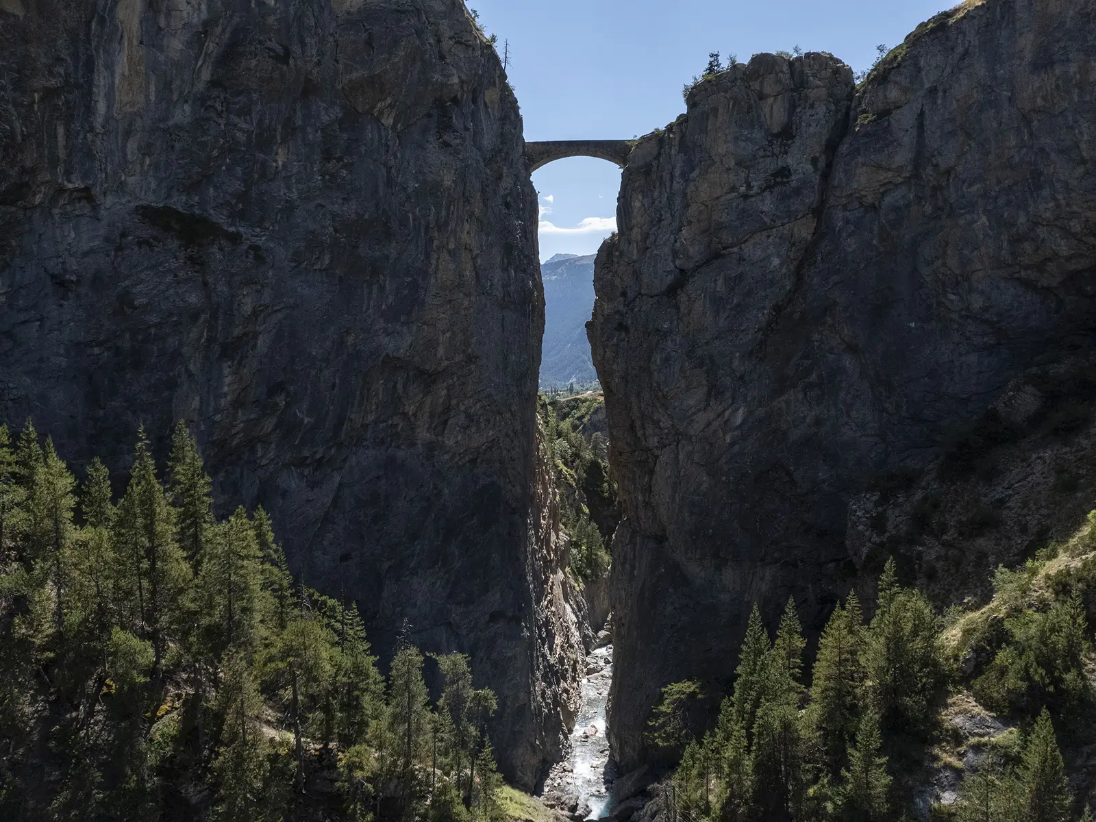
    Make a detour to Fouillouse, passing over the imposing Pont du Châtelet.
  • Departure
    Barcelonnette
  • Difference in height
    1527.61 m
  • Plain text rates
    Free of charge.
  • Plain text period
    All year round daily.
  • Documentation
    GPX / KML files allow you to export the trail of your hike to your GPS (or other navigation tool)
1528 meters of difference in height
  • Maximum altitude : 1900 m
  • Minimum altitude : 1137 m
  • Total positive elevation : 1528 m
  • Total negative elevation : -1528 m
  • Max positive elevation : 168 m
  • Min positive elevation : -240 m