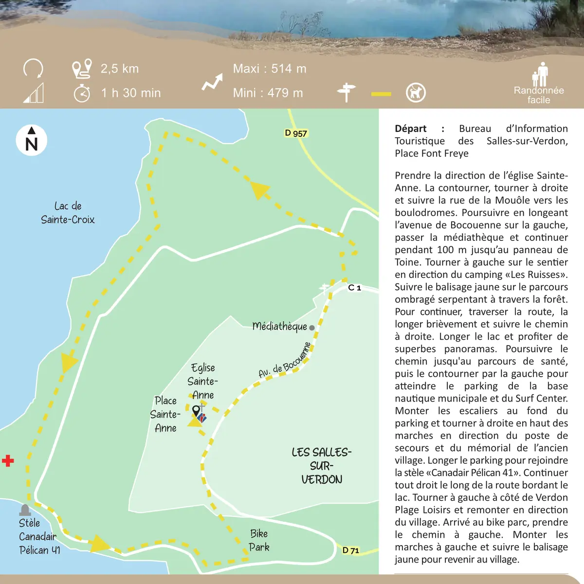
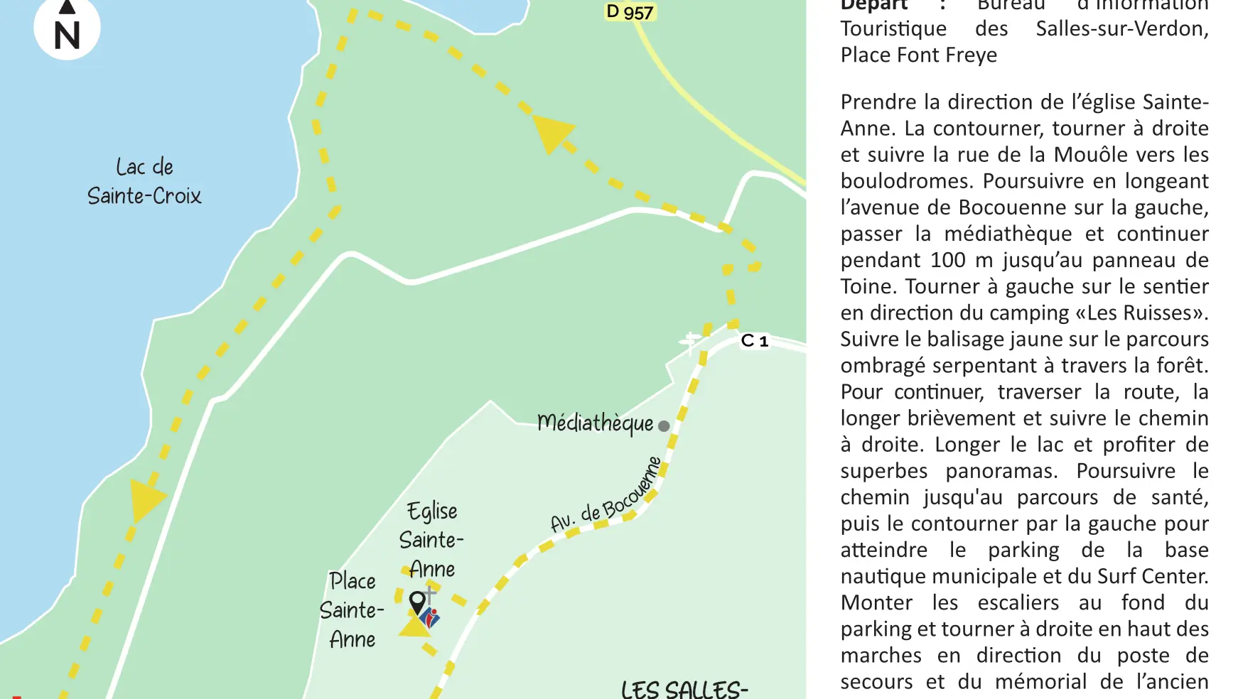
Head towards Sainte-Anne church. Go around it, turn right and follow rue de la Mouôle towards the pétanque grounds. Continue along avenue de Bocouenne on the left, past the media centre and continue for 100 m to the Toine sign. Turn left onto the path towards ‘’Les Ruisses’’ campsite. Follow the yellow markings on the shady path through the forest. Cross the road, walk alongside it briefly and follow the path to the right. Walk along the lake and enjoy the superb views. Continue along the path to the fitness trail, then take left and reach the parking of the municipal nautical base and Surf Centre. Take the stairs at the end of the parking and turn right at the top of the steps towards the first-aid post and the former village memorial. Walk along the parking to reach the road and the ‘’Canadair Pélican 41’’ monument. Continue straight ahead along the road by the lake. Turn left next to Verdon Plage Loisirs and follow up towards the village. At the bike park, take the path on the left. Climb the steps on the left and follow the yellow markings back to the village.
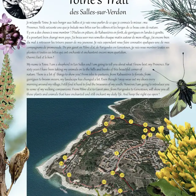
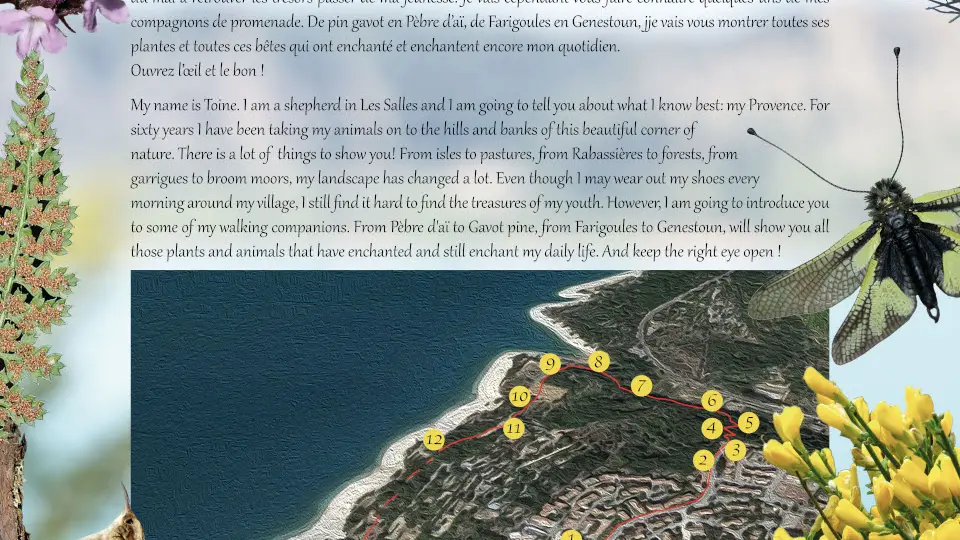
To see the hike on the map, click here: https://shorturl.at/sW70L
Read more