Over several high-altitude passes, this magnificent hike has a cumulative vertical drop of 1100 metres. This loop can be done in either direction, but we generally recommend starting directly with the ascent to Lac et Col des Béraudes: this pass, with its steep scree slope, is more accessible in the uphill direction, and ensures a gentler continuation of the loop.
From the Laval parking lot, take the wide, stony track leading down to the Clarée valley floor, then leave the track on the left to reach the Pont du Moutet. Cross the bridge and follow the small path on the left bank of the river across a magnificent grassy plain for a few metres to a fork in the road.
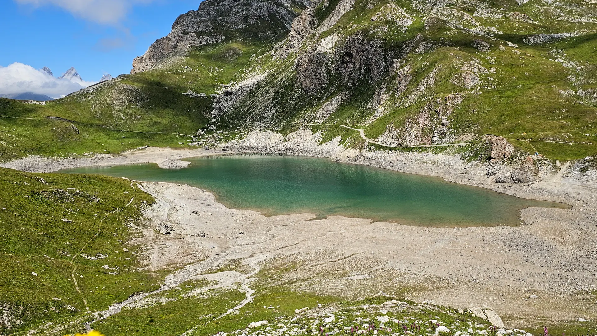
Then take the left-hand path, marked by the "Lac des Béraudes" sign: the ascent to the lake begins: this section is fairly short but steeply uphill (500 m ascent for 2.5 km). The path rises steadily and steadily, crossing several small streams, until it reaches the Lac des Béraudes spillway.
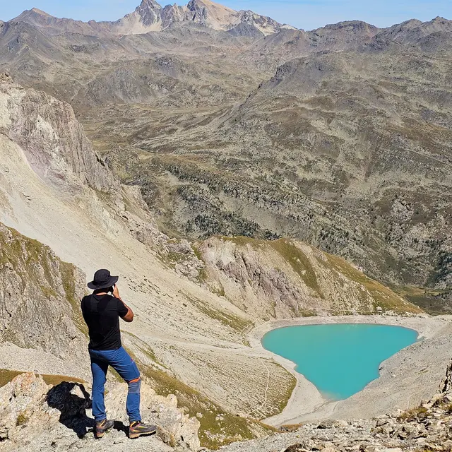
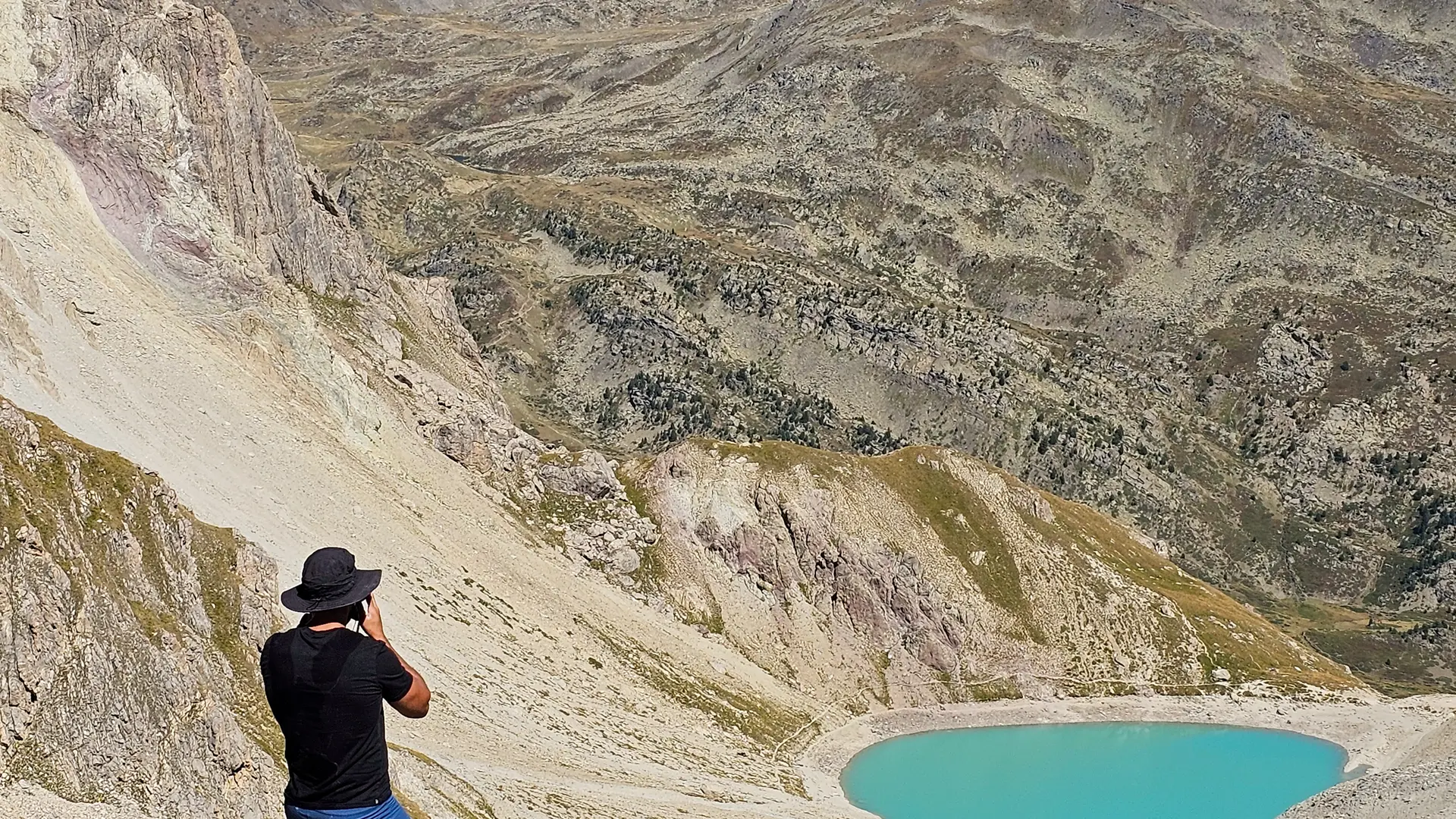
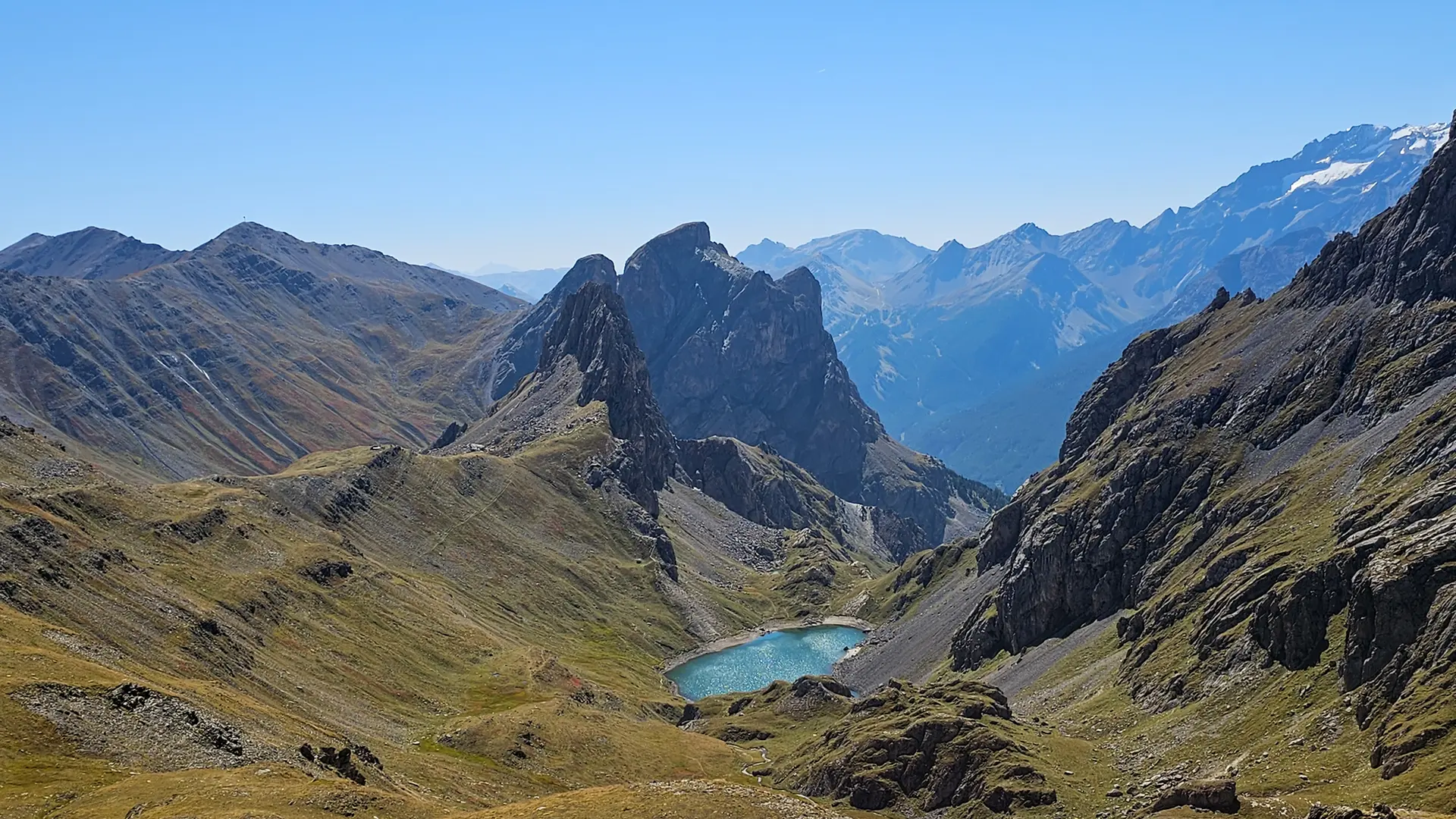
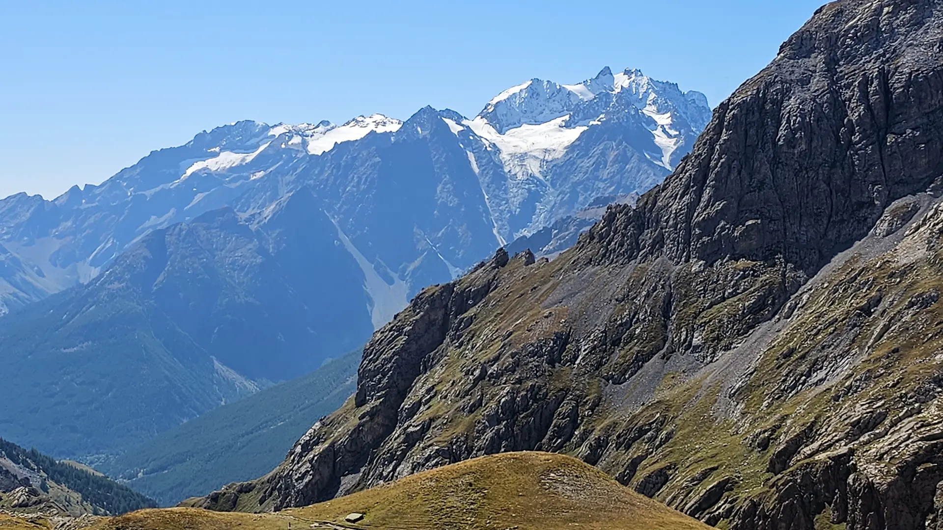
When you reach the lake, this narrow mineral basin is surrounded by the Béraudes point and ridge on the left, the Moutouze ridge on the right, the whole enclosed by the Col des Béraudes and the Pic de la Moulinière at the bottom: continue along the path, skirting the lake on the left: this little path crosses a vast scree slope overhanging and below the Béraudes ridge, for 270 metres of ascent to the Col .
At the Col, there's a slightly technical passage in the rocks, with cables in places. Once over the pass, start the descent for around 500 metres to reach a path under the Pic de la Moulinière.
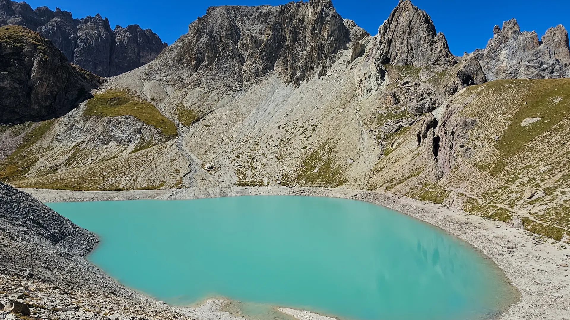
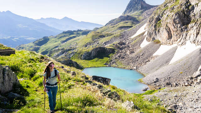
Turn right towards the Col de la Ponsonnière. The path passes under the crest of the same name, overlooking the small Lac de la Ponssonière, and below, the immense Grand Lac, dominated by the imposing Roche Colombe. Once over the pass, the path joins the GR57: descend the vast valley towards Lac des Cerces, then skirt it to the left (ignore the path to the right, which leads to Plan Lachat).
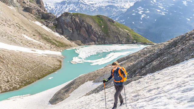
The GR rises again to cross the Col des Cerces (about 200 m ascent from Lac des Cerces), then begins a short descent once over the pass towards Lac du Grand Ban (on the left) and Lac Rond (on the right).
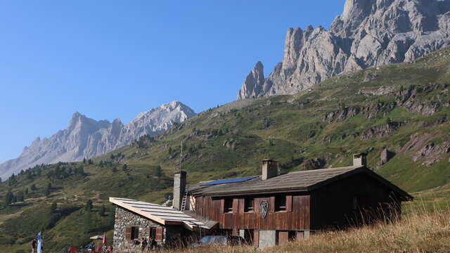
Turn right to go around Lac Rond (you can go around both banks). The GR then continues to cross the Seuil des Rochilles and Lac de la Clarée, before beginning a final descent to the Refuge des Drayères.
From the Refuge des Drayères , there are less than 3km to go along the Clarée, to reach the Laval parking lot: two options: stay on the wide, stony main trail, on the left bank of the river. Or take the narrow path on the right bank of the Clarée, leaving the wide track after 200 m on the right to reach the small footbridge spanning the Clarée.
In June, some high altitude passes are still difficult to negotiate and are therefore not recommended: be sure to check snow conditions before setting off.
Read more