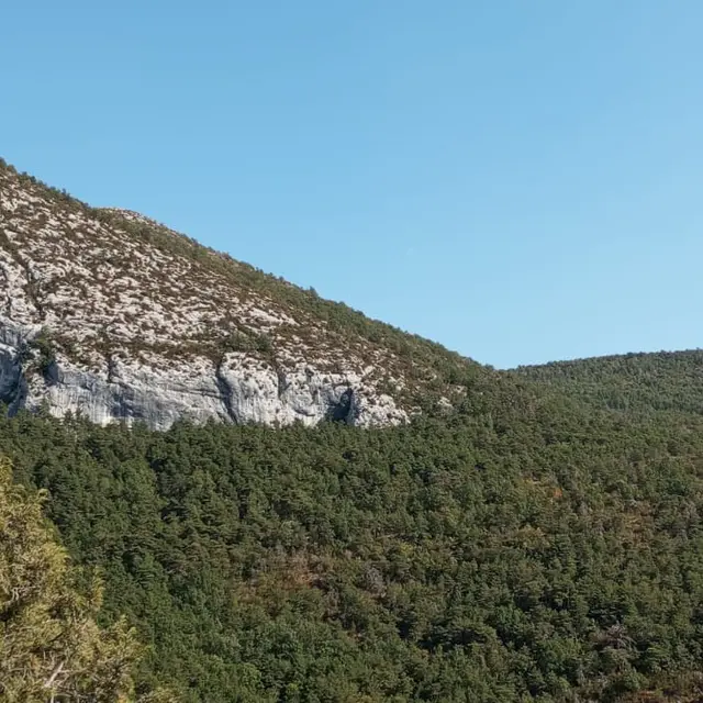
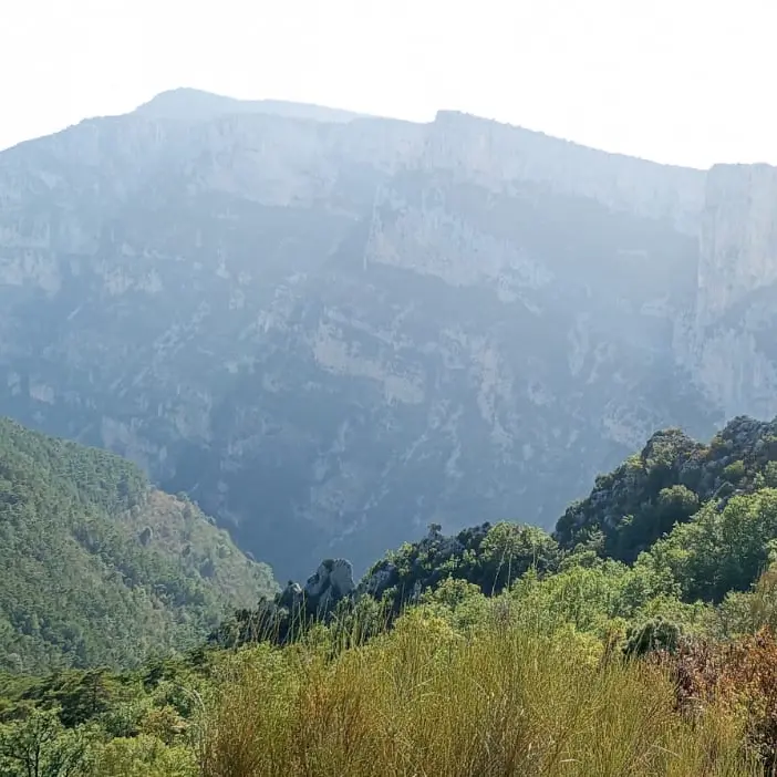
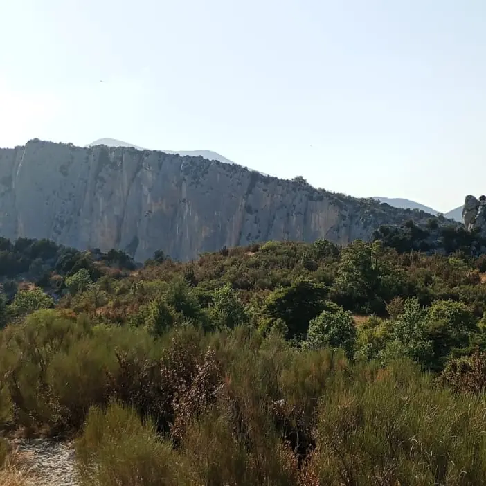
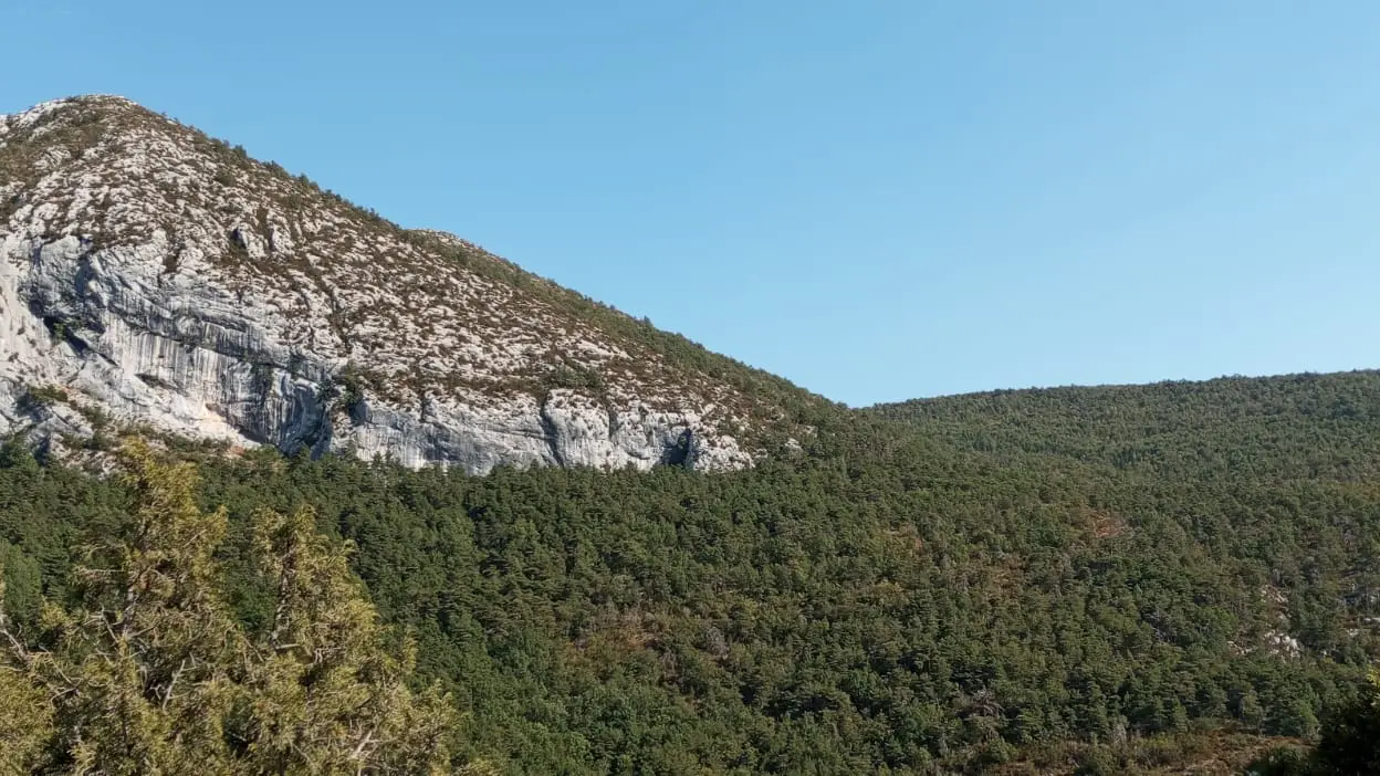
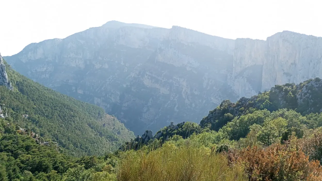
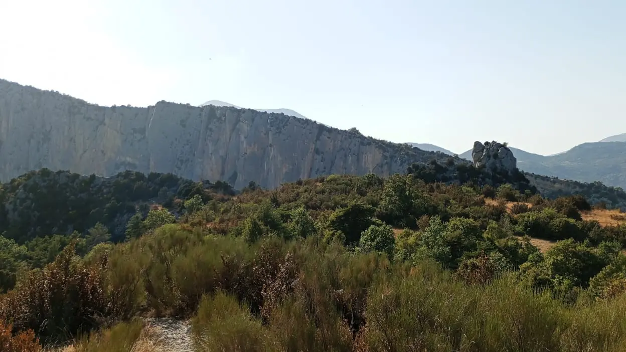
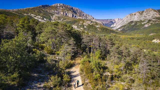
You'll fall under the spell of this secluded mountain setting and a medieval village clinging to the rock, with a beautiful view over the Verdon. The hamlets of Encastel (or at least its remains) and Entreverge are also well worth a visit.
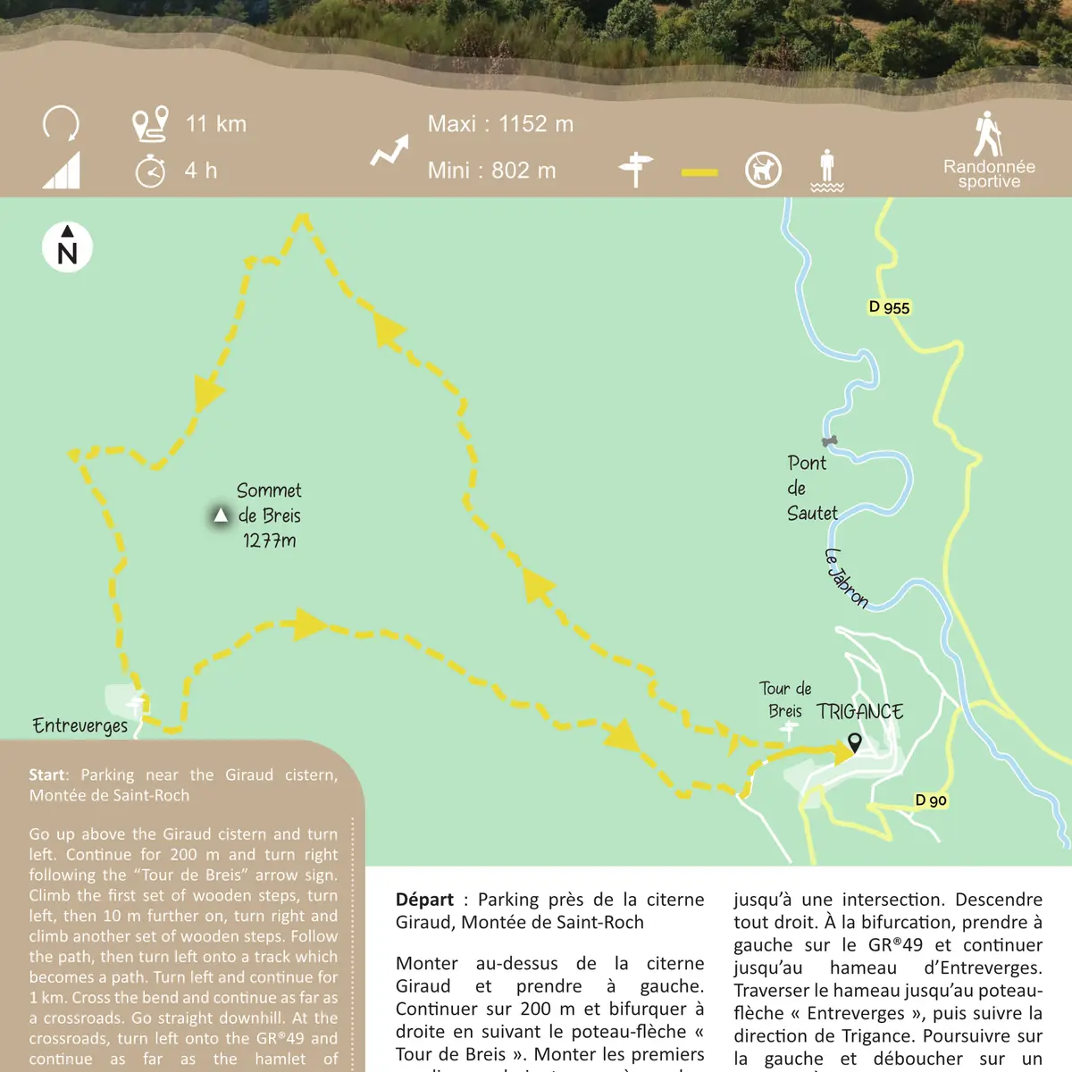
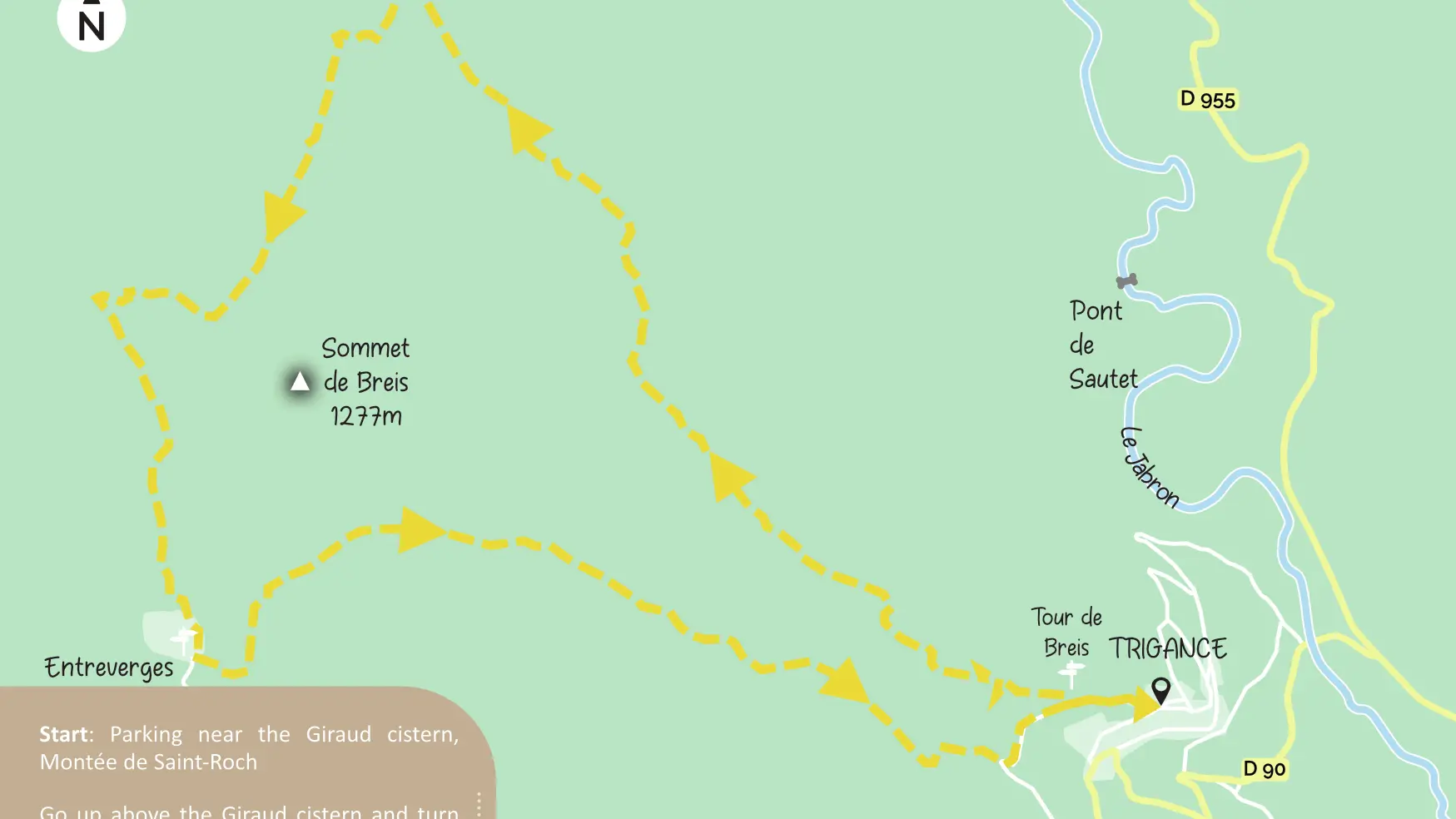
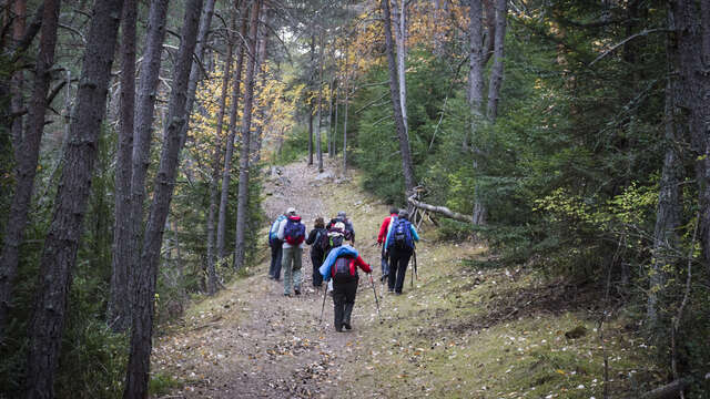
Continue straigth ahead for 200m towards the village’s centre. At the fountain, turn left. Follow straigth. In front of a small parking, turn right then left. Follow the ‘’Tour de Breis’’ arrow sign. Continue for 200 m. Turn right following the arrow sign again. Climb the first set of wooden steps, turn left, then 10 m further on, turn right and climb another set of wooden steps. Follow the path, then turn left onto a track which becomes a path. Turn left and continue for 1 km. Cross the bend and continue as far as a crossroads. Go straight downhill. At the next crossroads, turn left onto the GR®49 and continue as far as the hamlet of Entreverges. Go through the hamlet as far as the ‘’Entreverges’’ arrow sign. Follow the direction for Trigance. Turn left. Follow right onto a plateau. Near a spring, cross a muddy, rocky stream for about 100 m (active in rain!), then continue on the path. Go down the track for about 400 m. At the crossroads, turn left, then continue on chemin d’Entreverges, 2nd to the left and pass the oratory. Take the same route back to the village.
To see the hike on the map, click here: https://shorturl.at/fXDwW
Read more
Plain text period
All year round daily.
Before hiking, check whether access to forest areas is authorised.