img-name-mising

Walking tour "Circuit du Dragon".

Sport, Pedestrian sports, Hiking itinerary, Trail route in Levens
11.0 km
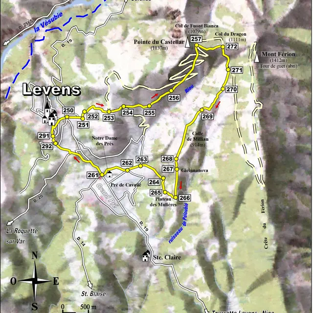
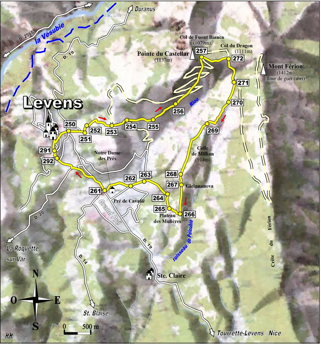
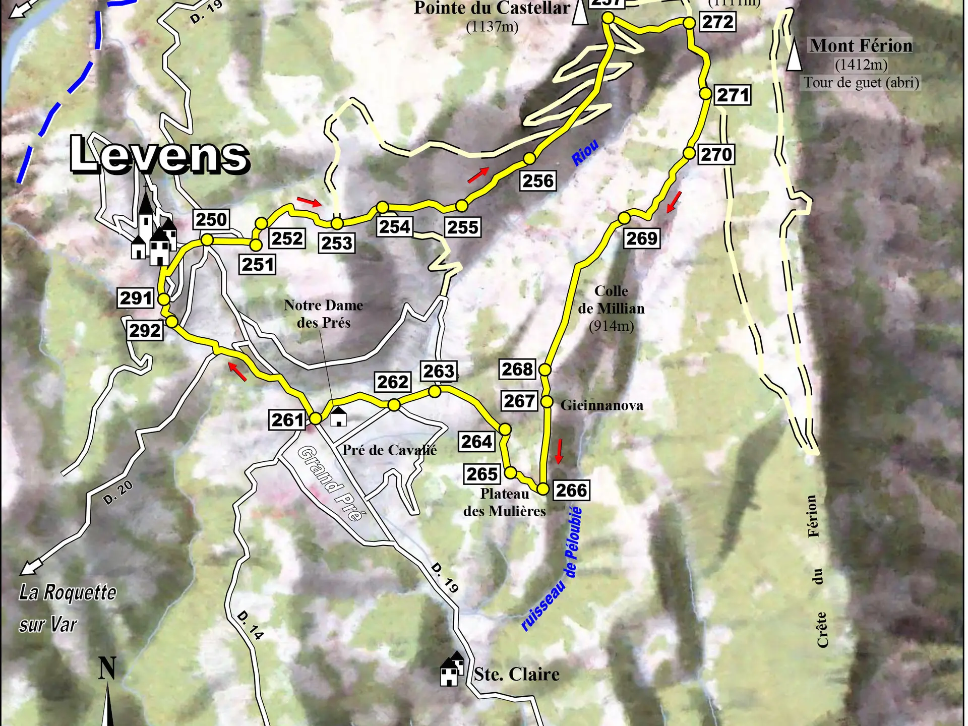
  • Don't let the title of the Dragon fool you,
    This one no longer spits flames, it can be struck down by St
    Michel du Férion whose chapel is built a few
    on the crest of the Férion.

  • The view to the north extends to the Affaia valley and the old arsenic mine of Eguisse. The pass between the Pointe du Castellar (1137m) and Mont Férion (1412m) offers the possibility of climbing to the summit of Férion and descending the homonymous ridge or, as with this itinerary, reaching Levens.
  • Departure
    Levens
  • Difference in height
    662.978 m
  • Documentation
    GPX / KML files allow you to export the trail of your hike to your GPS (or other navigation tool)
663 meters of difference in height
  • Maximum altitude : 1128 m
  • Minimum altitude : 487 m
  • Total positive elevation : 663 m
  • Total negative elevation : -663 m
  • Max positive elevation : 434 m
  • Min positive elevation : -450 m