

Description
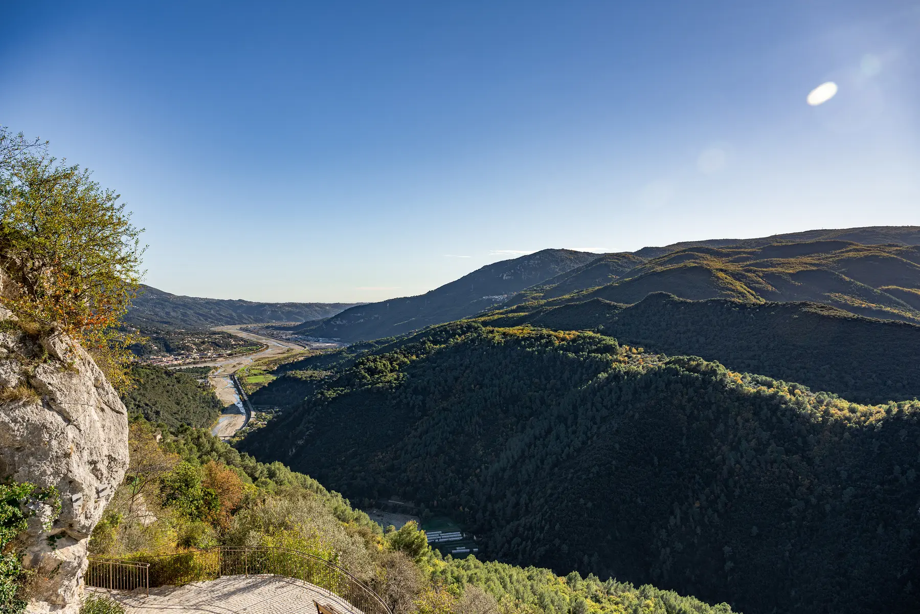
An exceptional panorama of Gilette castle and the Estéron valley!
After crossing the village of Gilette, whose name is said to come from gel, the dominant summit, you arrive at the foothills of the village, with the remains of the Château de l'Aiguille behind you, 300 metres above the Estéron. Your eye falls on the typical houses of the Nice village, then, drawn by the emptiness, returns to the vegetated slope that joins the river, where tended olive groves mingle with the forest.
On limestone soils, typical Mediterranean vegetation unfolds before the eye: pines, holm oaks, fig trees, vines, lentisks and cineraria cling to the slopes once cultivated for olives and oil, and to the rock faces. The olive groves on this hillside have been overtaken by the growth of pine trees, whose dark green outshines the grey foliage of the olive trees.
Our gaze wanders to the stream at the bottom of the valley and the flat land reclaimed for market gardening, where the soil can be worked mechanically.
On the right bank of the Estéron, there is an imposing wooded area dominated by pine trees. Here and there, an olive grove or stone sheepfold emerges. The eye wanders over the hillside landscape until the first buildings of the industrial zone come into view. Traffic routes are clearly identified, along the watercourses, and bridges are clearly visible to reach the left bank of the Estéron where it flows into the Var.